Gouy, Seine-Maritime
Gouy is a commune in the Seine-Maritime department in the Normandy region in northern France.
Gouy | |
|---|---|
 The entrance to the Gouy cave | |
 Coat of arms | |
Location of Gouy 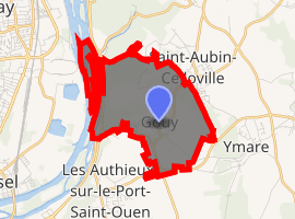
| |
 Gouy  Gouy | |
| Coordinates: 49°21′19″N 1°08′54″E | |
| Country | France |
| Region | Normandy |
| Department | Seine-Maritime |
| Arrondissement | Rouen |
| Canton | Darnétal |
| Intercommunality | Métropole Rouen Normandie |
| Government | |
| • Mayor | Jean-Pierre Breugnot |
| Area 1 | 4.97 km2 (1.92 sq mi) |
| Population (2017-01-01)[1] | 869 |
| • Density | 170/km2 (450/sq mi) |
| Time zone | UTC+01:00 (CET) |
| • Summer (DST) | UTC+02:00 (CEST) |
| INSEE/Postal code | 76313 /76520 |
| Elevation | 2–133 m (6.6–436.4 ft) (avg. 76 m or 249 ft) |
| 1 French Land Register data, which excludes lakes, ponds, glaciers > 1 km2 (0.386 sq mi or 247 acres) and river estuaries. | |
Geography
A farming village situated by the banks of the river Seine, some 6 miles (9.7 km) southeast of the centre of Rouen, at the junction of the D6015 and the D91 roads.
Heraldry
Arms of Gouy |
The arms of Gouy are blazoned : Per fess argent and azure, 2 keys in saltire sable and 3 baguettes palewise 2 & 1 Or. |
Population
| Year | 1962 | 1968 | 1975 | 1982 | 1990 | 1999 | 2006 |
|---|---|---|---|---|---|---|---|
| Population | 331 | 348 | 446 | 468 | 644 | 794 | 788 |
| From the year 1962 on: No double counting—residents of multiple communes (e.g. students and military personnel) are counted only once. | |||||||
Places of interest
- The church of St.Pierre and Paul, dating from the twelfth century.
- Prehistoric finds in caves and graves by the Seine.
References
- "Populations légales 2017". INSEE. Retrieved 6 January 2020.
External links
| Wikimedia Commons has media related to Gouy (Seine-Maritime). |
- Website about the grotto of Gouy (in French)
| Authority control |
|
|---|
This article is issued from Wikipedia. The text is licensed under Creative Commons - Attribution - Sharealike. Additional terms may apply for the media files.