Montérolier
Montérolier is a commune in the Seine-Maritime department in the Normandy region in northern France.
Montérolier | |
|---|---|
 Montérolier-Buchy railway station | |
Location of Montérolier 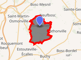
| |
 Montérolier  Montérolier | |
| Coordinates: 49°37′48″N 1°20′49″E | |
| Country | France |
| Region | Normandy |
| Department | Seine-Maritime |
| Arrondissement | Dieppe |
| Canton | Neufchâtel-en-Bray |
| Intercommunality | CC Bray-Eawy |
| Government | |
| • Mayor (2001–2008) | Yvette Pasquier |
| Area 1 | 11.7 km2 (4.5 sq mi) |
| Population (2017-01-01)[1] | 596 |
| • Density | 51/km2 (130/sq mi) |
| Time zone | UTC+01:00 (CET) |
| • Summer (DST) | UTC+02:00 (CEST) |
| INSEE/Postal code | 76445 /76680 |
| Elevation | 132–212 m (433–696 ft) (avg. 146 m or 479 ft) |
| 1 French Land Register data, which excludes lakes, ponds, glaciers > 1 km2 (0.386 sq mi or 247 acres) and river estuaries. | |
Geography
A farming village situated in the Pays de Bray, some 30 miles (48 km) southeast of Dieppe at the junction of the D24 and the D38 roads. The Varenne River has its source here.
Surrounded by the common Neufbosc, Mathonville and Saint-Martin-Osmonville, Montérolier is located 26 km northeast of Mont-Saint-Aignan, the largest city nearby.[2]
History
During 1943, in the Clairefeuille woods at Montérolier, the Germans built underground galleries in which to store V-1 flying bombs. After the Second World War, the galleries were opened to the public. On the 21 and 22 June 1995, 13 people died accidentally in the tunnels.
Population
| 1962 | 1968 | 1975 | 1982 | 1990 | 1999 | 2006 |
|---|---|---|---|---|---|---|
| 459 | 419 | 367 | 398 | 417 | 500 | 506 |
| Starting in 1962: Population without duplicates | ||||||
Places of interest
People
- Jean de Grouchy, sieur of Montérolier (1354–1435).
References
- "Populations légales 2017". INSEE. Retrieved 6 January 2020.
- "Annuaire-Mairie"
External links
| Wikimedia Commons has media related to Montérolier. |
- Montérolier - The tunnels of Clairefeuille (in French)
| Authority control |
|
|---|
This article is issued from Wikipedia. The text is licensed under Creative Commons - Attribution - Sharealike. Additional terms may apply for the media files.