Smermesnil
Smermesnil is a commune in the Seine-Maritime department in the Normandy region in northern France.
Smermesnil | |
|---|---|
Location of Smermesnil 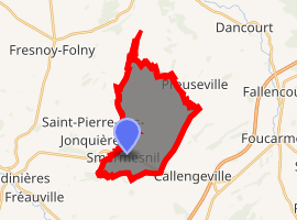
| |
 Smermesnil  Smermesnil | |
| Coordinates: 49°50′32″N 1°28′26″E | |
| Country | France |
| Region | Normandy |
| Department | Seine-Maritime |
| Arrondissement | Dieppe |
| Canton | Neufchâtel-en-Bray |
| Intercommunality | CC Londinières |
| Government | |
| • Mayor (2008–2014) | Jean-Michel Flahaut |
| Area 1 | 12.81 km2 (4.95 sq mi) |
| Population (2017-01-01)[1] | 407 |
| • Density | 32/km2 (82/sq mi) |
| Time zone | UTC+01:00 (CET) |
| • Summer (DST) | UTC+02:00 (CEST) |
| INSEE/Postal code | 76677 /76660 |
| Elevation | 117–218 m (384–715 ft) (avg. 211 m or 692 ft) |
| 1 French Land Register data, which excludes lakes, ponds, glaciers > 1 km2 (0.386 sq mi or 247 acres) and river estuaries. | |
Geography
A farming commune created from three ancient parishes and situated at the 2nd highest point in the department, between the valleys of the Yères and the Eaulne rivers in the Pays de Bray. The commune is about 17 miles (27 km) southeast of Dieppe at the junction of the D920, D14 and D59 roads.
Population
| 1962 | 1968 | 1975 | 1982 | 1990 | 1999 | 2006 |
|---|---|---|---|---|---|---|
| 414 | 446 | 285 | 267 | 218 | 250 | 439 |
| Starting in 1962: Population without duplicates | ||||||
Places of interest
- The château, built with stone from the ancient abbey de Foucarmont.
- The church of St. Martin, dating from the thirteenth century.
- The church of St. Jean, dating from the sixteenth century.
- The church of St. Madeleine, dating from the sixteenth century.
References
- "Populations légales 2017". INSEE. Retrieved 6 January 2020.
| Wikimedia Commons has media related to Smermesnil. |
| Authority control |
|
|---|
This article is issued from Wikipedia. The text is licensed under Creative Commons - Attribution - Sharealike. Additional terms may apply for the media files.