Beuzeville-la-Guérard
Beuzeville-la-Guérard is a commune in the Seine-Maritime department in the Normandy region in northern France.
Beuzeville-la-Guérard | |
|---|---|
Location of Beuzeville-la-Guérard 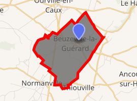
| |
 Beuzeville-la-Guérard  Beuzeville-la-Guérard | |
| Coordinates: 49°42′52″N 0°37′12″E | |
| Country | France |
| Region | Normandy |
| Department | Seine-Maritime |
| Arrondissement | Dieppe |
| Canton | Saint-Valery-en-Caux |
| Intercommunality | CC Côte d'Albâtre |
| Government | |
| • Mayor | Luc Bréant |
| Area 1 | 6.42 km2 (2.48 sq mi) |
| Population (2017-01-01)[1] | 225 |
| • Density | 35/km2 (91/sq mi) |
| Time zone | UTC+01:00 (CET) |
| • Summer (DST) | UTC+02:00 (CEST) |
| INSEE/Postal code | 76091 /76450 |
| Elevation | 106–144 m (348–472 ft) (avg. 110 m or 360 ft) |
| 1 French Land Register data, which excludes lakes, ponds, glaciers > 1 km2 (0.386 sq mi or 247 acres) and river estuaries. | |
Geography
A small farming village situated in the Pays de Caux, some 25 miles (40 km) northeast of Le Havre, at the junction of the D5, D50 and the D306 roads.
Population
| Year | 1962 | 1968 | 1975 | 1982 | 1990 | 1999 | 2006 |
|---|---|---|---|---|---|---|---|
| Population | 174 | 180 | 139 | 152 | 147 | 150 | 169 |
| From the year 1962 on: No double counting—residents of multiple communes (e.g. students and military personnel) are counted only once. | |||||||
Places of interest
- The church of Notre-Dame, dating from the eleventh century.
- A manorhouse and a farmhouse from the sixteenth century.
References
- "Populations légales 2017". INSEE. Retrieved 6 January 2020.
External links
| Wikimedia Commons has media related to Beuzeville-la-Guérard. |
- Beuzeville-la-Guérard on the Quid website (in French)
| Authority control |
|
|---|
This article is issued from Wikipedia. The text is licensed under Creative Commons - Attribution - Sharealike. Additional terms may apply for the media files.