Kozhikode district
Kozhikode District (![]()
Kozhikode district Calicut district | |
|---|---|
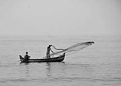 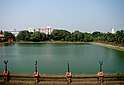 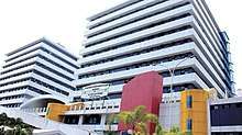  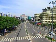 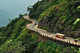 Clockwise from the top: Arabian Sea, Mananchira KSRTC bus stand complex, Calicut mini bypass, Kozhikode Beach, IIM Kozhikode, Thamarassery Churam. | |
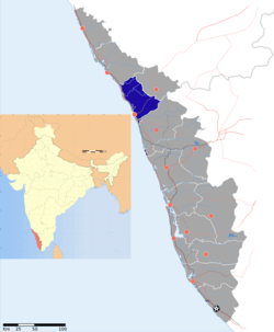 Location of Kozhikode district in Kerala | |
| Country | |
| State | Kerala |
| Headquarters | Kozhikode |
| Government | |
| • Collector | Shri. Seeram Sambasiva Rao |
| • District Panchayat President | Babu Parasserry CPI (M)[1] |
| • Members of Parliament | |
| Area | |
| • Total | 2,344 km2 (905 sq mi) |
| Population (2011) | |
| • Total | 3,086,293 |
| • Density | 1,300/km2 (3,400/sq mi) |
| Languages | |
| • Official | Malayalam, English |
| Time zone | UTC+5:30 (IST) |
| ISO 3166 code | IN-KL |
| Vehicle registration | Calicut City-KL11, Vatakara-KL-18, Koyilandy-KL-56, Koduvally-KL-57, Nanmanda-KL-76, Perambra-KL-77 |
| Website | kozhikode |
Kozhikode district is bordered by the districts of Kannur and Mahé (Puducherry) to the north, Wayanad to the east, and Malappuram to the south. The Arabian Sea lies to the west and Western Ghats stretches towards east. Vavul Mala is the highest peak in the district. It lies between latitudes 11° 08'N and 11° 50'N and longitudes 75° 30'E and 76° 8'E.
In 2001 the district was divided into four taluks: Kozhikode, Vatakara, Koyilandy and Thamarassery. By the 2011 census there are 12 block panchayats: Balusseri, Chelannur, Koduvally, Kozhikode, Kunnamangalam, Kunnummal, Melady, Panthalayani, Perambra, Thodannur, Thuneri, and Vatakara.[3]
Demographics
| Historical population | ||
|---|---|---|
| Year | Pop. | ±% p.a. |
| 1901 | 610,058 | — |
| 1911 | 654,846 | +0.71% |
| 1921 | 678,122 | +0.35% |
| 1931 | 796,881 | +1.63% |
| 1941 | 892,078 | +1.13% |
| 1951 | 1,116,391 | +2.27% |
| 1961 | 1,403,413 | +2.31% |
| 1971 | 1,821,734 | +2.64% |
| 1981 | 2,245,265 | +2.11% |
| 1991 | 2,619,941 | +1.56% |
| 2001 | 2,879,131 | +0.95% |
| 2011 | 3,086,293 | +0.70% |
| source:[4] | ||
| % of Population | Sex Ratio | Literacy Rate (L.R.) | L.R. Males | L.R. Females | |
|---|---|---|---|---|---|
| Hindus | 56.2% | 1049 | 94.5 | 97.3 | 91.9 |
| Muslims | 39.2% | 1058 | 91.6 | 95.3 | 88.1 |
| Christians | 4.3% | 1178 | 98.2 | 98.6 | 97.8 |
| Jains | 0.06 | 1003 | 97.7 | 99.3 | 96.1 |
(Details for 'Kozhikode Urban' retrieved from Census of India.[5])
According to the 2011 census Kozhikode district has a population of 3,086,293,[6] roughly equal to the nation of Mongolia[7] or the US state of Iowa.[8] This gives it a ranking of 115th in India (out of a total of 640).[6] Among this the population of the Hindus increased to 17,34,958 (males: 8,37,824, females: 8,97,134) from the figure of 16,69,161 in the 2001 census. Muslim population grew rapidly to 12,11,131 (males: 5,64,489: females: 6,46,642) from the 2001 figure of 10,78,759 while the Christian population stood at 1,31,516 (males: 64,367 and females: 67,149). Its population a decade ago was 1,27,468. The district has a population density of 1,318 inhabitants per square kilometre (3,410/sq mi).[6] Its population growth rate over the decade 2001-2011 was 7.31%.[6] Kozhikode has a sex ratio of 1097 females for every 1000 males,[6] and a literacy rate of 95.24%.[6]
The centuries of trade across the Indian Ocean has given Kozhikode a cosmopolitan population.
Religion
According to the 2011 census, Hindus constitute the majority of the population, followed by the Muslims and the Christians.In 2001,the proportion was 57.97% Hindus; 37.47% Muslims and 4.43% Christians.[9]
There is a small presence of Jains (601), Sikhs (297) and Buddhists (235).[9]
Climate
The district has a generally humid climate with a very hot season extending from March to May. The rainy season is during the South West Monsoon, which sets in the first week of June and extends up to September. The North East Monsoon extends from the second half of October through November. The average annual rainfall is 3266 mm. The best weather is found in towards the end of the year, in December and January — the skies are clear, and the air is crisp. The highest temperature recorded was 39.4 °C in March 1975. The lowest was 14 °C recorded on 26 December 1975.
| Climate data for Kozhikode | |||||||||||||
|---|---|---|---|---|---|---|---|---|---|---|---|---|---|
| Month | Jan | Feb | Mar | Apr | May | Jun | Jul | Aug | Sep | Oct | Nov | Dec | Year |
| Average high °C (°F) | 31.6 (88.9) |
32 (90) |
32.7 (90.9) |
33.1 (91.6) |
32.4 (90.3) |
29.4 (84.9) |
28.4 (83.1) |
28.3 (82.9) |
29.5 (85.1) |
30.6 (87.1) |
31.3 (88.3) |
31.6 (88.9) |
30.9 (87.6) |
| Average low °C (°F) | 22 (72) |
23.4 (74.1) |
25 (77) |
26.1 (79.0) |
25.8 (78.4) |
24 (75) |
23.5 (74.3) |
23.5 (74.3) |
24 (75) |
24 (75) |
23.6 (74.5) |
22.7 (72.9) |
23.8 (74.8) |
| Average precipitation mm (inches) | 2.7 (0.11) |
3.4 (0.13) |
21.4 (0.84) |
90.2 (3.55) |
310.9 (12.24) |
818.2 (32.21) |
902.5 (35.53) |
447.3 (17.61) |
233.4 (9.19) |
263.5 (10.37) |
136.6 (5.38) |
35 (1.4) |
3,284.6 (129.31) |
| Source: [10] | |||||||||||||
Political divisions
Parliament constituencies
- Kozhikode
- Vatakara
- Wayanad (Thiruvambady only)
Member of Kerala Legislative assembly
There are 13 legislative assembly seats in Kozhikode district.They are :-Balussery, Beypore, Elathur, Koduvally, Koyilandy, Kozhikode North, Kozhikode South, Kunnamangalam, Kuttiyadi, Nadapuram, Perambra, Thiruvambady and Vatakara.
| Sl. No | Constituency | Member | Party | Alliance |
|---|---|---|---|---|
| 1 | Nadapuram | E. K. Vijayan | CPI | LDF |
| 2 | Koyilandy | K. Dasan | CPI(M) | LDF |
| 3 | Perambra | T. P. Ramakrishnan | CPI(M) | LDF |
| 4 | Balussery | Purushan Kadalundy | CPI(M) | LDF |
| 5 | Elathur | A. K. Saseendran | NCP | LDF |
| 6 | Kozhikode North | A. Pradeepkumar | CPI(M) | LDF |
| 7 | Kozhikode South | M. K. Muneer | IUML | UDF |
| 8 | Beypore | V. K. C. Mammed Koya | CPI(M) | LDF |
| 9 | Kunnamangalam | P. T. A. Rahim | LDF Ind. | LDF |
| 10 | Koduvally | Karat Razak | LDF Ind. | LDF |
| 11 | Thiruvambady | George M. Thomas | CPI(M) | LDF |
| 12 | Vatakara | C. K. Nanu | JD(S) | LDF |
| 13 | Kuttiady | Parakkal Abdulla | IUML | UDF |
Economy
Transport
Air
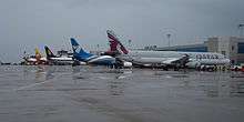
Kozhikode is served by Calicut International Airport (IATA: CCJ, ICAO: VOCL) located at Karipur, about 28 kilometres (17 miles) from Kozhikode city. The airport started operation in April 1988. It has two terminals, one for domestic flights and second for international flights.[11]
References
- "District Panchayath Kozhikode". kozhikodejillapanchayath.in. Retrieved 15 February 2020.
- "Archived copy". Archived from the original on 11 January 2010. Retrieved 18 November 2012.CS1 maint: archived copy as title (link)
- "Reports of National Panchayat Directory: Block Panchayats of Kozhikode, Kerala". Ministry of Panchayati Raj, Government of India. Archived from the original on 13 November 2011. Retrieved 22 April 2013.
- "Decadal Variation In Population Since 1901". Retrieved 15 February 2020.
- "Archived copy". Archived from the original on 3 January 2009. Retrieved 23 May 2006.CS1 maint: archived copy as title (link)
- "District Census 2011". Census2011.co.in. 2011. Retrieved 30 September 2011.
- US Directorate of Intelligence. "Country Comparison:Population". Retrieved 1 October 2011.
Mongolia 3,133,318 July 2011 est.
- "2010 Resident Population Data". U. S. Census Bureau. Archived from the original on 19 October 2013. Retrieved 30 September 2011.
Iowa 3,046,355
- "Hindu population 56.21% in Kozhikode". The Hindu. 28 August 2015. Retrieved 15 February 2020 – via www.thehindu.com.
- "Kozhikode weather". India Meteorological Department. Archived from the original on 5 May 2010. Retrieved 14 November 2010.
- "Silver jubilee does not bring cheer to Karipur airport users | Kozhikode News - Times of India". The Times of India. Retrieved 15 February 2020.
| Wikimedia Commons has media related to Kozhikode district. |
External links
| Wikivoyage has a travel guide for Kozhikode District. |
Places adjacent to Kozhikode district | ||||||||||
|---|---|---|---|---|---|---|---|---|---|---|
| ||||||||||