Purameri
Purameri is a Village Panchayat in Kozhikode district of North Malabar region in the Indian state of Kerala. It is located in the north-western part of the district, on the way from Vatakara to Nadapuram.[1]
Purameri | |
|---|---|
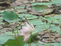 A Lotus Pond in Purameri | |
 Purameri Location in Kerala, India  Purameri Purameri (India) | |
| Coordinates: 11°38′N 75°46′E | |
| Country | |
| State | Kerala |
| District | Kozhikode |
| Area | |
| • Total | 2,027 km2 (783 sq mi) |
| Population (2001) | |
| • Total | 25,405 |
| • Density | 13/km2 (32/sq mi) |
| Languages | |
| • Official | Malayalam, English |
| Time zone | UTC+5:30 (IST) |
| PIN | 673503 |
| Telephone code | 0496 |
| Vehicle registration | KL-18 |
| Nearest city | Vatakara |
| Sex ratio | 1052 ♂/♀ |
| Literacy | 83% |
| Lok Sabha constituency | Vatakara |
| Vidhan Sabha constituency | Kuttiyadi |
| Climate | Climatic regions of India Tropical Monsoon (Köppen) |
| Website | www |
Demographics
As of 2001 India census,[2] Purameri had a population of 25,405. Males constitute 47.4% of the population and females 52.6%. Purameri has an average literacy rate of 83%, higher than the national average of 59.5%: female literacy is 81%, and male literacy is 85%.[3]
Geography
Purameri is located in Vatakara Taluk of Kozhikode district. It shares borders with Nadapuram to the east, Edacheri to the west, Thuneri to the south and Mayyazhipuzha to the north.
History & Culture
History of Purameri is known from the period of Ballads of North Malabar. In many ślokas of this ballad, Purameri has been mentioned. In the mediaeval's period, Purameri was administered by Naduvazhikal. During British Raj, this place was under Malabar district. The Kadathanadan culture is still alive here. Theyyams and Thiras are held during temple festivals. Major religions are Hinduism and Islams. People from both religions, take part in festivals of either group.[4]
Transportation
Purameri village connects to other parts of India through Vatakara city on the west and Kuttiady town on the east. National highway No.66 passes through Vatakara and the northern stretch connects to Mangalore, Goa and Mumbai. The southern stretch connects to Cochin and Trivandrum. The eastern Highway going through Kuttiady connects to Mananthavady, Mysore and Bangalore. The nearest airports are at Kannur and Kozhikode. The nearest railway station is at Vatakara.
References
- "Kerala Govt Site : Showing Purameri in Vatakara Block of Kozhikode District".
- "Census of India 2001: Data from the 2001 Census, including cities, villages and towns (Provisional)". Census Commission of India. Archived from the original on 16 June 2004. Retrieved 1 November 2008.
- "Census of India : Villages with population 5000 & above". Registrar General & Census Commissioner, India. Retrieved 10 December 2008.
- "Village History Purameri : Providing History of Villages".