Selaphum District
Selaphum (Thai: เสลภูมิ, pronounced [sěː.lā.pʰūːm]) is a district (amphoe) in the eastern part of Roi Et Province, northeastern Thailand.
Selaphum เสลภูมิ | |
|---|---|
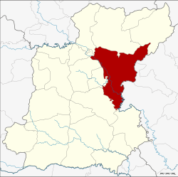 District location in Roi Et Province | |
| Coordinates: 16°2′0″N 103°56′2″E | |
| Country | Thailand |
| Province | Roi Et |
| Area | |
| • Total | 792.338 km2 (305.923 sq mi) |
| Population (2005) | |
| • Total | 122,100 |
| • Density | 154.1/km2 (399/sq mi) |
| Time zone | UTC+7 (ICT) |
| Postal code | 45120 |
| Geocode | 4510 |
Geography
Neighboring districts are (from the south clockwise): Phanom Phrai, At Samat, Thung Khao Luang, Thawat Buri, Chiang Khwan, Pho Chai, Phon Thong, and Nong Phok of Roi Et Province; Kut Chum, Sai Mun and Mueang Yasothon of Yasothon Province.
History
The district's history goes back to the village Ban Khao Din Bueng Don (บ้านเขาดินบึงโดน), named after an island in the large swamp Bueng Don. In 1879 Mueang Selaphum Nikhom (เสลภูมินิคม) was created. In 1912 it was renamed Selaphum, and converted into a district in 1914.
Administration
The district is divided into 18 sub-districts (tambons), which are further subdivided into 235 villages (mubans). Klang is a township (thesaban tambon) which covers tambon Klang and parts of tambons Na Mueang and Khwan Mueang. There are a further 16 tambon administrative organizations (TAO).
| No. | Name | Thai name | Villages | Pop. | |
|---|---|---|---|---|---|
| 1. | Klang | กลาง | 11 | 7,212 | |
| 2. | Na Ngam | นางาม | 16 | 8,372 | |
| 3. | Mueang Phrai | เมืองไพร | 14 | 6,498 | |
| 4. | Na Saeng | นาแซง | 14 | 5,824 | |
| 5. | Na Mueang | นาเมือง | 20 | 10,332 | |
| 6. | Wang Luang | วังหลวง | 18 | 6,291 | |
| 7. | Tha Muang | ท่าม่วง | 11 | 5,039 | |
| 8. | Khwao | ขวาว | 16 | 9,371 | |
| 9. | Pho Thong | โพธิ์ทอง | 14 | 7,931 | |
| 10. | Phu Ngoen | ภูเงิน | 18 | 12,061 | |
| 11. | Ko Kaeo | เกาะแก้ว | 14 | 7,611 | |
| 12. | Na Loeng | นาเลิง | 10 | 4,933 | |
| 13. | Lao Noi | เหล่าน้อย | 10 | 5,741 | |
| 14. | Si Wilai | ศรีวิลัย | 11 | 4,725 | |
| 15. | Nong Luang | หนองหลวง | 9 | 3,024 | |
| 16. | Phon Sawan | พรสวรรค์ | 9 | 4,456 | |
| 17. | Khwan Mueang | ขวัญเมือง | 11 | 6,582 | |
| 18. | Bueng Kluea | บึงเกลือ | 9 | 6,097 |