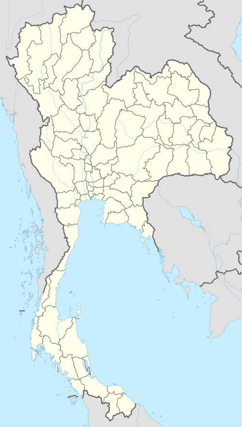
Roi Et
Roi Et (Thai: ร้อยเอ็ด, pronounced [rɔ́ːj ʔèt]) is a town (thesaban mueang) in north-eastern Thailand, capital of Roi Et Province.[1] It covers the whole tambon Nai Mueang of Mueang Roi Et district. As of 2006 it had a population of 34,229. Roi Et is 514 km from Bangkok.[2]
Roi Et | |
|---|---|
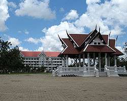 Roi Et City Hall | |
 Roi Et | |
| Coordinates: 16°3′11″N 103°39′4″E | |
| Country | |
| Provinces | Roi Et Province |
| Amphoe | Mueang Roi Et District |
| Elevation | 150 m (490 ft) |
| Population (2006) | 34,229 |
| Time zone | UTC+7 (ICT) |


Geography
Roi Et lies on a flat plain about 150 metres (490 ft) above sea level.
Climate
Roi Et has a tropical savanna climate (Köppen climate classification Aw). Winters are dry and very warm. Temperatures rise until April, which is hot with the average daily maximum at 35.7 °C (96.3 °F). The monsoon season runs from May through October, with heavy rain and somewhat cooler temperatures during the day, although nights remain warm.
| Climate data for Roi Et (1981–2010) | |||||||||||||
|---|---|---|---|---|---|---|---|---|---|---|---|---|---|
| Month | Jan | Feb | Mar | Apr | May | Jun | Jul | Aug | Sep | Oct | Nov | Dec | Year |
| Record high °C (°F) | 37.3 (99.1) |
38.5 (101.3) |
40.1 (104.2) |
41.2 (106.2) |
41.1 (106.0) |
37.8 (100.0) |
36.8 (98.2) |
35.2 (95.4) |
35.7 (96.3) |
34.9 (94.8) |
36.2 (97.2) |
35.0 (95.0) |
41.2 (106.2) |
| Average high °C (°F) | 30.3 (86.5) |
32.6 (90.7) |
34.7 (94.5) |
35.7 (96.3) |
34.2 (93.6) |
33.1 (91.6) |
32.4 (90.3) |
31.7 (89.1) |
31.4 (88.5) |
31.1 (88.0) |
30.5 (86.9) |
29.3 (84.7) |
32.3 (90.1) |
| Daily mean °C (°F) | 23.3 (73.9) |
25.7 (78.3) |
28.2 (82.8) |
29.8 (85.6) |
29.0 (84.2) |
28.7 (83.7) |
28.3 (82.9) |
27.9 (82.2) |
27.5 (81.5) |
26.7 (80.1) |
24.9 (76.8) |
22.9 (73.2) |
26.9 (80.4) |
| Average low °C (°F) | 17.2 (63.0) |
19.8 (67.6) |
22.7 (72.9) |
24.8 (76.6) |
25.0 (77.0) |
25.2 (77.4) |
25.0 (77.0) |
24.8 (76.6) |
24.5 (76.1) |
23.0 (73.4) |
20.1 (68.2) |
17.3 (63.1) |
22.5 (72.5) |
| Record low °C (°F) | 8.9 (48.0) |
11.3 (52.3) |
10.9 (51.6) |
17.5 (63.5) |
20.0 (68.0) |
21.8 (71.2) |
21.2 (70.2) |
21.9 (71.4) |
20.4 (68.7) |
16.0 (60.8) |
11.8 (53.2) |
6.7 (44.1) |
6.7 (44.1) |
| Average rainfall mm (inches) | 3.6 (0.14) |
19.2 (0.76) |
41.2 (1.62) |
75.9 (2.99) |
186.1 (7.33) |
223.5 (8.80) |
195.9 (7.71) |
252.2 (9.93) |
219.8 (8.65) |
107.3 (4.22) |
15.2 (0.60) |
2.1 (0.08) |
1,342 (52.83) |
| Average rainy days (≥ 110.0) | 0.9 | 2.5 | 4.3 | 7.4 | 14.7 | 15.6 | 15.8 | 18.7 | 16.7 | 10.0 | 2.6 | 0.8 | 110 |
| Average relative humidity (%) | 65 | 63 | 61 | 65 | 73 | 76 | 77 | 80 | 81 | 77 | 70 | 66 | 71 |
| Mean monthly sunshine hours | 257.3 | 243.0 | 238.7 | 204.0 | 158.1 | 117.0 | 120.9 | 117.8 | 144.0 | 179.8 | 219.0 | 257.3 | 2,256.9 |
| Mean daily sunshine hours | 8.3 | 8.6 | 7.7 | 6.8 | 5.1 | 3.9 | 3.9 | 3.8 | 4.8 | 5.8 | 7.3 | 8.3 | 6.2 |
| Source 1: Thai Meteorological Department[3] | |||||||||||||
| Source 2: Office of Water Management and Hydrology, Royal Irrigation Department (sun and humidity)[4] | |||||||||||||
Transportation
Route 214 leads north to Kalasin and south to Kaset Wisai, Surin, and Prasat. Route 2044 leads east to Phon Thong. Route 23 leads west to Maha Sarakham and Ban Phai, and east to Yasothon and Ubon Ratchathani. Route 215 leads south to Suwannaphum and the border with Surin Province.
Roi Et is served by Roi Et Airport to the north of the town.[5]
References
- "Roi Et". Tourism Authority of Thailand (TAT). Archived from the original on 23 June 2012. Retrieved 21 June 2015.
- "Distance Bangkok-Roi Et". DistancesFrom.com. Retrieved 21 June 2015.
- "Climatological Data for the Period 1981–2010". Thai Meteorological Department. p. 11–12. Retrieved 1 August 2016.
- "ปริมาณการใช้น้ำของพืชอ้างอิงโดยวิธีของ Penman Monteith (Reference Crop Evapotranspiration by Penman Monteith)" (PDF) (in Thai). Office of Water Management and Hydrology, Royal Irrigation Department. p. 54. Retrieved 1 August 2016.
- "Rob Muang Airport". OurAirports. Retrieved 4 February 2013.
External links
