Ouville-l'Abbaye
Ouville-l’Abbaye is a commune in the Seine-Maritime department in the Normandy region in northern France.
Ouville-l’Abbaye | |
|---|---|
 The church in Ouville-l'Abbaye | |
Location of Ouville-l’Abbaye 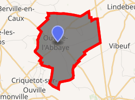
| |
 Ouville-l’Abbaye  Ouville-l’Abbaye | |
| Coordinates: 49°41′44″N 0°51′43″E | |
| Country | France |
| Region | Normandy |
| Department | Seine-Maritime |
| Arrondissement | Rouen |
| Canton | Yvetot |
| Intercommunality | CC Plateau de Caux-Doudeville-Yerville |
| Government | |
| • Mayor (2008–2014) | Olivier Leconte |
| Area 1 | 7.31 km2 (2.82 sq mi) |
| Population (2017-01-01)[1] | 672 |
| • Density | 92/km2 (240/sq mi) |
| Time zone | UTC+01:00 (CET) |
| • Summer (DST) | UTC+02:00 (CEST) |
| INSEE/Postal code | 76491 /76760 |
| Elevation | 134–173 m (440–568 ft) (avg. 165 m or 541 ft) |
| 1 French Land Register data, which excludes lakes, ponds, glaciers > 1 km2 (0.386 sq mi or 247 acres) and river estuaries. | |
Geography
A farming village situated in the Pays de Caux, some 27 miles (43 km) northwest of Rouen at the junction of the D55 and the D67 roads.
Population
| 1962 | 1968 | 1975 | 1982 | 1990 | 1999 | 2006 |
|---|---|---|---|---|---|---|
| 232 | 285 | 405 | 483 | 602 | 553 | 616 |
| Starting in 1962: Population without duplicates | ||||||
Places of interest
- The church of St.Martin, dating from the seventeenth century.
- The ruins of the seventeenth century abbey.
- Outline of a Roman villa.
- A château in Louis XV style, with many dependant buildings.
- The medieval manorhouse of Mont-de-Bourg.
- Several sixteenth century buildings.
References
- "Populations légales 2017". INSEE. Retrieved 6 January 2020.
| Wikimedia Commons has media related to Ouville-l'Abbaye. |
| Authority control |
|
|---|
This article is issued from Wikipedia. The text is licensed under Creative Commons - Attribution - Sharealike. Additional terms may apply for the media files.