National Register of Historic Places listings in Southold (town), New York
This list is intended to provide a comprehensive listing of entries on the National Register of Historic Places in Town of Southold, New York. The locations of National Register properties for which the latitude and longitude coordinates are included below, may be seen in a Google map.[1]
Listings
| [2] | Name on the Register | Image | Date listed[3] | Location | City or town | Description |
|---|---|---|---|---|---|---|
| 1 | Charles and Anna Bates House | 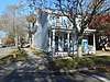 Charles and Anna Bates House |
August 18, 2017 (#100001490) |
126 Center St. 41°06′17″N 72°21′46″W |
Greenport | |
| 2 | Brecknock Hall | 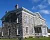 Brecknock Hall |
April 22, 2005 (#05000331) |
North Road near Manhassett Avenue 41°07′00″N 72°21′43″W |
Stirling | |
| 3 | Congregation Tifereth Israel Synagogue | 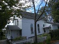 Congregation Tifereth Israel Synagogue |
March 22, 2006 (#06000161) |
519 Fourth Street 41°06′02″N 72°21′55″W |
Greenport | |
| 4 | Richard Cox House | 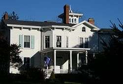 Richard Cox House |
August 21, 1986 (#86001721) |
Mill Road 40°59′55″N 72°33′28″W |
Mattituck | |
| 5 | East Marion Main Road Historic District | August 8, 2019 (#100004238) |
Generally Main Road, Bay Avenue, and Cemetery Avenue 41°07′40″N 72°20′24″W |
East Marion | Represents evolution of East Marion from settlement of fishermen and farmers in mid-18th century to mid-20th century vacation community. | |
| 6 | Fort Corchaug Archeological Site | 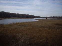 Fort Corchaug Archeological Site |
January 18, 1974 (#74001308) |
Address Restricted |
Cutchogue | |
| 7 | Andrew Gildersleeve Octagonal Building |  Andrew Gildersleeve Octagonal Building |
August 19, 1976 (#76001280) |
Main Road and Love Lane 40°59′28″N 72°31′25″W |
Mattituck | |
| 8 | Greenport Railroad Station | .jpg) Greenport Railroad Station |
July 20, 1989 (#89000947) |
Third and Wiggins Streets 41°05′59″N 72°21′49″W |
Greenport | |
| 9 | Greenport Village Historic District | Greenport Village Historic District |
September 13, 1984 (#84002973) |
Roughly bounded by Stirling Basin, Main, Monsell, 2nd, and Front Streets 41°06′17″N 72°21′53″W |
Greenport | |
| 10 | Joseph Nelson Hallock House | 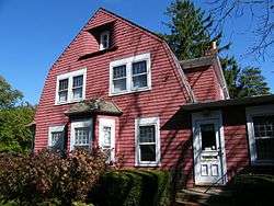 Joseph Nelson Hallock House |
April 22, 2005 (#05000330) |
Main Road and Maple Avenue 41°03′55″N 72°25′26″W |
Southold | |
| 11 | Horton Point Lighthouse | 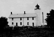 Horton Point Lighthouse |
October 21, 1994 (#94001237) |
N end of Lighthouse Road 41°05′07″N 72°26′47″W |
Southold | |
| 12 | Samuel Landon House | 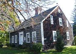 Samuel Landon House |
April 20, 2005 (#05000329) |
Main Road Bet. Hobart Road and Maple Lane 41°03′57″N 72°25′25″W |
Southold | |
| 13 | Latimer Reef Light Station | 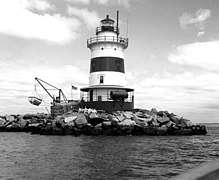 Latimer Reef Light Station |
July 19, 2006 (#06000635) |
In Fisher's Island Sound, one mi NW of East Point on Fisher's Island 41°18′15″N 71°56′02″W |
Fisher's Island | |
| 14 | New Suffolk School | 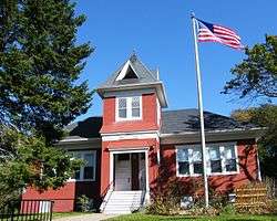 New Suffolk School |
September 12, 2002 (#02001050) |
Fifth Street at King Street 40°59′32″N 72°28′32″W |
New Suffolk | |
| 15 | The Old House | 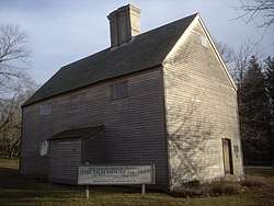 The Old House |
October 15, 1966 (#66000573) |
NY 25 41°00′29″N 72°29′10″W |
Cutchogue | |
| 16 | Orient Historic District | 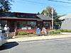 Orient Historic District |
May 21, 1976 (#76001283) |
NY 25, Village Lane and vicinity 41°08′21″N 72°18′11″W |
Orient | |
| 17 | Orient Point Light Station | 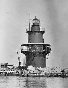 Orient Point Light Station |
January 9, 2007 (#06001229) |
NE tip of Long Island, 1.1 mi. NE of Eastern Terminus of NY 25 41°09′48″N 72°13′27″W |
Orient | |
| 18 | Plum Island Light Station | 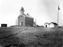 Plum Island Light Station |
February 11, 2011 (#11000014) |
Northwestern corner of Plum Island 41°10′25″N 72°12′41″W |
Orient Point | |
| 19 | Henry W. Prince Building | 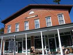 Henry W. Prince Building |
February 24, 2005 (#05000091) |
54325 Main Road 41°03′53″N 72°25′40″W |
Southold | |
| 20 | Race Rock Light Station | 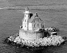 Race Rock Light Station |
April 29, 2005 (#05000347) |
0.6 mi. SW of Race Point 41°14′44″N 72°02′49″W |
Fishers Island | |
| 21 | Southold Historic District | 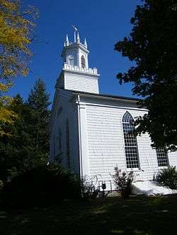 Southold Historic District |
October 14, 1997 (#97001202) |
Along Main Road, roughly bounded by Jockey Creek Drive, Griswold Street, Long Island RR Tracks, and Wells Road 41°03′35″N 72°26′01″W |
Southold | |
| 22 | Terry-Mulford House |  Terry-Mulford House |
February 7, 1984 (#84003003) |
NY 25 41°09′06″N 72°16′38″W |
Orient | |
| 23 | Town Doctors' House and Site | 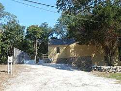 Town Doctors' House and Site |
January 5, 2005 (#04001448) |
310 Ackerly Pond Lane 41°03′25″N 72°26′12″W |
Southold | |
| 24 | David Tuthill Farmstead | 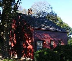 David Tuthill Farmstead |
November 23, 1984 (#84000295) |
New Suffolk Lane 41°00′25″N 72°29′39″W |
Cutchogue | |
| 25 | Jesse and Ira Tuthill House | 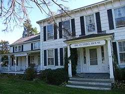 Jesse and Ira Tuthill House |
March 22, 2006 (#06000158) |
Main Road and Cardinal Drive 40°59′49″N 72°31′11″W |
Mattituck | |
| 26 | Joshua Wells House | 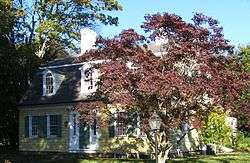 Joshua Wells House |
March 6, 2002 (#02000139) |
525 New Suffolk Road 41°00′35″N 72°29′05″W |
Cutchogue |
See also
| Wikimedia Commons has media related to National Register of Historic Places in Suffolk County, New York. |
References
- The latitude and longitude information provided is primarily from the National Register Information System, and has been found to be fairly accurate for about 99% of listings. For 1%, the location info may be way off. We seek to correct the coordinate information wherever it is found to be erroneous. Please leave a note in the Discussion page for this article if you believe any specific location is incorrect.
- Numbers represent an ordering by significant words. Various colorings, defined here, differentiate National Historic Landmarks and historic districts from other NRHP buildings, structures, sites or objects.
- The eight-digit number below each date is the number assigned to each location in the National Register Information System database, which can be viewed by clicking the number.
External links
- NRHP applications for New York State sites (Note, interface works best with Microsoft Internet Explorer browser; hit "Results" after searching, to actually see the results).
| Topics |  | |
|---|---|---|
| Lists by county |
| |
| Lists by city | ||
| Other lists | ||
| ||
This article is issued from Wikipedia. The text is licensed under Creative Commons - Attribution - Sharealike. Additional terms may apply for the media files.