List of cities in Canada
This is a list of incorporated cities in Canada, in alphabetical order categorized by province or territory. More thorough lists of communities are available for each province.

Capitals
Alberta

To qualify as a city in Alberta, a sufficient population size (10,000 people or more) must be present and a majority of the buildings must be on parcels of land less than 1,850 square metres.[1] A community is not always incorporated as a city even if it meets these requirements. The urban service areas of Fort McMurray and Sherwood Park are hamlets recognized as equivalents of cities, but remain unincorporated. Nine towns are also eligible for city status but remain incorporated as towns.
Alberta has 19 cities. Beaumont is Alberta's newest city, incorporating from town status on January 1, 2019.[2]
| Cities in Alberta | ||||||
|---|---|---|---|---|---|---|
| Name | Incorporation date (city)[3] |
Population (2016)[4] |
Population (2011)[4] |
Change (%)[4] |
Land area (km²)[4] |
Population density (per km²)[4] |
| Airdrie | January 1, 1985 | 61,581 | 43,271 | +42.3% | 84.57 | 728.2/km2 |
| Beaumont[AB 1] | January 1, 2019 | 17,396 | 13,284 | +31.0% | 10.47 | 1,661.5/km2 |
| Brooks | September 1, 2005 | 14,451 | 13,676 | +5.7% | 18.59 | 777.4/km2 |
| Calgary[AB 2] | January 1, 1894 | 1,239,220 | 1,096,833 | +13.0% | 825.56 | 1,501.1/km2 |
| Camrose | January 1, 1955 | 18,742 | 17,286 | +8.4% | 42.62 | 439.7/km2 |
| Chestermere[AB 3] | January 1, 2015[5] | 19,887 | 14,824 | +34.2% | 32.94 | 603.7/km2 |
| Cold Lake | October 1, 2000 | 14,961 | 13,839 | +8.1% | 59.92 | 249.7/km2 |
| Edmonton[AB 4] | October 8, 1904 | 932,546 | 812,201 | +14.8% | 685.25 | 1,360.9/km2 |
| Fort Saskatchewan | July 1, 1985 | 24,149 | 19,051 | +26.8% | 48.18 | 501.2/km2 |
| Grande Prairie | January 1, 1958 | 63,166 | 55,655 | +13.5% | 132.73 | 475.9/km2 |
| Lacombe | September 5, 2010 | 13,057 | 11,707 | +11.5% | 20.81 | 627.4/km2 |
| Leduc | September 1, 1983 | 29,993 | 24,304 | +23.4% | 42.44 | 706.7/km2 |
| Lethbridge | May 9, 1906 | 92,729 | 83,517 | +11.0% | 122.09 | 759.5/km2 |
| Lloydminster (part)[AB 5] | January 1, 1958 | 19,645[AB 6] | 18,032[AB 7] | +8.9% | 24.04 | 817.2/km2[AB 8] |
| Medicine Hat | May 9, 1906 | 63,260 | 60,005 | +5.4% | 112.04 | 564.6/km2 |
| Red Deer | March 25, 1913 | 100,418 | 90,564 | +10.9% | 104.73 | 958.8/km2 |
| Spruce Grove | March 1, 1986 | 34,066 | 26,171 | +30.2% | 32.2 | 1,058.0/km2 |
| St. Albert | January 1, 1977 | 65,589 | 61,466 | +6.7% | 48.45 | 1,353.7/km2 |
| Wetaskiwin[AB 9] | May 9, 1906 | 12,655 | 12,525 | +1.0% | 18.31 | 691.2/km2 |
| Total cities | — | 2,837,511 | 2,488,211 | +14.0% | 2,465.94 | 1,150.7/km2 |
Notes:
- Beaumont is Alberta's newest city, incorporated on January 1, 2019. Based on 2016 data, Beaumont is Alberta's smallest city by land area, but in 2017 its area increased to nearly 2,400 hectares, making it larger than Wetaskiwin and Lacombe.[3]
- Calgary is Canada's third-largest city, Alberta's largest city by both population and area, and was Alberta's first city, incorporated on January 1, 1894. The Calgary census metropolitan area (CMA) includes the cities of Airdrie, Calgary and Chestermere.
- Chestermere was known as Chestermere Lake prior to March 1, 1993.[3]
- Edmonton is Canada's fifth-largest city and Alberta's capital. The Edmonton CMA includes the cities of Beaumont, Edmonton, Fort Saskatchewan, Leduc, Spruce Grove and St. Albert.
- The balance of Lloydminster is located within Saskatchewan.
- This 2016 population does not include 11,765 in the Saskatchewan portion of Lloydminster. The city's total population in 2016 was 31,410.
- This 2011 population does not include 9,772 in the Saskatchewan portion of Lloydminster. The city's total population in 2011 was 27,804.
- This area does not include 18.28 km2 (7.06 sq mi) in the Saskatchewan portion of Lloydminster. The city's total land area in 2011 was 42.32 km2 (16.34 sq mi).
- Wetaskiwin is Alberta's smallest city by population and land area.
British Columbia
In British Columbia, a community can be incorporated as a city if its population exceeds 5,000.[6] Once so incorporated, a city does not lose this status even if its population later declines; the once-larger City of Greenwood, for example, now has a population of just 665 people.
British Columbia has 52 cities.
| Cities in British Columbia | |||||||||
|---|---|---|---|---|---|---|---|---|---|
| Name | Location | Incorporation Date (City) | Population (2016) | Population (2011) | Change (%) | Land Area (km2) | Population Density (/km2) | ||
| Abbotsford | Abbotsford, City of | City | Fraser Valley | December 12, 1995 | 141,397 | 133,497 | 5.9 | 375.55 | 376.5 |
| Armstrong | Armstrong, City of | City | North Okanagan | March 31, 1913 | 5,114 | 4,830 | 5.9 | 5.22 | 979.8 |
| Burnaby | Burnaby, City of | City | Metro Vancouver | September 22, 1892 | 232,755 | 223,218 | 4.3 | 90.61 | 2,568.7 |
| Campbell River | Campbell River, City of | City | Strathcona | June 24, 1947 | 32,588 | 31,186 | 4.5 | 144.36 | 225.7 |
| Castlegar | Castlegar, City of | City | Central Kootenay | January 1, 1974 | 8,039 | 7,816 | 2.9 | 19.67 | 408.6 |
| Chilliwack | Chilliwack, City of | City | Fraser Valley | April 26, 1873 | 83,788 | 77,936 | 7.5 | 261.65 | 320.2 |
| Colwood | Colwood, City of | City | Capital | June 24, 1985 | 16,859 | 16,093 | 4.8 | 17.67 | 954.2 |
| Coquitlam | Coquitlam, City of | City | Metro Vancouver | July 25, 1891 | 139,284 | 126,804 | 9.8 | 122.30 | 1,138.9 |
| Courtenay | Courtenay, The Corporation of the City of | City | Comox Valley | January 1, 1915 | 25,599 | 24,216 | 5.7 | 29.38 | 789.9 |
| Cranbrook | Cranbrook, The Corporation of the City of | City | East Kootenay | November 1, 1905 | 20,047 | 19,319 | 3.8 | 32.00 | 626.6 |
| Dawson Creek | Dawson Creek, The Corporation of the City of | City | Peace River | May 26, 1936 | 12,178 | 11,583 | 5.1 | 24.37 | 499.8 |
| Delta | Delta, City of | City | Metro Vancouver | September 22, 2017[7] | 102,238 | 99,863 | 2.4 | 180.20 | 567.4 |
| Duncan | Duncan, The Corporation of the City of | City | Cowichan Valley | March 4, 1912 | 4,944 | 4,932 | 0.2 | 2.07 | 2,387.1 |
| Enderby | Enderby, The Corporation of the City of | City | North Okanagan | March 1, 1905 | 2,964 | 2,932 | 1.1 | 4.26 | 695.3 |
| Fernie | Fernie, The Corporation of the City of | City | East Kootenay | July 28, 1904 | 5,249 | 4,448 | 18.0 | 13.50 | 388.7 |
| Fort St. John | Fort St. John, City of | City | Peace River | December 31, 1947 | 20,155 | 18,609 | 8.3 | 26.27 | 767.3 |
| Grand Forks | Grand Forks, The Corporation of the City of | City | Kootenay Boundary | April 15, 1897 | 4,049 | 3,985 | 1.6 | 10.43 | 388.1 |
| Greenwood | Greenwood, The Corporation of the City of | City | Kootenay Boundary | July 12, 1897 | 665 | 708 | −6.1 | 2.42 | 274.9 |
| Kamloops | Kamloops, City of | City | Thompson-Nicola | October 17, 1967 | 90,280 | 85,678 | 5.4 | 299.25 | 301.7 |
| Kelowna | Kelowna, City of | City | Central Okanagan | May 4, 1905 | 127,380 | 117,312 | 8.6 | 211.85 | 601.3 |
| Kimberley | Kimberley, City of | City | East Kootenay | March 29, 1944 | 7,425 | 6,652 | 11.6 | 60.62 | 122.5 |
| Langford | Langford, City of | City | Capital | December 8, 1992 | 35,342 | 29,228 | 20.9 | 39.94 | 885.0 |
| Langley | Langley, City of | City | Metro Vancouver | March 15, 1955 | 25,888 | 25,081 | 3.2 | 10.22 | 2,533.6 |
| Maple Ridge | Maple Ridge, City of | City | Metro Vancouver | September 12, 2014[8] | 82,256 | 76,052 | 8.2 | 266.78 | 308.3 |
| Merritt | Merritt, City of | City | Thompson-Nicola | April 1, 1911 | 7,139 | 7,113 | 0.4 | 26.07 | 273.9 |
| Nanaimo | Nanaimo, City of | City | Nanaimo | December 24, 1874 | 90,504 | 83,810 | 8.0 | 90.76 | 997.2 |
| Nelson | Nelson, The Corporation of the City of | City | Central Kootenay | March 18, 1897 | 10,572 | 10,230 | 3.3 | 11.95 | 884.3 |
| New Westminster | New Westminster, The Corporation of the City of | City | Metro Vancouver | July 16, 1860 | 70,996 | 65,976 | 7.6 | 15.63 | 4,543.4 |
| North Vancouver | North Vancouver, The Corporation of the City of | City | Metro Vancouver | August 10, 1891 | 52,898 | 48,196 | 1.8 | 11.85 | 4,465.1 |
| Parksville | Parksville, City of | City | Nanaimo | June 19, 1945 | 12,514 | 11,977 | 4.5 | 14.56 | 859.6 |
| Penticton | Penticton, The Corporation of the City of | City | Okanagan-Similkameen | January 1, 1909 | 33,761 | 32,877 | 2.7 | 42.10 | 801.8 |
| Pitt Meadows | Pitt Meadows, City of | City | Metro Vancouver | April 25, 1914 | 18,573 | 17,736 | 4.7 | 86.51 | 214.7 |
| Port Alberni | Port Alberni, City of | City | Alberni-Clayoquot | October 28, 1967 | 17,678 | 17,743 | −0.4 | 19.76 | 894.7 |
| Port Coquitlam | Port Coquitlam, The Corporation of the City of | City | Metro Vancouver | March 7, 1913 | 58,612 | 55,958 | 4.7 | 29.17 | 2,009.4 |
| Port Moody | Port Moody, City of | City | Metro Vancouver | March 11, 1913 | 33,551 | 33,011 | 1.6 | 25.89 | 1,295.9 |
| Powell River | Powell River, The Corporation of the City of | City | Powell River | October 15, 1955 | 13,157 | 13,165 | −0.1 | 28.91 | 455.1 |
| Prince George | Prince George, City of | City | Fraser-Fort George | March 6, 1915 | 74,003 | 71,974 | 2.8 | 318.26 | 232.5 |
| Prince Rupert | Prince Rupert, City of | City | Skeena-Queen Charlotte | March 10, 1910 | 12,220 | 12,508 | −2.3 | 66.28 | 184.4 |
| Quesnel | Quesnel, City of | City | Cariboo | March 21, 1928 | 9,879 | 10,007 | −1.3 | 35.39 | 279.2 |
| Revelstoke | Revelstoke, City of | City | Columbia Shuswap | March 1, 1899 | 7,547 | 7,139 | 5.7 | 41.13 | 183.5 |
| Richmond | Richmond, City of | City | Metro Vancouver | November 10, 1879 | 198,309 | 190,473 | 4.1 | 129.27 | 1,534.1 |
| Rossland | Rossland, The Corporation of the City of | City | Kootenay Boundary | March 18, 1897 | 3,729 | 3,556 | 4.9 | 59.79 | 62.4 |
| Salmon Arm | Salmon Arm, City of | City | Columbia Shuswap | May 15, 1905 | 17,706 | 17,464 | 1.4 | 155.28 | 114.0 |
| Surrey | Surrey, City of | City | Metro Vancouver | November 10, 1879 | 517,887 | 468,251 | 10.6 | 316.41 | 1,636.8 |
| Terrace | Terrace, City of | City | Kitimat-Stikine | December 31, 1927 | 11,643 | 11,486 | 1.4 | 57.36 | 203.0 |
| Trail | Trail, City of | City | Kootenay Boundary | June 14, 1901 | 7,709 | 7,681 | 0.4 | 34.93 | 220.7 |
| Vancouver[lower-alpha 1] | Vancouver, City of | City | Metro Vancouver | April 6, 1886 | 631,486 | 603,502 | 4.6 | 114.97 | 5,492.6 |
| Vernon | Vernon, The Corporation of the City of | City | North Okanagan | December 30, 1892 | 40,116 | 38,180 | 5.1 | 96.05 | 417.7 |
| Victoria[lower-alpha 2] | Victoria, The Corporation of the City of | City | Capital | August 2, 1862 | 85,792 | 80,017 | 7.2 | 19.47 | 4,305.8 |
| West Kelowna | West Kelowna, City of | City | Central Okanagan | June 26, 2015[9] | 32,655 | 30,902 | 5.7 | 123.53 | 264.4 |
| White Rock | White Rock, The Corporation of the City of | City | Metro Vancouver | April 15, 1957 | 19,952 | 19,339 | 3.2 | 5.12 | 3,893.1 |
| Williams Lake | Williams Lake, City of | City | Cariboo | March 15, 1929 | 10,753 | 10,832 | −0.7 | 33.13 | 324.6 |
| Total cities | — | 2,950,111 | 2,881,552 | 8.03125 | 4,243 | 1031.435 | |||
Notes:
- Vancouver is Canada's eighth-largest city and British Columbia's largest city by population. The Vancouver CMA includes the cities of Burnaby, Coquitlam, Langley, Maple Ridge, New Westminster, North Vancouver, Pitt Meadows, Port Coquitlam, Port Moody, Richmond, Surrey, Vancouver and White Rock.
- Victoria is British Columbia's capital. The Victoria CMA includes the cities of Colwood, Langford and Victoria.
Manitoba
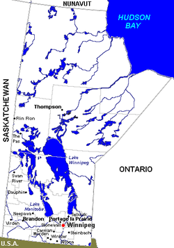
A community in Manitoba may seek city status once reaching a population of 7,500.[10] Manitoba's newest city is Morden, which changed from town to city status on August 24, 2012.[10]
Manitoba has 10 cities.
| Cities in Manitoba | |||||
|---|---|---|---|---|---|
| Name | Population (2016)[11][12] |
Population (2011)[11] |
Change (%)[11] |
Area (km²)[11] |
Population density (2016)[11] |
| Brandon | 48,859 | 46,061 | +6.1% | 77.41 | 631.2 |
| Dauphin[MB 1] | 8,369[MB 2] | 8,251 | +1.4% | 12.61 | 670.7 |
| Flin Flon (part)[MB 3] | 4,991[MB 4] | 5,405 | −7.7% | 13.87[MB 5] | 359.2 |
| Morden[MB 6] | 8,668 | 7,812 | +11.0% | 16.37 | 529.4 |
| Portage la Prairie | 13,304 | 12,996 | +2.4% | 24.68 | 539.1 |
| Selkirk | 10,278 | 9,834 | +4.5% | 24.86 | 413.4 |
| Steinbach | 15,829 | 13,524 | +17.0% | 25.59 | 618.6 |
| Thompson | 13,678 | 13,123 | +4.2% | 20.79 | 657.8 |
| Winkler | 12,660[MB 7] | 10,670 | +18.7% | 17.00 | 740.5 |
| Winnipeg[MB 8] | 705,244 | 663,617 | +6.3% | 464.33 | 1,518.8 |
| Total cities | 841,880 | 791,293 | +6.4% | 697.51 | 1,207.0 |
Notes:
- Dauphin is Manitoba's smallest city by area.
- Statistics Canada originally published Dauphin's 2016 population as 8,457, but subsequently amended it to 8,369.[12]
- Flin Flon is Manitoba's smallest city by population. The balance of Flin Flon is located within Saskatchewan.
- Statistics Canada originally published the Manitoba portion of Flin Flon's 2016 population as 4,982, but subsequently amended it to 4,991.[12]
- This area does not include 2.37 km2 (0.92 sq mi) in the Saskatchewan portion of Flin Flon. The city's total area in 2016 was 16.24 km2 (6.27 sq mi).
- Morden is Manitoba's newest city, incorporated August 24, 2012.
- Statistics Canada originally published Winkler's 2016 population as 12,591, but subsequently amended it to 12,660.[12]
- Winnipeg is Canada's seventh-largest city and Manitoba's capital and largest city by both population and area. The Winnipeg census metropolitan area (CMA) is formed around the City of Winnipeg.
New Brunswick

New Brunswick has eight cities.
| Cities in New Brunswick | |||||||
|---|---|---|---|---|---|---|---|
| Name | Council type[13] | Council size[13] | Population (2016)[14] |
Population (2011)[15] |
Change (%)[15] |
Land area (km²)[15] |
Population density (per km²)[15] |
| Bathurst | at-large | 7 | 11,897 | 12,275 | −3.1 | 92.04 | 129.3 |
| Campbellton[NB 1] | at-large | 6 | 6,883 | 7,385 | −6.8 | 18.58 | 370.5 |
| Dieppe | ward | 8 | 25,384 | 23,310 | 8.9 | 54.05 | 469.6 |
| Edmundston | ward | 8 | 16,580 | 16,032 | 3.4 | 106.85 | 155.2 |
| Fredericton[NB 2] | ward | 12 | 58,220 | 56,224 | 3.6 | 132.57 | 439.2 |
| Miramichi | at-large | 8 | 17,537 | 17,811 | −1.5 | 179.93 | 99.0 |
| Moncton[NB 3] | ward | 10 | 71,889 | 69,074 | 4.1 | 141.92 | 506.5 |
| Saint John[NB 4] | ward | 10 | 67,575 | 70,063 | −3.6 | 315.96 | 213.9 |
| Total cities | — | — | 275,965 | 256,141 | 1,040.22 | 261.7 | |
Notes:
- Campbellton is New Brunswick's smallest city by population and area.
- Fredericton is New Brunswick's capital.
- The Moncton census metropolitan area (CMA) includes the City of Dieppe.
- Saint John is New Brunswick's second largest city by population and area. The Saint John CMA is formed around the City of Saint John.
Newfoundland and Labrador
Newfoundland and Labrador has three cities.
| Name | Population (2016)[16] |
Population (2011)[17] |
Change (%)[17] |
Area (km²)[17] |
Population density[17] |
|---|---|---|---|---|---|
| Corner Brook[NL 1] | 19,806 | 19,886 | −0.4 | 148.26 | 133.6 |
| Mount Pearl[NL 2] | 22,957 | 24,284 | −5.5 | 15.76 | 1,456.8 |
| St. John's[NL 3] | 108,860 | 106,172 | 2.5 | 445.88 | 244.1 |
| Total cities | 151,623 | 150,342 | −1.1 | 609.90 | 611.5 |
Notes:
- Corner Brook is Newfoundland and Labrador's smallest city by population.
- Mount Pearl is Newfoundland and Labrador's smallest city by area.
- St. John's is Newfoundland and Labrador's capital and largest city by both population and area. The St. John's census metropolitan area includes the cities of Mount Pearl and St. John's.
Northwest Territories
As in the other two Canadian territories, the only incorporated city in the Northwest Territories is its capital, Yellowknife.
| Name | Population (2016)[18] |
Population (2011)[19] |
Change (%)[19] |
Area (km²)[19] |
Population density[19] |
|---|---|---|---|---|---|
| Yellowknife | 19,569 | 19,234 | 1.7 | 105.47 | 185.5 |
Nova Scotia
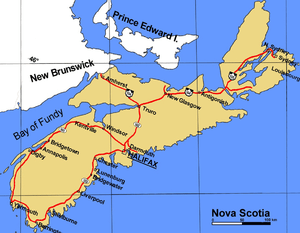
Nova Scotia no longer has any incorporated cities, as they were amalgamated into regional municipalities in the 1990s.
- Halifax – provincial capital and metropolitan area and formerly the largest city in Nova Scotia by population, now part of the Halifax Regional Municipality
- Sydney – formerly the smallest city in Nova Scotia by population, now part of the Cape Breton Regional Municipality
- Dartmouth – formerly a city in Nova Scotia, now part of the Halifax Regional Municipality
Nunavut
As in the other two Canadian territories, the only incorporated city in Nunavut is its capital, Iqaluit.
| Name | Population (2016)[20] |
Population (2011)[21] |
Change (%)[21] |
Area (km²)[21] |
Population density[21] |
|---|---|---|---|---|---|
| Iqaluit | 7,740 | 6,699 | 15.5 | 52.50 | 147.4 |
Ontario
Ontario has 52 cities. In Ontario, city status is conferred by the provincial government, generally upon the request of the incorporated municipality. A municipality may apply for city status anytime after its population surpasses 10,000. This status is not automatically conferred on a community that reaches this population target, but must be requested by the municipality and granted by the provincial Ministry of Municipal Affairs and Housing. Not all municipalities which reach this population target have pursued city designation. For example, Ajax, Oakville, and Whitby, which all had populations greater than 100,000 in 2011, are still designated as towns.[22] Once designated a city, however, a municipality does not lose this status even if its population later falls back below 10,000 (as, for example, Dryden). Ontario's newest city is Richmond Hill, which changed from town to city status on March 25, 2019.[23]
| Cities in Ontario | |||||||
|---|---|---|---|---|---|---|---|
| Name[24][22] | Municipal status[24] |
Census division[24][25] | Population (2016)[26] |
Population (2011)[22] |
Change (%)[22] |
Area (km²)[22] |
Population density[22] |
| Barrie[note 1] | Single-tier | Simcoe | 141,434 | 136,063 | 3.9 | 99.04 | 1,428.0 |
| Belleville | Single-tier | Hastings | 50,716 | 49,454 | 2.6 | 247.25 | 205.1 |
| Brampton[note 2] | Lower-tier | Peel | 593,638 | 523,911 | 13.3 | 266.36 | 2,228.7 |
| Brant | Single-tier | Brant | 36,707 | 35,638 | 3.0 | 843.25 | 43.5 |
| Brantford[note 3] | Single-tier | Brant | 97,496 | 93,650 | 4.1 | 72.44 | 1,345.9 |
| Brockville | Single-tier | Leeds and Grenville | 21,346 | 21,870 | −2.4 | 20.85 | 1,023.6 |
| Burlington | Lower-tier | Halton | 183,314 | 175,779 | 4.3 | 185.66 | 987.3 |
| Cambridge[note 4] | Lower-tier | Waterloo | 129,920 | 126,748 | 2.5 | 113.01 | 1,149.6 |
| Clarence-Rockland | Lower-tier | Prescott and Russell | 24,512 | 23,185 | 5.7 | 297.71 | 82.3 |
| Cornwall | Single-tier | Stormont, Dundas and Glengarry | 46,589 | 46,340 | 0.5 | 61.56 | 756.8 |
| Dryden[note 5] | Single-tier | Kenora | 7,749 | 7,617 | 1.7 | 66.19 | 117.1 |
| Elliot Lake | Single-tier | Algoma | 10,741 | 11,348 | −5.3 | 714.65 | 15.0 |
| Greater Sudbury[note 6] | Single-tier | Sudbury | 161,531 | 160,274 | 0.8 | 3,228.35 | 50.0 |
| Guelph[note 7] | Single-tier | Wellington | 131,794 | 121,688 | 8.3 | 87.22 | 1,511.1 |
| Haldimand County | Single-tier | Haldimand | 45,608 | 44,876 | 1.6 | 1,251.54 | 36.4 |
| Hamilton[note 8] | Single-tier | Hamilton | 536,917 | 519,949 | 3.3 | 1,117.29 | 480.6 |
| Kawartha Lakes | Single-tier | Kawartha Lakes | 75,423 | 73,214 | 3.0 | 3,084.38 | 24.5 |
| Kenora | Single-tier | Kenora | 15,096 | 15,348 | −1.6 | 211.59 | 71.3 |
| Kingston[note 9] | Single-tier | Frontenac | 123,798 | 123,363 | 0.4 | 451.19 | 274.4 |
| Kitchener[note 10] | Lower-tier | Waterloo | 233,222 | 219,153 | 6.4 | 136.77 | 1,705.2 |
| London[note 11] | Single-tier | Middlesex | 383,822 | 366,151 | 4.8 | 420.35 | 913.1 |
| Markham[note 12] | Lower-tier | York | 328,966 | 301,709 | 9.0 | 212.35 | 1,549.2 |
| Mississauga[note 13] | Lower-tier | Peel | 721,599 | 713,443 | 1.1 | 292.43 | 2,467.6 |
| Niagara Falls[note 14] | Lower-tier | Niagara | 88,071 | 82,997 | 6.1 | 209.73 | 419.9 |
| Norfolk County | Single-tier | Norfolk | 64,044 | 63,175 | 1.4 | 1,607.55 | 39.8 |
| North Bay | Single-tier | Nipissing | 51,553 | 53,651 | −3.9 | 319.11 | 161.6 |
| Orillia | Single-tier | Simcoe | 31,166 | 30,586 | 1.9 | 28.58 | 1,090.3 |
| Oshawa[note 15] | Lower-tier | Durham | 159,458 | 149,607 | 6.6 | 145.64 | 1,094.9 |
| Ottawa[note 16] | Single-tier | Ottawa | 934,243 | 883,391 | 5.8 | 2,790.30 | 334.8 |
| Owen Sound | Lower-tier | Grey | 21,341 | 21,688 | −1.6 | 24.27 | 879.2 |
| Pembroke[note 17] | Single-tier | Renfrew | 13,882 | 14,360 | −3.3 | 14.56 | 953.3 |
| Peterborough[note 18] | Single-tier | Peterborough | 81,032 | 78,698 | 2.9 | 64.25 | 1,261.2 |
| Pickering | Lower-tier | Durham | 91,771 | 88,721 | 3.4 | 231.55 | 396.3 |
| Port Colborne | Lower-tier | Niagara | 18,306 | 18,424 | −0.6 | 121.96 | 150.1 |
| Prince Edward County | Single-tier | Prince Edward | 24,735 | 25,258 | −2.1 | 1,050.49 | 23.5 |
| Quinte West | Single-tier | Hastings | 43,577 | 43,086 | 1.1 | 494.02 | 88.2 |
| Richmond Hill[note 19] | Lower-tier | York | 195,022 | 185,541 | 5.1 | 101.11 | 1,928.8 |
| Sarnia | Lower-tier | Lambton | 71,594 | 72,366 | −1.1 | 164.85 | 434.3 |
| Sault Ste. Marie | Single-tier | Algoma | 73,368 | 75,141 | −2.4 | 223.24 | 328.6 |
| St. Catharines[note 20] | Lower-tier | Niagara | 133,113 | 131,400 | 1.3 | 96.13 | 1,384.8 |
| St. Thomas | Single-tier | Elgin | 38,909 | 37,905 | 2.6 | 35.63 | 1,092.1 |
| Stratford | Single-tier | Perth | 31,465 | 30,886 | 1.8 | 28.28 | 1,112.5 |
| Temiskaming Shores | Single-tier | Timiskaming | 9,920 | 10,400 | −4.6 | 178.11 | 55.7 |
| Thorold | Lower-tier | Niagara | 18,801 | 17,931 | 4.9 | 82.99 | 226.5 |
| Thunder Bay[note 21] | Single-tier | Thunder Bay | 107,909 | 108,359 | −0.4 | 328.36 | 328.6 |
| Timmins | Single-tier | Cochrane | 41,788 | 43,165 | −3.2 | 2,978.83 | 14.0 |
| Toronto[note 22] | Single-tier | Toronto | 2,731,571 | 2,615,060 | 4.5 | 630.20 | 4,334.4 |
| Vaughan | Lower-tier | York | 306,233 | 288,301 | 6.2 | 273.56 | 1,119.4 |
| Waterloo[note 23] | Lower-tier | Waterloo | 104,986 | 98,780 | 6.3 | 64.02 | 1,639.8 |
| Welland | Lower-tier | Niagara | 52,293 | 50,631 | 3.3 | 81.04 | 645.3 |
| Windsor[note 24] | Single-tier | Essex | 217,188 | 210,891 | 3.0 | 146.38 | 1,483.8 |
| Woodstock | Lower-tier | Oxford | 40,902 | 37,754 | 8.3 | 48.97 | 835.3 |
| Total cities | — | — | 9,900,179 | 9,478,924 | 2.39 | 26,045.14 | 813.91 |
Notes:
Prince Edward Island
Prince Edward Island has two cities.
| Name | County | Population (2016)[27] |
Population (2011)[28] |
Change (%)[28] |
Area (km²)[28] |
Population density[28] |
|---|---|---|---|---|---|---|
| Charlottetown[PE 1] | Queens | 36,094 | 34,562 | 4.4 | 44.34 | 814.1 |
| Summerside[PE 2] | Prince | 14,829 | 14,751 | 0.5 | 28.49 | 520.5 |
| Total cities | – | 50,923 | 49,313 | 2.45 | 72.83 | 667.3 |
Notes:
- Charlottetown is Prince Edward Island's capital and largest city by population and area.
- Summerside is Prince Edward Island's smallest city by population and area.
Quebec
In Quebec, provincial law does not currently distinguish between towns and cities — one designation, ville, covers both types of communities regardless of size. A ville might be informally referred to as a town or a city in English, but this is an arbitrary and subjective distinction. Quebec does, however, distinguish between villes and municipalités.
Quebec has 223 villes.
Notes:
- La Tuque is Quebec's largest ville by area.
- L'Île-Dorval is Quebec's smallest ville by both population and area.
- Montreal is Canada's second-largest ville and Quebec's largest ville by population.
- Quebec City is Quebec's capital.
Saskatchewan
In Saskatchewan, Section 39(1) of The Cities Act indicates a town must have a population of 5,000 or more[30] and meet other criteria in order to incorporate as a city, although in the early 20th century several centres such as Saskatoon and Regina were granted city status despite having a smaller population. The City of Melville retains its city status despite dropping below 5,000 people in the 1990s. Kindersley has expressed an interest in applying for city status upon reaching the 5,000 milestone.[31] Saskatchewan's newest city is Warman, which changed from town to city status on October 24, 2012.[32]
Saskatchewan has 16 cities.
| Cities in Saskatchewan | ||||||||
|---|---|---|---|---|---|---|---|---|
| Name | Rural municipality[33] | Incorporation date (city) [34] |
Population (2016)[35] |
Population (2011)[36] |
Population (2006)[36] |
Change (%)[36] |
Land area (km²)[36] |
Population density (per km²)[36] |
| Estevan | Estevan No. 5 | March 1, 1957 | 11,483 | 11,054 | 10,084 | 9.6 | 18.85 | 586.6 |
| Flin Flon (part)[SK 1] | — | — | 203 | 229[SK 2] | 242 | −5.4 | 2.37[SK 3] | 96.4 |
| Humboldt | Humboldt No. 370 | November 7, 2000 | 5,869 | 5,678 | 4,998 | 13.6 | 13.46 | 421.9 |
| Lloydminster (part)[SK 4] | Britannia No. 502 | January 1, 1958 | 11,765 | 9,772[SK 5] | 8,118 | 20.4 | 17.34[SK 6] | 563.6 |
| Martensville[SK 7] | Corman Park No. 344 | November 3, 2009 | 9,645 | 7,716 | 4,978 | 55.0 | 6.23 | 1,239.3 |
| Meadow Lake | Meadow Lake No. 588 | November 9, 2009 | 5,344 | 5,045 | 4,771 | 5.7 | 7.95 | 634.2 |
| Melfort | Star City No. 428 | September 2, 1980 | 5,992 | 5,576 | 5,192 | 7.4 | 14.78 | 377.3 |
| Melville[SK 8] | Cana No. 214 | August 1, 1960 | 4,562 | 4,546[37] | 4,149 | 9.6 | 14.82 | 306.7 |
| Moose Jaw | Moose Jaw No. 161 | November 20, 1903 | 33,890 | 33,274 | 32,132 | 3.6 | 50.68 | 656.5 |
| North Battleford | North Battleford No. 437 | May 1, 1913 | 14,315 | 13,888 | 13,190 | 5.3 | 33.55 | 414 |
| Prince Albert | Prince Albert No. 461 | October 8, 1904 | 35,926 | 35,129 | 34,127 | 2.9 | 65.74 | 534.4 |
| Regina[SK 9] | Sherwood No. 159 | June 19, 1903 | 215,106 | 193,100 | 179,282 | 7.7 | 145.45 | 1,327.6 |
| Saskatoon[SK 10] | Corman Park No. 344 | May 26, 1906 | 246,376 | 222,189 | 202,408 | 9.8 | 209.56 | 1,060.3 |
| Swift Current | Swift Current No. 137 | January 15, 1914 | 16,604 | 15,503 | 14,946 | 3.7 | 24.04 | 644.9 |
| Warman[SK 11] | Corman Park No. 344 | October 27, 2012 | 11,020 | 7,084 | 4,769 | 48.5 | 8.54 | 829.7 |
| Weyburn | Weyburn No. 67 | September 1, 1913 | 10,870 | 10,484 | 9,433 | 11.1 | 18.49 | 566.9 |
| Yorkton | Orkney No. 244 | February 1, 1928 | 16,343 | 15,669 | 15,038 | 4.2 | 25.77 | 608.1 |
| Total cities | — | — | 629,233 | 595,707 | 547,615 | 8.8 | 675.25 | 882.2 |
Notes:
- The balance of Flin Flon is located within Manitoba.
- This population does not include 5,363 in the Manitoba portion of Flin Flon. The city's total population in 2011 was 5,592.
- This area does not include 13.88 km2 (5.36 sq mi) in the Manitoba portion of Flin Flon. The city's total area in 2011 was 16.25 km2 (6.27 sq mi).
- The balance of Lloydminster is located within Alberta.
- This population does not include 18,032 in the Alberta portion of Lloydminster. The city's total population in 2011 was 27,804.
- This area does not include 24.19 km2 (9.34 sq mi) in the Alberta portion of Lloydminster. The city's total area in 2011 was 41.53 km2 (16.03 sq mi).
- Martensville is Saskatchewan's smallest city by area.
- Melville is Saskatchewan's smallest city by population.
- Regina is Saskatchewan's capital and was its first city, incorporated June 19, 1903. The Regina census metropolitan area (CMA) is formed around the City of Regina.
- Saskatoon is Saskatchewan's largest city by both population and area. The Saskatoon CMA includes the cities of Martensville and Saskatoon.
- Warman is Saskatchewan's newest city, incorporated October 27, 2012.
Yukon
As in the other two Canadian territories, the only incorporated city in the Yukon is its capital, Whitehorse. Dawson was also previously incorporated as a city, but when the criteria were changed in the 1980s, its status was reduced to that of a town due to population. Through special provision, however, it is officially the town of the city of Dawson.
| Name | Population (2016)[38] |
Population (2011)[39] |
Change (%)[39] |
Area (km²)[39] |
Population density[39] |
|---|---|---|---|---|---|
| Whitehorse | 25,085 | 23,276 | 7.8 | 416.54 | 60.2 |
See also
- History of cities in Canada
- List of the 100 largest cities and towns in Canada by area
- List of the 100 largest municipalities in Canada by population
- List of cities and towns of Upper Canada
- List of cities in North America
- List of city nicknames and slogans in Canada
- List of largest Canadian cities by census
- List of towns in Canada
- List of villages in Canada
- Origins of names of cities in Canada
Notes
- The Barrie census metropolitan area (CMA) is formed around the City of Barrie.
- Brampton is Canada's ninth-largest city.
- The Brantford CMA includes the City of Brantford as well as the County of Brant, which is a single-tier city.
- The City of Cambridge, as well as the cities of Kitchener and Waterloo, form parts of the Kitchener–Cambridge–Waterloo CMA.
- Dryden is Ontario's smallest city by population.
- Greater Sudbury is Ontario's largest city by area. The Greater Sudbury CMA is formed around the City of Greater Sudbury.
- The Guelph CMA is formed around the City of Guelph.
- Hamilton is Canada's tenth-largest city. The Hamilton CMA includes the cities of Burlington and Hamilton.
- The Kingston CMA is formed around the City of Kingston.
- The City of Kitchener, as well as the cities of Cambridge and Waterloo, form parts of the Kitchener–Cambridge–Waterloo CMA.
- The London CMA includes the cities of London and St. Thomas.
- Markham is Ontario's second-newest city, adopting the name on July 1, 2012.
- Mississauga is Canada's sixth-largest city.
- The City of Niagara Falls, as well as the cities of Port Colborne, St. Catharines, Thorold and Welland, form parts of the St. Catharines–Niagara CMA.
- The Oshawa CMA is formed around the City of Oshawa.
- Ottawa is Canada's capital and fourth-largest city. The Ontario portion of the Ottawa–Gatineau CMA includes the cities of Clarence-Rockland and Ottawa.
- Pembroke is Ontario's smallest city by area.
- The Peterborough CMA is formed around the City of Peterborough.
- Richmond Hill is Ontario's newest city, adopting the name on March 26, 2019.
- The City of St. Catharines, as well as the cities of Niagara Falls, Port Colborne, Thorold and Welland, form parts of the St. Catharines–Niagara CMA.
- The Thunder Bay CMA is formed around the City of Thunder Bay.
- Toronto is Ontario's capital and Canada's and Ontario's largest city by population. The Toronto CMA includes the cities of Brampton, Markham, Mississauga, Pickering, Richmond Hill, Toronto and Vaughan.
- The City of Waterloo, as well as the cities of Cambridge and Kitchener, form parts of the Kitchener–Cambridge–Waterloo CMA.
- The Windsor CMA is formed around the City of Windsor.
References
- "Municipal Government Act - Revised Statutes of Alberta 2000, Chapter M-26 (Section 82)". Alberta Queen's Printer. January 1, 2010. Retrieved April 29, 2019.
- "O.C. 395/2018 - Municipal Government Act". Alberta Queen’s Printer. Government of Alberta. December 11, 2018. Archived from the original on January 2, 2019. Retrieved January 1, 2019.
- "City Municipal Profiles" (PDF). Alberta Municipal Affairs. April 17, 2019. Retrieved April 17, 2019.
- "Population and dwelling counts, for Canada, provinces and territories, and census subdivisions (municipalities), 2016 and 2011 censuses – 100% data (Alberta)". Statistics Canada. February 8, 2018. Retrieved January 12, 2019.
- "O.C. 499/2014". Government of Alberta. December 19, 2014. Retrieved January 1, 2015.
- Government of British Columbia - Local Government Act
- "Order in Council No. 362". Province of British Columbia. September 22, 2017. Retrieved January 10, 2018.
- "Order of the Lieutenant Governor in Council: Order in Council No. 513" (PDF). Province of British Columbia. September 9, 2014. Retrieved September 14, 2014.
- "Order in Council No. 357". Province of British Columbia. June 26, 2015. Retrieved July 1, 2015.
- "Morden Gets City Status". City of Morden. August 27, 2012. Archived from the original on September 23, 2012. Retrieved October 31, 2012.
- "Population and dwelling counts, for Canada, provinces and territories, and census subdivisions (municipalities), 2016 and 2011 censuses – 100% data (Manitoba)". Statistics Canada. February 8, 2018. Retrieved October 8, 2018.
- "Population and dwelling count amendments, 2016 Census". Statistics Canada. August 15, 2018. Retrieved October 8, 2018.
- Saint John Telegraph-Journal: "municipal election 2016 results", p.A4-A5 10 May 2016
- "Population and dwelling counts, for Canada, provinces and territories, and census subdivisions (municipalities), 2016, 2011 and 2006 censuses (New Brunswick)". Statistics Canada. May 28, 2012. Retrieved February 10, 2017.
- "Population and dwelling counts, for Canada, provinces and territories, and census subdivisions (municipalities), 2011 and 2006 censuses (New Brunswick)". Statistics Canada. May 28, 2012. Retrieved January 4, 2013.
- "Population and dwelling counts, for Canada, provinces and territories, and census subdivisions (municipalities), 2016 and 2011 censuses (Newfoundland and Labrador)". Statistics Canada.
- "Population and dwelling counts, for Canada, provinces and territories, and census subdivisions (municipalities), 2011 and 2006 censuses (Newfoundland and Labrador)". Statistics Canada. February 8, 2012. Retrieved March 1, 2012.
- "Population and dwelling counts, for Canada, provinces and territories, and census subdivisions (municipalities), 2016 and 2011 censuses (Northwest Territories)". Statistics Canada.
- "Population and dwelling counts, for Canada, provinces and territories, and census subdivisions (municipalities), 2011 and 2006 censuses (Northwest Territories)". Statistics Canada. February 8, 2012. Retrieved March 1, 2012.
- "Population and dwelling counts, for Canada, provinces and territories, and census subdivisions (municipalities), 2016 and 2011 censuses (Nunavut)". Statistics Canada.
- "Population and dwelling counts, for Canada, provinces and territories, and census subdivisions (municipalities), 2011 and 2006 censuses (Nunavut)". Statistics Canada. February 8, 2012. Retrieved March 1, 2012.
- "Population and dwelling counts, for Canada, provinces and territories, and census subdivisions (municipalities), 2011 and 2006 censuses (Ontario)". Statistics Canada. May 28, 2012. Retrieved January 3, 2013.
- Wang, sheila (26 March 2019). "Richmond Hill changes status from town to city". Richmond Hill Liberal. Retrieved 13 April 2019.
- "List of Ontario Municipalities". Ontario Municipal Affairs and Housing. September 21, 2012. Archived from the original on February 28, 2013. Retrieved January 3, 2013.
- "Population and dwelling counts, for Canada, provinces and territories, and census divisions, 2011 and 2006 censuses (Ontario)". Statistics Canada. January 30, 2013. Retrieved June 27, 2013.
- "subdivisions (municipalities) and designated places, 2016 and 2011 censuses – 100% data". Statistics Canada.
- "Population and dwelling counts, for Canada, provinces and territories, and census subdivisions (municipalities), 2016 and 2011 censuses (Prince Edward Island)". Statistics Canada.
- "Population and dwelling counts, for Canada, provinces and territories, and census subdivisions (municipalities), 2011 and 2006 censuses (Prince Edward Island)". Statistics Canada. January 1, 2013. Retrieved May 19, 2013.
- "Census Profile, 2016 Census, Quebec". Statistics Canada. January 30, 2013. Retrieved April 10, 2020.
- "The Cities Act (Chapter C-11.1 of The Statutes of Saskatchewan, 2002)" (PDF). Saskatchewan Queen's Printer. Retrieved June 4, 2010.
- "Town of Kindersley May 2011 Newsletter" (PDF). Town of Kindersley. May 2011. Archived from the original (PDF) on November 13, 2013. Retrieved May 29, 2012.
- "Warman joins Saskatchewan's family of cities". Government of Saskatchewan. October 27, 2012. Archived from the original on November 13, 2013. Retrieved October 31, 2012.
- "Search for Municipal Information". Saskatchewan Ministry of Municipal Affairs. Archived from the original on March 10, 2014. Retrieved December 16, 2012.
- "Urban Municipality Incorporation Dates". Archived from the original on February 25, 2012. Retrieved February 12, 2010.
- "Population and dwelling counts, for Canada, provinces and territories, and census subdivisions (municipalities), 2016 and 2011 censuses – 100% data". Statistics Canada. February 8, 2018. Retrieved May 22, 2018.
- "Population and dwelling counts, for Canada, provinces and territories, and census subdivisions (municipalities), 2011 and 2006 censuses (Saskatchewan)". Statistics Canada. May 28, 2012. Retrieved December 16, 2012.
- "Corrections and updates: Population and dwelling count amendments, 2011 Census". Statistics Canada. August 13, 2013. Retrieved December 15, 2013.
- "Population and dwelling counts, for Canada, provinces and territories, and census subdivisions (municipalities), 2016 and 2011 censuses (Yukon)". Statistics Canada.
- "Population and dwelling counts, for Canada, provinces and territories, and census subdivisions (municipalities), 2011 and 2006 censuses (Yukon)". Statistics Canada. February 8, 2012. Retrieved March 1, 2012.
External links
| |||||||||||||||||||||||||||||||||||||||||||||||||||||