Chaudière-Appalaches
Chaudière-Appalaches (French pronunciation: [ʃodjɛʁ apalaʃ]) is an administrative region in Quebec, Canada. It comprises most of what is historically known as the "Beauce" (French: La Beauce; compare with the electoral district of Beauce). It is named for the Chaudière River and the Appalachian Mountains.
Chaudière-Appalaches | |
|---|---|
Region | |
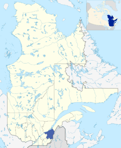 Map of Chaudière-Appalaches within Quebec. | |
| Coordinates: 46°29′N 70°37′W | |
| Country | |
| Province | |
| Government | |
| • Regional conference of elected officers | Maurice Sénécal (President) |
| Area | |
| • Land | 15,083.25 km2 (5,823.68 sq mi) |
| Population (2016)[1] | |
| • Total | 420,082 |
| • Density | 27.9/km2 (72/sq mi) |
| Website | www |
Chaudière-Appalaches has a population of 420,082 residents (as of the Canada 2016 Census) and a land area of 15,083.25 square kilometres (5,823.68 sq mi).[1] The main cities are Lévis, Saint-Georges, Thetford Mines, Sainte-Marie and Montmagny.
Subdivisions
Regional County Municipalities
| Regional County Municipality (RCM) | Population Canada 2016 Census[2] |
Land Area | Density (pop. per km2) |
Seat of RCM |
|---|---|---|---|---|
| Beauce-Sartigan | 52,406 | 1,954.50 km2 (754.64 sq mi) | 26.8 | Saint-Georges |
| Bellechasse | 37,233 | 1,751.06 km2 (676.09 sq mi) | 21.3 | Saint-Lazare-de-Bellechasse |
| La Nouvelle-Beauce | 36,785 | 905.58 km2 (349.65 sq mi) | 40.6 | Sainte-Marie |
| Les Appalaches | 42,346 | 1,912.49 km2 (738.42 sq mi) | 22.1 | Thetford Mines |
| Les Etchemins | 16,536 | 1,810.05 km2 (698.86 sq mi) | 9.1 | Lac-Etchemin |
| L'Islet | 17,798 | 2,100.02 km2 (810.82 sq mi) | 8.5 | Saint-Jean-Port-Joli |
| Lotbinière | 31,741 | 1,662.27 km2 (641.81 sq mi) | 19.1 | Sainte-Croix |
| Montmagny | 22,698 | 1,698.13 km2 (655.65 sq mi) | 13.4 | Montmagny |
| Robert-Cliche | 19,125 | 840.10 km2 (324.36 sq mi) | 22.8 | Beauceville |
Major communities
- Beauceville
- Disraeli
- Laurier-Station
- Lévis
- Montmagny
- Saint-Apollinaire
- Saint-Georges
- Saint-Joseph-de-Beauce
- Sainte-Marie
- Saint-Pamphile
- Thetford Mines
Landmarks
References
- "Census Profile, 2016 Census Chaudière-Appalaches [Economic region], Quebec". Statistics Canada. Retrieved November 22, 2019.
- "Population and Dwelling Count Highlight Tables, 2016 Census". Statistics Canada. Retrieved November 26, 2019.
External links
| Wikimedia Commons has media related to Chaudière-Appalaches. |
| Regional county municipalities and equivalent territories | |
|---|---|
| Municipalities |
|
| Subdivisions | |
|---|---|
| Communities | |
| Major cities | |
| Regions | |
Portal:Canada | |
This article is issued from Wikipedia. The text is licensed under Creative Commons - Attribution - Sharealike. Additional terms may apply for the media files.