Brome-Missisquoi Regional County Municipality
Brome-Missisquoi is a regional county municipality in the Eastern Townships region of Quebec, Canada. Its seat is Cowansville.[2]
Brome-Missisquoi | |
|---|---|
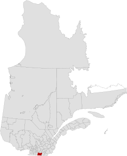 Location in province of Quebec. | |
| Coordinates: 45°08′N 72°48′W[1] | |
| Country | |
| Province | |
| Region | Eastern Townships |
| Effective | January 1, 2010 |
| County seat | Cowansville |
| Government | |
| • Type | Prefecture |
| • Prefect | Arthur Fauteux |
| Area | |
| • Total | 1,685.90 km2 (650.93 sq mi) |
| • Land | 1,652.08 km2 (637.87 sq mi) |
| Population (2016)[3] | |
| • Total | 58,314 |
| • Density | 35.3/km2 (91/sq mi) |
| • Change 2006-2011 | |
| • Dwellings | 31,470 |
| Time zone | UTC−5 (EST) |
| • Summer (DST) | UTC−4 (EDT) |
| Area code(s) | 450 and 579 |
| Website | www |
| [4] | |
In Parliament it is covered by the Brome—Missisquoi federal electoral district.
History
In the 1980s, the RCM was formed from municipalities of historic Brome and Missisquoi counties. On January 1, 2010, the city of Bromont moved from La Haute-Yamaska Regional County Municipality to Brome-Missisquoi.[5]
Subdivisions
There are 21 subdivisions within the RCM:[2][6]
|
|
|
|
|
|
Demographics
Population
| Canada census – Brome-Missisquoi Regional County Municipality, Quebec community profile | |||
|---|---|---|---|
| 2016 | 2011 | 2006 | |
| Population: | 58,314 (+4.8% from 2011) | 55,621 (+5.4% from 2006) | 46,720 (+1.2% from 2001) |
| Land area: | 1,652.08 km2 (637.87 sq mi) | 1,651.73 km2 (637.74 sq mi) | 1,537.00 km2 (593.44 sq mi) |
| Population density: | 35.3/km2 (91/sq mi) | 33.7/km2 (87/sq mi) | 30.4/km2 (79/sq mi) |
| Median age: | 48.4 (M: 47.4, F: 49.4) | 46.5 (M: 45.8, F: 47.2) | 44.9 (M: 43.9, F: 45.9) |
| Total private dwellings: | 31,470 | 29,296 | 23,713 |
| Median household income: | $57,801 | $50,670 | $43,997 |
| References: 2016[8] 2011[9] 2006[10] earlier[11] | |||
| Historical Census Data - Brome-Missisquoi Regional County Municipality, Quebec | ||||||||||||||||||||||||||||||||
|---|---|---|---|---|---|---|---|---|---|---|---|---|---|---|---|---|---|---|---|---|---|---|---|---|---|---|---|---|---|---|---|---|
|
|
| ||||||||||||||||||||||||||||||
| [12][3] (A) adjustment due to boundary change. | ||||||||||||||||||||||||||||||||
Language
| Canada Census Mother Tongue - Brome-Missisquoi Regional County Municipality, Quebec[12] | ||||||||||||||||||
|---|---|---|---|---|---|---|---|---|---|---|---|---|---|---|---|---|---|---|
| Census | Total | French |
English |
French & English |
Other | |||||||||||||
| Year | Responses | Count | Trend | Pop % | Count | Trend | Pop % | Count | Trend | Pop % | Count | Trend | Pop % | |||||
2016 |
56,955 |
44,820 | 78.69% | 9,790 | 17.02% | 870 | 1.53% | 1,330 | 2.33% | |||||||||
2011 |
54,590 |
42,240 | 77.38% | 10,250 | 18.78% | 840 | 1.54% | 1,260 | 2.31% | |||||||||
2006 |
45,400 |
33,560 | 73.92% | 9,835 | 21.66% | 710 | 1.56% | 1,295 | 2.85% | |||||||||
2001 |
44,830 |
32,975 | 73.56% | 10,120 | 22.57% | 745 | 1.66% | 990 | 2.21% | |||||||||
1996 |
44,485 |
32,105 | n/a | 72.17% | 10,780 | n/a | 24.23% | 710 | n/a | 1.60% | 890 | n/a | 2.00% | |||||
Highways
Highways and numbered routes that run through the municipality, including external routes that start or finish at the county border:[13]
References
- Reference number 141114 of the Commission de toponymie du Québec (in French)
- Geographic code 460 in the official Répertoire des municipalités (in French)
- "Census Profile, 2016 Census: Brome-Missisquoi, Municipalité régionale de comté [Census division], Quebec". Statistics Canada. Retrieved November 25, 2019.
- "(Code 2446) Census Profile". 2011 census. Statistics Canada. 2012.
- "Modifications aux municipalités du Québec" (PDF) (in French). Institut de la statistique du Québec. p. 4. Retrieved November 25, 2019.
- "MRC Council - Distribution of votes at the council". Brome-Missisquoi MRC. 2017-02-21. Retrieved 2017-05-09.
- "Décret de population pour 2017 - Municipalités locales, arrondissements, villages nordiques et territoires non organisés". Gazette officielle du Québec. 2016-12-28.
- "2016 Community Profiles". 2016 Canadian Census. Statistics Canada. February 21, 2017. Retrieved 2019-11-25.
- "2011 Community Profiles". 2011 Canadian Census. Statistics Canada. July 5, 2013. Retrieved 2014-03-11.
- "2006 Community Profiles". 2006 Canadian Census. Statistics Canada. March 30, 2011. Retrieved 2014-03-11.
- "2001 Community Profiles". 2001 Canadian Census. Statistics Canada. February 17, 2012.
- Statistics Canada: 1996, 2001, 2006, 2011 census
- Official Transport Quebec Road Map
External links
- Official site
- Official MRC site
- Tourism website of Brome-Missisquoi
- Cultural website of Brome-Missisquoi
- The Wine Route of Brome-Missisquoi
- Statistics Canada
Adjacent Counties & Equivalent Territories | |
|---|---|
This article is issued from Wikipedia. The text is licensed under Creative Commons - Attribution - Sharealike. Additional terms may apply for the media files.