Pohénégamook
Pohénégamook, Quebec (pop. 2940) is a Canadian town on the Canada–United States border in Quebec's Témiscouata Regional County Municipality.
Pohénégamook | |
|---|---|
City | |
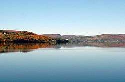 Pohenegamook Lake | |
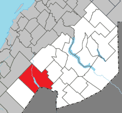 Location within Témiscouata RCM | |
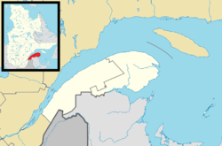 Pohénégamook Location in eastern Quebec | |
| Coordinates: 47°28′N 69°13′W[1] | |
| Country | |
| Province | |
| Region | Bas-Saint-Laurent |
| RCM | Témiscouata |
| Constituted | November 3, 1973 |
| Government | |
| • Mayor | Louise Labonté |
| • Federal riding | Rimouski-Neigette— Témiscouata—Les Basques |
| • Prov. riding | Rivière-du-Loup-Témiscouata |
| Area | |
| • Total | 349.40 km2 (134.90 sq mi) |
| • Land | 340.33 km2 (131.40 sq mi) |
| Population (2011)[3] | |
| • Total | 2,770 |
| • Density | 8.1/km2 (21/sq mi) |
| • Pop 2006-2011 | |
| • Dwellings | 1,383 |
| Time zone | UTC−5 (EST) |
| • Summer (DST) | UTC−4 (EDT) |
| Postal code(s) | G0L 1J0 |
| Area code(s) | 418 and 581 |
| Highways | |
| Website | www |
The town shares the border with Estcourt Station, Maine, the northernmost point in New England.
As of 2006, Pohénégamook had 2940 people, down 5.1% from the last census in 2001.
The town is named after Lake Pohenegamook and is located on the lake's southern and western shores.
Pohénégamook was amalgamated with the formerly-independent communities of Saint-Pierre d'Estcourt, Saint-Éleuthère, Village-Blier and Saint-David-de-Sully on October 23, 1973.
See also
- Lake Pohenegamook, a waterbody
- Boucanée River, a stream
- List of cities in Quebec
References
- Reference number 50039 of the Commission de toponymie du Québec (in French)
- Geographic code 13095 in the official Répertoire des municipalités (in French)
- "(Code 2413095) Census Profile". 2011 census. Statistics Canada. 2012.
External links

- http://www.pohenegamook.net (Pohenegamook official website)
Places adjacent to Pohénégamook | |
|---|---|
| Cities & Towns | |
|---|---|
| Municipalities | |
| Parishes |
|
| |
This article is issued from Wikipedia. The text is licensed under Creative Commons - Attribution - Sharealike. Additional terms may apply for the media files.