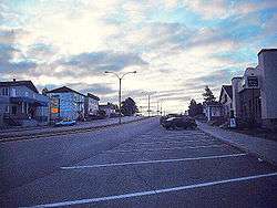
Chapais, Quebec
Chapais is a community in the Canadian province of Quebec, located on Route 113 near Chibougamau in the Jamésie region. It is surrounded by, but not a part of, the local municipality of Eeyou Istchee James Bay Regional Government. The community was first settled in 1929, when prospector Léo Springer discovered deposits of copper, silver and gold in the area, and was incorporated as a city in 1955. It was named for Thomas Chapais.[1]
Chapais | |
|---|---|
City | |
 | |
 Chapais | |
| Coordinates: 49°46′55″N 74°51′16″W[1] | |
| Country | |
| Province | |
| Region | Nord-du-Québec |
| RCM | None |
| Settled | 1929 |
| Constituted | November 16, 1955 |
| Named for | Thomas Chapais[1] |
| Government | |
| • Mayor | Steve Gamache |
| • Federal riding | Abitibi—Baie-James—Nunavik—Eeyou |
| • Prov. riding | Ungava |
| Area | |
| • Total | 62.40 km2 (24.09 sq mi) |
| • Land | 63.64 km2 (24.57 sq mi) |
| There is an apparent contradiction between two authoritative sources | |
| Population (2011)[3] | |
| • Total | 1,610 |
| • Density | 25.3/km2 (66/sq mi) |
| • Change (2006–11) | |
| • Dwellings | 728 |
| Time zone | UTC−5 (EST) |
| • Summer (DST) | UTC−4 (EDT) |
| Postal code(s) | G0W 1H0 |
| Area code(s) | 418 and 581 |
| Climate | Dfc |
| Website | www |
History
Opémisca Copper Mines operated the community's mine until 1991. More recently, with the closure of the mines the community's primary industry has been forestry, and the community opened the first cogeneration plant in Quebec to produce electricity from the sawmill's waste matter.
On the night of January 1, 1980, at 1:30 a.m., 48 people were killed when a fire destroyed the Opémiska Community Hall. Fifty others were injured and rushed to Chibougamau hospital. This fire was the worst to occur in Quebec for more than 40 years. The fire started in wreaths of dried branches and other Christmas decorations, and the ensuing chaos that followed quickly blocked access to the main entrance. Several people managed to escape in time, but the tragedy left deep scars in the community.[4]
Chapais had a population of 1,610 in the Canada 2011 Census.
A crater on Mars is named after this community.
Demographics
Population:[5]
- Population in 2006: 1610
- 2006 to 2011 population change: -1.2%
- Population in 2006: 1630
- Population in 2001: 1795
- Population in 1996: 2030
- Population in 1991: 2391
Private dwellings occupied by usual residents: 674 (total dwellings: 728)
Mother tongue:
- English as first language: 0.6%
- French as first language: 94%
- English and French as first language: 0%
- Other as first language: 5.4%
Climate
Chapais has a marginal subarctic climate[6] (Koppen: Dfc) just a shade colder than the humid continental (Koppen: Dfb) areas to the south. Winters are bitterly cold, but summers are relatively warm during daytime, but nights remain relatively cool. As such the yearly mean is just above freezing. Summers have high rainfall and winters are quite snowy.
| Climate data for Chapais (1981−2010) | |||||||||||||
|---|---|---|---|---|---|---|---|---|---|---|---|---|---|
| Month | Jan | Feb | Mar | Apr | May | Jun | Jul | Aug | Sep | Oct | Nov | Dec | Year |
| Record high °C (°F) | 8.5 (47.3) |
9.0 (48.2) |
16.0 (60.8) |
28.0 (82.4) |
31.5 (88.7) |
34.5 (94.1) |
35.0 (95.0) |
33.3 (91.9) |
29.0 (84.2) |
24.4 (75.9) |
17.8 (64.0) |
11.0 (51.8) |
35.0 (95.0) |
| Average high °C (°F) | −13.5 (7.7) |
−10.3 (13.5) |
−3.3 (26.1) |
5.2 (41.4) |
13.9 (57.0) |
20.0 (68.0) |
22.2 (72.0) |
20.5 (68.9) |
14.2 (57.6) |
6.7 (44.1) |
−1.9 (28.6) |
−9.3 (15.3) |
5.4 (41.7) |
| Daily mean °C (°F) | −18.8 (−1.8) |
−16.2 (2.8) |
−9.5 (14.9) |
−0.3 (31.5) |
8.1 (46.6) |
14.1 (57.4) |
16.4 (61.5) |
15.0 (59.0) |
9.7 (49.5) |
3.1 (37.6) |
−5.2 (22.6) |
−13.6 (7.5) |
0.2 (32.4) |
| Average low °C (°F) | −24.2 (−11.6) |
−22.2 (−8.0) |
−15.5 (4.1) |
−5.7 (21.7) |
2.2 (36.0) |
8.2 (46.8) |
10.5 (50.9) |
9.5 (49.1) |
5.2 (41.4) |
−0.5 (31.1) |
−8.5 (16.7) |
−18 (0) |
−4.9 (23.2) |
| Record low °C (°F) | −43.3 (−45.9) |
−42.8 (−45.0) |
−38 (−36) |
−27.2 (−17.0) |
−16.1 (3.0) |
−5.6 (21.9) |
−0.6 (30.9) |
−2.2 (28.0) |
−6 (21) |
−13.3 (8.1) |
−30 (−22) |
−42 (−44) |
−43.3 (−45.9) |
| Average precipitation mm (inches) | 61.9 (2.44) |
39.4 (1.55) |
50.3 (1.98) |
56.6 (2.23) |
82.4 (3.24) |
100.1 (3.94) |
124.3 (4.89) |
100.2 (3.94) |
129.7 (5.11) |
93.9 (3.70) |
93.2 (3.67) |
63.5 (2.50) |
995.5 (39.19) |
| Average rainfall mm (inches) | 3.2 (0.13) |
2.4 (0.09) |
8.8 (0.35) |
28.7 (1.13) |
75.5 (2.97) |
100.1 (3.94) |
124.3 (4.89) |
100.2 (3.94) |
128.6 (5.06) |
70.9 (2.79) |
36.7 (1.44) |
5.0 (0.20) |
684.4 (26.93) |
| Average snowfall cm (inches) | 58.8 (23.1) |
37.0 (14.6) |
41.6 (16.4) |
29.5 (11.6) |
6.9 (2.7) |
0.0 (0.0) |
0.0 (0.0) |
0.0 (0.0) |
1.2 (0.5) |
23.0 (9.1) |
56.5 (22.2) |
58.5 (23.0) |
313 (123.2) |
| Average precipitation days (≥ 0.2 mm) | 18.1 | 13.6 | 12.1 | 12.3 | 14.8 | 16.3 | 17.4 | 17.1 | 20.2 | 19.8 | 19.9 | 19.3 | 200.9 |
| Average rainy days (≥ 0.2 mm) | 0.55 | 1.1 | 2.4 | 6.7 | 13.6 | 16.3 | 17.4 | 17.1 | 20.1 | 14.5 | 6.1 | 1.3 | 117.15 |
| Average snowy days (≥ 0.2 cm) | 18.0 | 12.9 | 10.4 | 7.9 | 2.5 | 0.0 | 0.0 | 0.0 | 0.47 | 7.4 | 16.1 | 18.5 | 94.17 |
| Mean monthly sunshine hours | 90 | 122 | 170 | 164 | 202 | 234 | 233 | 208 | 113 | 84 | 46 | 66 | 1,732 |
| Source 1: Environment Canada[7] | |||||||||||||
| Source 2: The Weather Network(sunshine data only).[8] | |||||||||||||
References
- Reference number 12293 of the Commission de toponymie du Québec (in French)
- Geographic code 99020 in the official Répertoire des municipalités (in French)
- "(Code 2499020) Census Profile". 2011 census. Statistics Canada. 2012.
- 1 janvier 1980 - Incendie meurtrier à Chapais
- Statistics Canada: 1996, 2001, 2006, 2011 census
- "Chapais, Quebec Climate Summary". Weatherbase. Retrieved 15 June 2015.
- "Chapais 2". Canadian Climate Normals 1981–2010. Environment Canada. Retrieved October 6, 2013.
- Statistics, Accessed 10 March 2012.
External links
| Regional county municipalities and equivalent territories |
|
|---|---|
| Municipalities |
|
| Authority control |
|
|---|