Candiac, Quebec
Candiac is an off-island suburb of Montreal, in the Canadian province of Quebec; it is located on the south shore of the Saint Lawrence River opposite Montreal near La Prairie. The population as of the Canada 2016 Census was 21,047.
Candiac | |
|---|---|
City | |
 Candiac town hall | |
Seal  Coat of arms | |
| Motto(s): Ma ville sous les arbres (French for "My city under the trees") | |
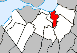 Location within Roussillon RCM | |
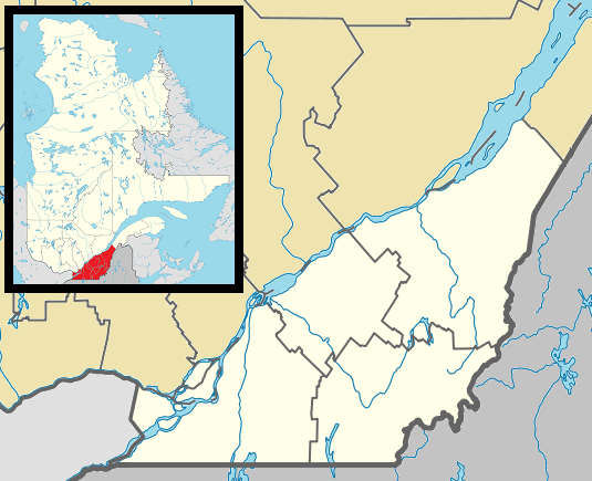 Candiac Location in southern Quebec | |
| Coordinates: 45.38°N 73.52°W[1] | |
| Country | |
| Province | |
| Region | Montérégie |
| RCM | Roussillon |
| Constituted | January 31, 1957 |
| Government | |
| • Mayor | Normand Dyotte |
| • Federal riding | La Prairie |
| • Prov. riding | La Prairie |
| Area | |
| • Total | 18.70 km2 (7.22 sq mi) |
| • Land | 17.59 km2 (6.79 sq mi) |
| Population (2016)[4] | |
| • Total | 21,047 |
| • Density | 1,215.8/km2 (3,149/sq mi) |
| • Pop 2011-2016 | |
| • Dwellings | 7,832 |
| Time zone | UTC−5 (EST) |
| • Summer (DST) | UTC−4 (EDT) |
| Postal code(s) | J5R |
| Area code(s) | 450 and 579 |
| Highways | |
| Website | candiac |
History
Candiac was created January 31, 1957, when the government of Quebec accepted the request of a Canadian-European investors group, the Candiac Development Corporation. The investors had collected over $4.5 million and bought 2,500 acres (10 km2) of land from farmers and the neighbouring towns.
In its early days, Candiac was home to 320 people who mostly lived near the St. Lawrence River. Most of the inhabitants were either farmers or Montrealers who owned a second residence in Candiac.
Candiac was named after the birthplace of Louis-Joseph de Montcalm, who was born in 1712 at Château de Candiac in Vestric-et-Candiac, near Nîmes, in France. Montcalm died at the Battle of the Plains of Abraham at Quebec City while fighting for the Kingdom of France in the Annus Mirabilis of 1759.
Coat of arms
Montcalm's heritage and the first mayor, Jean Leman, family's coat of arms were the inspiration for Candiac's coat of arms. The colour red symbolizes charity and justice, two very important values. It is also present in the Leman's coat of arms and is said to honour Montcalm's legacy. The silver cross is a typical French-Canadian symbol that reminds citizens of their French heritage. The stars were taken from the Leman's coat of arms and the towers from Montcalm's. The crown symbolizes the Château de Candiac and the maple leaves symbolize Canada.
The floral emblem of Candiac is the Campanula carpatica, better known as White Clips.
Demographics
| |||||||||||||||||||||||||||||
| Historical Census Data - Candiac, Quebec[7] | ||
|---|---|---|
| Year | Pop. | ±% |
| 1991 | 10,765 | — |
| 1996 | 11,805 | +9.7% |
| 2001 | 12,675 | +7.4% |
| 2006 | 15,947 | +25.8% |
| 2011 | 19,876 | +24.6% |
| Canada Census Mother Tongue - Candiac, Quebec[7] | ||||||||||||||||||
|---|---|---|---|---|---|---|---|---|---|---|---|---|---|---|---|---|---|---|
| Census | Total | French |
English |
French & English |
Other | |||||||||||||
| Year | Responses | Count | Trend | Pop % | Count | Trend | Pop % | Count | Trend | Pop % | Count | Trend | Pop % | |||||
2016 |
21,045 |
16,200 | 76.98% | 2,280 | 10.83% | 350 | 1.66% | 2,280 | 10.83% | |||||||||
2011 |
19,705 |
15,830 | 80.33% | 1,915 | 9.72% | 305 | 1.55% | 1,655 | 8.40% | |||||||||
2006 |
15,945 |
13,015 | 81.62% | 1,700 | 10.66% | 140 | 0.88% | 1,090 | 6.84% | |||||||||
2001 |
12,670 |
10,100 | 79.72% | 1,565 | 12.35% | 175 | 1.38% | 830 | 6.55% | |||||||||
1996 |
11,720 |
9,565 | n/a | 81.61% | 1,365 | n/a | 11.65% | 140 | n/a | 1.19% | 650 | n/a | 5.55% | |||||
Infrastructure
Transportation
The CIT Le Richelain provides commuter and local bus services. Commuter trains, provided by Exo link Candiac to Lucien L'Allier train station in downtown Montréal.
Municipal Buildings
The City of Candiac has four (4) main municipal buildings: The "Hotel de Ville" (city hall), Centre Roméo-V.-Patenaude (renovated in 2005), Centre Frank-Vocino (the old library, now the Ideal Club meeting area) and Centre Claude-Hébert (the new restored library)
Education
The South Shore Protestant Regional School Board previously served the municipality.[8]
See also
- List of cities in Quebec
- Roussillon Regional County Municipality, Quebec
- Brossard—La Prairie
- La Prairie (provincial electoral district)
- Rivière de la Tortue (Delson)
References
- Reference number 10164 of the Commission de toponymie du Québec (in French)
- "Ministère des Affaires municipales, des Régions et de l'Occupation du territoire: Candiac". Archived from the original on 2013-12-14. Retrieved 2012-03-11.
- Riding history for Brossard--La Prairie (Quebec) from the Library of Parliament
- "2011 Community Profiles". 2011 Canadian Census. Statistics Canada. July 5, 2013. Retrieved 2014-02-19.
- "2006 Community Profiles". 2006 Canadian Census. Statistics Canada. March 30, 2011. Retrieved 2014-02-19.
- "2001 Community Profiles". 2001 Canadian Census. Statistics Canada. February 17, 2012.
- Statistics Canada: 1996, 2001, 2006, 2011, 2016 census
- King, M.J. (Chairperson of the board). "South Shore Protestant Regional School Board Archived 2016-05-16 at the Wayback Machine" (St. Johns, PQ). The News and Eastern Townships Advocate. Volume 119, No. 5. Thursday December 16, 1965. p. 2. Retrieved from Google News on November 23, 2014.
External links
| Wikimedia Commons has media related to Candiac. |
Adjacent Municipal Subdivisions | |
|---|---|
| Cities | |
|---|---|
| Municipalities | |
| Parishes | |
| |