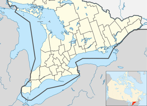
Markham, Ontario
Markham (/ˈmɑːrkəm/) is a city in the Regional Municipality of York in Southern Ontario, Canada. It is approximately 30 km (19 mi) northeast of Downtown Toronto. In the 2016 Census, Markham had a population of 328,940,[1][3] which ranked it the largest in York Region, fourth largest in the Greater Toronto Area (GTA), and 16th largest in Canada.[4]
Markham | |
|---|---|
| City of Markham | |
 | |
 Flag  Coat of arms Logo | |
| Nickname(s): The High-Tech Capital | |
| Motto(s): Leading While Remembering | |
 Location of Markham within York Region | |
 Markham Markham in relation to southern Ontario | |
| Coordinates: 43°52′36″N 79°15′48″W | |
| Country | Canada |
| Province | Ontario |
| Regional Municipality | York Region |
| Communities | List of subdivisions
|
| Settled | 1794 |
| Incorporated | 1872 (village) 1972 (town) 2012 (city) |
| Government | |
| • Mayor | Frank Scarpitti |
| • Deputy Mayor | Don Hamilton |
| • Governing Body | Markham City Council |
| • MPs | List of MPs
|
| • MPPs | List of MPPs
|
| Area | |
| • Total | 212.35 km2 (81.99 sq mi) |
| Elevation | 200 m (700 ft) |
| Population (2016)[1] | |
| • Total | 328,966 (16th) |
| Demonym(s) | Markhamite |
| Time zone | UTC−05:00 (EST) |
| • Summer (DST) | UTC−04:00 (EDT) |
| Forward Sortation Area | L3P to L3S, L6B to L6G |
| Area code(s) | 905, 289, and 365 |
| ISO 3166-2 | CA-ON |
| GNBC Code | FDNFZ[2] |
| Website | www |
The city gained its name from the first Lieutenant-Governor of Upper Canada, John Graves Simcoe (in office 1791–1796), who named the area after his friend, William Markham, the Archbishop of York from 1776 to 1807. The first European settlement in Markham occurred when William Berczy, a German artist and developer, led a group of approximately sixty-four German families to North America. While they planned to settle in New York, disputes over finances and land tenure led Berczy to negotiate with Simcoe for 64,000 acres (260 km2) in Markham Township in 1794.[5] Since the 1970s, Markham rapidly shifted from being an agricultural community to an industrialized municipality due to urban sprawl from neighbouring Toronto.[6] Markham changed its status from town to city on July 1, 2012.[7]
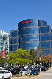
As of 2013, tertiary industry mainly drives Markham. As of 2010, "business services" employed the largest proportion of workers in Markham – nearly 22% of its labour force.[8] The city also has over 1,000[9] technology and life-sciences companies, with IBM as the city's largest employer.[10][11] Several multinational companies have their Canadian headquarters in Markham, including: Honda Canada, Hyundai,[12] Advanced Micro Devices,[13] Johnson & Johnson, Avaya,[14] IBM,[15] Motorola,[16] Oracle,[17] Toshiba,[18] Toyota Financial Services,[19] Huawei, Honeywell and Scholastic Canada.[20]
History
Indigenous people lived in the area of present-day Markham for thousands of years before Europeans arrived in the area. These people include the Haudenosaunee Confederacy (the Iroquois), the Huron Wendat, the Petun and the Neutral.[21]
Objects recovered by local mill-owners, the Milne family, in the 1870s give evidence of a village within the boundaries of the present Milne Conservation Area.[21]
The Lieutenant-Governor of Upper Canada, John Graves Simcoe (in office 1791–1796), named the township of Markham, north of the town of York (now Toronto), after his friend William Markham, then Archbishop of York. William Berczy first surveyed Markham as a township in 1793, and in 1794 led 75 German families (including the Ramers, Reesors, Wheters, Burkholders, Bunkers, Wicks and Lewis) from Upstate New York to an area of Markham now known as German Mills.[22] Each family was granted 200 acres (0.81 km2) of land; however the lack of roads in the region led many to settle in York (present-day Toronto) and Niagara. German Mills later became a ghost town. Between 1803 and 1812 another attempt at settling the region was made. The largest group of settlers were Pennsylvania Dutch, most of them Mennonites. These highly skilled craftsmen and knowledgeable farmers settled the region and founded Reesorville, named after the Mennonite settler Joseph Reesor.[23] In 1825 Reesorville was renamed to Markham, having taken the name of the unincorporated village (see Markham Village, Ontario).
By 1830 many Irish, Scottish and English families began immigrating to Upper Canada and settling in Markham.[24] Markham's early years blended the rigours of the frontier with the development of agriculture-based industries. The township's many rivers and streams soon supported water-powered saw- and gristmills and later wooden mills. With improved transportation routes, such as the construction of Yonge Street in the 1800s, along with the growing population, urbanization increased. In 1842 the township population had reached 5,698; 29,005 acres (117.38 km2) were under cultivation (second highest in the province), and the township had eleven gristmills and twenty-four sawmills.[25]
In 1846 Smith's Canadian Gazetteer indicated a population of about 300, mostly Canadians, Pennsylvanian Dutch (actually Pennsylvania Deitsch or German), other Germans, Americans, Irish and a few from Britain. There were two churches with a third being built. There were tradesmen of various types, a grist mill, an oatmill mill, five stores, a distillery and a threshing-machine maker. There were eleven grist and twenty-four saw mills in the surrounding township.[26] In 1850 the first form of structured municipal government formed in Markham.[27]
By 1857 most of the township had been cleared of timber and was under cultivation. Villages like Thornhill, Unionville and Markham greatly expanded.[28] In 1851 Markham Village "was a considerable village, containing between eight and nine hundred inhabitants, pleasantly situated on the Rouge River. It contains two grist mills ... a woollen factory, oatmeal mill, barley mill and distillery, foundry, two tanneries, brewery, etc., a temperance hall and four churches... ."[29] In 1871, with a township population of 8,152,[30] the Toronto and Nipissing Railway built the first rail line to Markham Village and Unionville, which is still used today by the GO Transit commuter services.
In 1972 Markham was incorporated as a town, as its population skyrocketed due to urban sprawl from Toronto. In 1976 Markham's population was approximately 56,000. Since that time, the population has more than quintupled, with explosive growth in new subdivisions. Much of Markham's farmland has disappeared, but some still remains north of Major Mackenzie Drive. Controversy over the development of the environmentally-sensitive Oak Ridges Moraine will likely curb development north of Major Mackenzie Drive and by Rouge National Urban Park east of Reesor Road between Major Mackenzie Drive to Steeles Avenue East to the south.
Since the 1980s Markham has been recognized as a suburb of Toronto. As of 2006 the city comprises six major communities: Berczy Village, Cornell, Markham Village, Milliken, Thornhill and Unionville. Many high-tech companies have established head offices in Markham, attracted by the relative abundance of land, low tax-rates and good transportation routes. Broadcom Canada, ATI Technologies (now known as AMD Graphics Product Group), IBM Canada, Motorola Canada, Honeywell Canada and many other well-known companies have chosen Markham as their home in Canada. The city has accordingly started branding itself as Canada's "High-Tech Capital". The province of Ontario has erected a historical plaque in front of the Markham Museum to commemorate the founding of Markham's role in Ontario's heritage.[31]
Town council voted on May 29, 2012, to change Markham's legal designation from "town" to "city"; according to Councillor Alex Chiu, who introduced the motion, the change of designation merely reflects the fact that many people already think of Markham as a city.[7] Some residents objected to the change because it will involve unknown costs without any demonstrated benefits. The designation officially took effect on July 1.[7]
Geography


Markham covers 212.47 km2 (82.04 sq mi) and Markham's City Centre is at 43°53′N 79°15′W. It is bounded by 5 municipalities; in the west is Vaughan with the boundary along Yonge Street between Steeles Avenue and Highway 7 and Richmond Hill with the boundary along Highway 7 from Yonge Street to Highway 404 and at Highway 404 from Highway 7 to 19th Avenue and Stouffville Road. In the south, it borders Toronto with the boundary along Steeles Avenue. In the North it borders Whitchurch–Stouffville with the boundary from Highway 404 to York-Durham Line between 19th Avenue and Stouffville Road. In the East it borders Pickering along the York-Durham Line.
Topography
Markham's average altitude is at 200 m (660 ft) and in general consists of gently rolling hills. The city is intersected by two rivers; the Don River and Rouge River, as well as their tributaries. To the north is the Oak Ridges Moraine, which further elevates the elevation towards the north.
Climate
Markham borders and shares the same climate as Toronto. On an average day, Markham is generally 1–2 °C (1.8–3.6 °F) cooler than in downtown Toronto. It has a humid continental climate (Köppen climate classification Dfb) and features warm, humid summers with significant rainfall occurring from May to October and cold, snowy winters. The highest temperature recorded was 37.8 °C (100.0 °F) on August 8, 2001 and the lowest temperature recorded was −35.2 °C (−31.4 °F) on January 16, 1994.[32]
| Climate data for Markham 1981–2010 (Toronto/Buttonville Municipal Airport) | |||||||||||||
|---|---|---|---|---|---|---|---|---|---|---|---|---|---|
| Month | Jan | Feb | Mar | Apr | May | Jun | Jul | Aug | Sep | Oct | Nov | Dec | Year |
| Record high humidex | 16.0 | 14.4 | 29.2 | 35.7 | 41.0 | 44.6 | 50.9 | 47.4 | 43.6 | 37.8 | 24.9 | 20.6 | 50.9 |
| Record high °C (°F) | 14.9 (58.8) |
14.9 (58.8) |
26.0 (78.8) |
31.7 (89.1) |
34.6 (94.3) |
36.6 (97.9) |
37.2 (99.0) |
37.8 (100.0) |
34.4 (93.9) |
31.0 (87.8) |
22.1 (71.8) |
18.0 (64.4) |
37.8 (100.0) |
| Average high °C (°F) | −1.5 (29.3) |
−0.9 (30.4) |
4.5 (40.1) |
12.1 (53.8) |
19.1 (66.4) |
24.6 (76.3) |
27.1 (80.8) |
26.0 (78.8) |
21.5 (70.7) |
14.1 (57.4) |
7.2 (45.0) |
0.9 (33.6) |
12.9 (55.2) |
| Daily mean °C (°F) | −5.8 (21.6) |
−5.6 (21.9) |
−0.4 (31.3) |
6.7 (44.1) |
13.0 (55.4) |
18.6 (65.5) |
21.2 (70.2) |
20.2 (68.4) |
15.7 (60.3) |
8.9 (48.0) |
3.1 (37.6) |
−2.9 (26.8) |
7.7 (45.9) |
| Average low °C (°F) | −10.1 (13.8) |
−10.2 (13.6) |
−5.3 (22.5) |
1.2 (34.2) |
6.8 (44.2) |
12.6 (54.7) |
15.2 (59.4) |
14.3 (57.7) |
9.9 (49.8) |
3.6 (38.5) |
−1.1 (30.0) |
−6.8 (19.8) |
2.5 (36.5) |
| Record low °C (°F) | −35.2 (−31.4) |
−25.7 (−14.3) |
−25.6 (−14.1) |
−10.1 (13.8) |
−2.1 (28.2) |
1.9 (35.4) |
6.9 (44.4) |
4.2 (39.6) |
−2.0 (28.4) |
−7.4 (18.7) |
−15.0 (5.0) |
−26.0 (−14.8) |
−35.2 (−31.4) |
| Record low wind chill | −42.6 | −37.4 | −35.6 | −18.6 | −4.4 | 0.0 | 0.0 | 0.0 | −4.2 | −8.8 | −23.9 | −36.6 | −42.6 |
| Average precipitation mm (inches) | 62.1 (2.44) |
50.5 (1.99) |
53.2 (2.09) |
74.1 (2.92) |
79.6 (3.13) |
82.8 (3.26) |
79.0 (3.11) |
76.2 (3.00) |
81.8 (3.22) |
68.0 (2.68) |
80.0 (3.15) |
65.7 (2.59) |
852.9 (33.58) |
| Average rainfall mm (inches) | 26.0 (1.02) |
22.9 (0.90) |
33.6 (1.32) |
66.7 (2.63) |
79.5 (3.13) |
82.8 (3.26) |
78.8 (3.10) |
76.2 (3.00) |
81.8 (3.22) |
66.7 (2.63) |
68.3 (2.69) |
34.2 (1.35) |
717.4 (28.24) |
| Average snowfall cm (inches) | 38.9 (15.3) |
29.9 (11.8) |
19.3 (7.6) |
7.5 (3.0) |
0.1 (0.0) |
0.0 (0.0) |
0.0 (0.0) |
0.0 (0.0) |
0.0 (0.0) |
0.6 (0.2) |
12.1 (4.8) |
34.2 (13.5) |
142.6 (56.1) |
| Average precipitation days (≥ 0.2 mm) | 16.7 | 12.9 | 12.0 | 12.3 | 12.0 | 11.8 | 11.2 | 9.9 | 10.8 | 13.2 | 14.5 | 15.3 | 152.7 |
| Average rainy days (≥ 0.2 mm) | 5.8 | 3.8 | 6.7 | 10.8 | 12.0 | 11.8 | 11.2 | 9.9 | 10.8 | 13.0 | 11.3 | 6.6 | 113.7 |
| Average snowy days (≥ 0.2 cm) | 13.4 | 10.8 | 7.0 | 2.9 | 0.13 | 0.0 | 0.0 | 0.0 | 0.0 | 0.48 | 4.7 | 10.8 | 50.2 |
| Average relative humidity (%) (at 1500 LST) | 69.6 | 64.0 | 57.8 | 52.9 | 52.3 | 53.9 | 53.4 | 55.9 | 59.2 | 62.4 | 68.9 | 71.1 | 60.1 |
| Source: Environment Canada[32] | |||||||||||||
Neighbourhoods

Markham is made up of many original 19th-century communities, each with a distinctive character. Many of these, despite being technically suburban districts today, are still signed with official "city limits" signs on major roads:
|
|
|
Thornhill and Unionville are popularly seen as being separate communities. Thornhill straddles the Markham-Vaughan municipal boundary (portions of it in both municipalities). Unionville is a single community with three sub-communities:
- original Unionville lying along Highway 7 and Kennedy Road
- South Unionville is a newer residential community (beginning from the 1990s onwards) south of Highway 7 to Highway 407 and from McCowan to Kennedy Road
- Upper Unionville is a new residential development being built on the northeast corner of 16th Avenue and Kennedy Road
Demographics
| Markham | ||
|---|---|---|
| Year | Pop. | ±% |
| 1986 | 114,597 | — |
| 1991 | 153,811 | +34.2% |
| 1996 | 173,383 | +12.7% |
| 2001 | 208,615 | +20.3% |
| 2006 | 261,573 | +25.4% |
| 2011 | 301,709 | +15.3% |
| 2016 | 328,966 | +9.0% |
| 2016[34], 2011[35], 2006[36], 2001 and 1996 [37], 1991 and 1986[38] | ||
According to the 2011 Canadian Census,[39] Markham's population is 301,709, a 15.3% increased from 2006, which is approximately 3 times faster than Canada as a whole. Markham's land mass is 212.58 km2 with a consequent population density of 1,419.3 people per km2. The median age is 39.6 years old which is slightly lower than the median age of Canada at 40.6 years old.
According to the 2016 census, 87% of Markham's residents are Canadian citizens, and about 6% of residents are recent immigrants (from 2011 to 2016). Markham's visible minorities which represent over 55.5% of the population include: Chinese (45%), South Asian (18%), Black (2.9%), Filipino (2.7%) and West Asian (2.4%), and 2.1% of the population reported multiple visible minority status. Non-visible minorities (White Canadians) make up 22% of the population.[40]
The most common ethnicities as per 2016 census are as follows: Chinese (46.5%), Indian (10.1%), Canadian (6.5%), English (6.3%), Scottish (4.5%), Sri Lankan (4.4%), Irish (4.2%), Italian (3.7%), Filipino (3.1%) and Iranian (2.5%).[41]
According to the 2011 national household survey, 29.9% of Markham's population does not affiliate with any particular religion. For those who do, the religious make up is Christian (44.1%), Hindu (10.1%), Muslim (7.3%), Buddhist (4.4%), Jewish (2.4%) and Sikh (1.4%). The remaining population is divided between various belief systems.
Government
City Council
Markham City Council consists of Frank Scarpitti as mayor, four regional councillors and eight ward councillors each representing one of the city's eight wards. Scarpitti replaced Don Cousens, a former Progressive Conservative MPP for Markham and a Presbyterian church minister. The community elects the mayor and four regional councillors to represent the City of Markham at the regional level. The municipality pays the Councillors for their services, but in many municipalities, members of council usually serve part-time and work at other jobs. Residents elected the current members of council to a four-year term of office, in accordance with standards set by the province. The selection of members for the offices of mayor and regional councillors are made town-wide, while ward councillors are elected by individual ward.
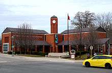
Markham Civic Centre

The city council is at the Markham Civic Centre at the intersection of York Regional Road 7 and Warden Avenue. The site of the previous offices on Woodbine Avenue has been redeveloped for commercial uses. The historic town hall on Main Street is now a restored office building. The Mayor's Youth Task Force was created to discuss issues facing young people in the city and to plan and publicize events. Its primary purpose is to encourage youth participation within the community.
Elections
Municipal elections are held every four years in Ontario. The most recent election took place in October, 2018, and the next is scheduled for October, 2022. The links listed below provide the results of recent election results:
By-laws
The city is permitted to create and enforce by-laws upon residents on various matters affecting the town. The by-laws are generally enforced by City By-Law enforcement officers, but they may involve York Regional Police if violations are deemed too dangerous for the officers to handle. In addition the by-laws can be linked to various provincial acts and enforced by the town. Violation of by-laws is subject to fines of up to $20,000 CAD. The by-laws of Markham include:
- Animal Control (see Dog Owners' Liability Act of Ontario)
- Construction Permits
- Driveway Extensions
- Fencing and Swimming Pools
- Heritage Conservation (see Ontario Heritage Act)
- Home-Based Businesses
- Noise
- Parking
- Property Standards
- Registration of Basement Apartments and Second Suites
- Sewers
- Site Alteration
- Waste Collection
- Water Use
City services

Courts and police
There are no courts in Markham, but the city is served by an Ontario Court of Justice in Newmarket, as well as an Ontario Small Claims court in Richmond Hill. There are also served by a Provincial Offence Court in Richmond Hill. The Ontario Court of Appeal is in Toronto, while the Supreme Court of Canada is in Ottawa, Ontario.
Policing is provided by York Regional Police at a station (5 District) at the corner of McCowan Road and Carlton Road and Highway 7.[42] Highway 404, Highway 407 and parts of Highway 48 are patrolled by the Ontario Provincial Police. Toronto Police Service is responsible for patrol on Steeles from Yonge Street to the York—Durham Line.
Fire
Markham Fire and Emergency Services was established in 1970 as Markham Fire Department and replaced various local volunteer fire units. Nine fire stations serve Markham. Toronto/Buttonville Municipal Airport is also served by Markham's Fire service.
Hospitals
Markham Stouffville Hospital in the city's far eastern end is Markham's main healthcare facility. Markham is also home to Shouldice Hospital, one of the world's premier facilities for people suffering from hernias. For those living near Steeles, they sometimes will be able to receive treatment at The Scarborough Hospital Birchmount Campus in Toronto/Scarborough.
Garbage collection
Garbage collection is provided by Miller Waste Systems since the company's founding in 1961.[43] Different areas of the city are assigned different garbage collection days. Recycling is collected weekly, while household trash and yard waste is collected every other week. The last week of May is "Bulk Collection", where residents can put out as much waste as they want without limits.[44]
To promote recycling, Markham mandated the use of clear garbage bags in 2013 to let Miller Waste staff see the contents of trash bags. Bags containing high amounts of recycling mixed with regular trash will not be collected.[44]
Winter operations
Winter operations are conducted on all City-owned roads according to the following criteria:[45]
- Primary roads plowed and salted 24/7 when snow reaches 5 cm
- Secondary roads plowed between the hours of 7am and 6pm when snow reaches 5 cm
- Local roads, cul-de-sacs, and private lanes plowed when snow reaches at least 7.5 cm
- Salting is done when roads are found to be slippery
Plowing of all roads takes around 16 hours to complete after the end of a snowfall, which exceeds provincial standards.
Winter operations are conducted on all City-owned sidewalks according to the following criteria:[45]
- Plowed and sanded when snow reaches 5 cm
Plowing of all sidewalks takes around 17 hours to complete after the end of a snowfall.
Parking is only permitted on the odd numbered side of a street from November 15 to April 15 and parking is banned when snow is falling.[45]
Education
Post-secondary
Seneca College has a campus in Markham, at highways 7 and 404, in the York Region business district.[46] This location opened in 2005, offering full and part-time programs in business, marketing and tourism, and also the college's departments of Finance, Human Resources and Information Technology Services. Since 2011 the campus has also housed the Confucius Institute.[47]
Primary and secondary schools
Markham has a number of both public and Catholic high schools. All have consistently scored high on standardized tests and have some of the highest rate of graduates attending universities.
The York Region District School Board operates secular English public schools. The York Catholic District School Board operates English Catholic schools. The Conseil scolaire Viamonde operates secular French schools, and the Conseil scolaire catholique MonAvenir operates Catholic French schools.
- York Region District School Board
- Bill Crothers Secondary School
- Bill Hogarth Secondary School
- Bur Oak Secondary School
- Markham District High School
- Markville Secondary School
- Middlefield Collegiate Institute
- Milliken Mills High School
- Pierre Elliott Trudeau High School
- Thornhill Secondary School
- Thornlea Secondary School
- Unionville High School
- York Catholic District School Board
Economy
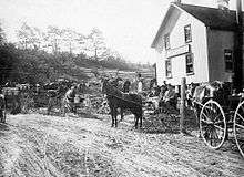
In the 19th century Markham had a vibrant, independent community with mills, distilleries and breweries around the Highway 7 and 48 intersection. The Thomas Speight Wagon Works exported products (wagons, horsecars) around the world, and Markham had a reputation as being more active than York (the former name for Toronto) early on. Most of these industries disappeared leaving farming as the main source of business.
Light industries and businesses began to move into Markham in the 1980s attracted by land and lower taxes. Today, it claims to be "Canada's Hi-Tech Capital" with a number of key companies in the area, such as IBM, Motorola, Toshiba, Lucent, Honeywell, Apple, Genesis Microchip, and is home to the head office of graphics card producer ATI (recently merged with AMD). Over 1,100 technology and life science companies have offices in Markham, employing over one fifth of the total workforce.[48] In 2014, the top five employers in the city in order are IBM Canada, the City of Markham, TD Waterhouse Inc., Markham Stouffville Hospital and AMD Technologies Inc.[49]
Yogen Früz has its headquarters in Markham.[50]
Markham also maintains economic and cultural cooperation agreements with the city of Laval, Quebec, which is the second largest city in the Greater Montreal area.
General Motors Canada Canadian Technical Centre is located in Markham since 2017, which was formerly Canadian head office of American Express from 1985–2015.
Performing arts

Markham is home to several locally oriented performing arts groups:
- Kindred Spirits Orchestra
- Markham Little Theatre
- Markham Youth Theatre
- Unionville Theatre Company
- Markham Concert Band
A key arts venue is the 'Markham Theatre For Performing Arts', at the Markham Civic Centre at Highway 7 and Warden Avenue. The facility is owned by the City of Markham and under the city's Culture Department.
Culture
Until the 1970s, Markham was mostly farmland and marsh, as reflected in events like the Markham Fair. Markham has several theatres, Markham Little Theatre at the Markham Museum,[51] the Markham Youth Theatre, and the Markham Theatre.
The Markham Public Library system has eight branches.[52] Some branches offer unique digital tools such as a Digital Media lab with graphic designs software, a recording studio with video editing / audio editing software and a green screen, and a maker space with 3D printers, virtual reality, and laser cutter.[53] With a library card, user can take free online courses,[54] borrow household tools and equipment[55] and educational toys.[56]
Sports
Community centres and recreational facilities
Recreation Department runs programs in these facilities and maintained by the city's Operations Department:
- Aaniin Community Centre – library, indoor pool, multi-purpose rooms
- Angus Glen Community Centre – library, tennis courts, indoor pool
- Armadale Community Centre – multi-purpose rooms, outdoor tennis courts
- Centennial Community Centre – multi-purpose rooms, indoor ice rink, indoor pool, squash courts, gym
- Cornell Community Centre – library, indoor pool, multi-purpose rooms, gym, indoor track, fitness centre
- Crosby Community Centre – indoor ice rink, multi-purpose rooms
- Markham Pan Am Centre – indoor pools, gym, fitness centre
- Markham Village Community Centre – library, indoor ice rink
- Milliken Community Centre – library, indoor pool, multi-purpose rooms, indoor ice rink
- Mount Joy Community Centre – outdoor soccer pitches, indoor ice rink, multi-purpose rooms
- R.J. Clatworthy Community Centre – indoor ice rink, multi-purpose rooms
- Rouge River Community Centre – multi-purpose rooms, outdoor pool
- Thornhill Community Centre – indoor ice rink, multi-purpose rooms, indoor track, library, squash court, gym
Parks and pathways
Markham has scenic pathways running over 22 km over its region. These pathways include 12 bridges allowing walkers, joggers and cyclists to make use and enjoy the sights it has to offer. Markham's green space includes woodlots, ravines and valleys that are not only enjoyable to its residents, but are important for the continued growth of the region's plants and animals. These natural spaces are the habitats for rare plant and insect species, offering food and homes essential for the survival of different native insects and birds.[57]
Parks and pathways are maintained by the City's Operations Department.

City issues
Like most cities and towns in the Greater Toronto Area, Markham has a few issues it must deal with:
Urban growth
There is a desire by the city to control urban sprawl by requesting higher density for new development. The city plan calls for more growth along Highway 7 and less towards the farmland to the north. A similar development in Cornell promotes the need for services to be closer to residences.
Transit plan
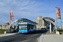
Linked to the concern of urban growth, Markham through York Region Transit (YRT) has implemented a transit system called Viva to ease the strain on the region's congested roads. Viva is similar to YRT but is used as an express bus service with the ability to change traffic signals to help reduce delays. The YRT is also planning to build a transit terminal somewhere near Cornell soon.
Attractions
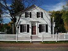
Markham has retained its historic past in part of the town. Here a just few places of interest:
- Frederick Horsman Varley Art Gallery
- Heintzman House – Home of Colonel George Crookshank, Sam Francis and Charles Heintzman of Heintzman & Co., the piano manufacturer.
- Markham Museum
- Markham Village
- Markham Heritage Estates – a unique, specially designed heritage subdivision owned by the City of Markham
- Reesor Farm Market
- Cathedral of the Transfiguration
- Thornhill village
Heritage streets preserve the old town feeling:
- Main Street Markham (Markham Road/Highway 48)
- Main Street Unionville (Kennedy Road/Highway 7)
There are still farms operating in the northern reaches of the town, but there are a few 'theme' farms in other parts of Markham:
- Galten Farms
- Forsythe Family Farms
- Adventure Valley
Markham's heritage railway stations are either an active station or converted to other uses:
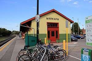
- Markham GO Station – built in 1871 by Toronto and Nipissing Railway and last used by CN Rail in the 1990s and restored in 2000 as active GO station and community use
- Locust Hill Station – built in 1936 in Locust Hill, Ontario and last used by the CPR in 1969; relocated in 1983 to the grounds of the Markham Museum; replaced earlier station built in the late 19th century for the Ontario and Quebec Railway and burned down in 1935.
- Unionville Station – built in 1871 by the Toronto and Nipissing Railway, later by Via Rail and by GO Transit from 1982 to 1991; it was sold to the city in 1989 and restored as a community centre within the historic Unionville Main Street area. The building features classic Canadian Railway Style found in Markham and (old) Unionville Stations.
Annual events
Events taking place annually include the Night It Up! Night Market, Taste of Asia Festival, Tony Roman Memorial Hockey Tournament, Markham Youth Week, Unionville Festival, Markham Village Music Festival, Markham Jazz Festival, Milliken Mills Children's Festival, Markham Ribfest & Music Festival, Doors Open Markham, Thornhill Village Festival, Markham Fair, Olde Tyme Christmas Unionville, Markham Santa Claus Parade and Markham Festival of Lights.
Shopping
Markham is home to several large malls of 100+ stores. These include:
- King Square Shopping Mall (1000+ stores)
- CF Markville (160+ stores)
- Pacific Mall (450 mini-shops)
- Langham Square (700 stores)
- First Markham Place (180 stores) and Woodside Power Centre
There are also a lot of higher-profile malls in nearby Toronto, and elsewhere in York Region.
Chinese businesses
Many shopping centres in Markham are also ethnically Chinese and Asian-oriented. This is a reflection of Markham's large Asian, particularly Chinese Canadian, population making it an important Chinese community in the GTA. They carry a wide variety of traditional Chinese products, apparel, and foods.
On Highway 7, between Woodbine and Warden Avenues, is First Markham Place, containing numerous shops and restaurants; this is several kilometres east of Richmond Hill's Chinese malls. Further east along Highway 7 is an older plaza is at the southwest quadrant with the intersection with Kennedy Road.
Pacific Mall is the most well-known Chinese mall in Markham, at Kennedy Road and Steeles Avenue East, which, combined with neighbouring Market Village (now closed) and Splendid China Mall, formed the second largest Chinese shopping area in North America, after the Golden Village in Richmond, British Columbia. In close proximity, at Steeles East and Warden Avenue, there is the New Century Plaza mall and a half-block away there is a plaza of Chinese shops anchored by a T & T Supermarket.
There are also some smaller shopping centres in Markham, such as:
- Albion Mall
- Alderland Centre
- J-Town
- Markham Town Square
- Metro Square
- Peachtree Centre
- New Kennedy Square
- The Shops on Steeles and 404
- Thornhill Square Shopping Centre
Local media
- Markham Review – local monthly newspaper
- TLM The Local Magazine – local satire & lifestyle magazine[58]
- Markham Economist and Sun – community paper owned by Metroland Media Group
- The Liberal – serving Thornhill and Richmond Hill – community paper owned by Metroland Media Group
- The York Region Business Times – business news
- York Region Media Group – Online news which includes some Metroland Media papers
- North of the City – magazine for York Region
- Rogers Cable 10 – community TV station for York Region, owned by Rogers Media
- Markham News24' – Hyper-local, video-based news website focusing on municipal politics, crime, lifestyle and business features
- Sing Tao Daily – an ethnic Chinese newspaper that serves the Greater Toronto Area
Transportation
Roads
Major highways that pass through Markham include Highway 404 (from Toronto to just south of Lake Simcoe) and Highway 407, a toll highway that passes north of Toronto and connects Markham with Burlington and Oshawa. Highway 407 primarily serves Markham from Yonge Street to York-Durham Line. The highway connects Markham with Clarington to the east, and Burlington to the west.
Highway 407 runs parallel to Highway 7, also known as York Regional Road 7, which is a major east–west artery suffering from congestion due to development along its route. Other major east–west routes include 16th Avenue, Major MacKenzie Drive, and Steeles Avenue which forms Markham's southern boundary with Toronto.
Rail
The GO Transit Stouffville line, a commuter rail line stretching from Lincolnville to downtown Toronto, provides passenger rail service in Markham. It operates only at rush hour and uses tracks owned by Metrolinx, the provincial transit agency. Five stations on the Stouffville line serve Markham, of which 4 are within the municipal borders. In 2015, Metrolinx announced that the Stouffville Line would get an expansion in service, bringing all day both directional trains from Union Station to Unionville GO Station.[59] Markham's section of this GO line also came under the spotlight in 2015 as City of Toronto Mayor John Tory's announced SMART Track plan for rapid transit expansion in Toronto includes the rail spur between Union Station and the Unionville GO.[60]
On April 8, 2019, GO Transit added ten midday train trips to Mount Joy GO Station, replacing the need for passengers to change to buses at Unionville GO.[61]
Public transit
York Region Transit (YRT) connects Markham with surrounding municipalities in York Region, and was created in 2001 from the merger of Markham Transit, Richmond Hill Transit, Newmarket Transit and Vaughan Transit. YRT to connects to the Toronto Transit Commission (TTC) subway system by way of Viva bus rapid transit from Finch station along Yonge Street, and Don Mills station through Unionville and on to Markville Mall.
YRT has two major terminals in Markham: Unionville GO Terminal and Markham Stouffville Hospital Bus Terminal. The new Cornell Terminal which will be on Rose Way near Ninth Line and Highway 7 is approved and construction would begin by late 2017 and to be completed in June 2019 which will result in major restructuring routes in Markham.[62] This new bus terminal will replace the transit hub along Church Street at Country Glen Road.
The TTC also provides service in Markham on several north–south routes, such as Warden Avenue, Birchmount Road, McCowan Road and Markham Road. These routes charge riders a double fare if they are travelling across the Steeles border.
GO Transit provides train service on the old trackbed of the Toronto and Nipissing Railway, which connects Markham with downtown Toronto on the Stouffville commuter rail service. The line has stops at several stations in Markham, namely Unionville GO Station, Centennial GO Station, Markham GO Station, and Mount Joy GO Station. The Richmond Hill commuter rail line provides service to the Langstaff GO Station, which straddles Markham and Richmond Hill but is used primarily by residents of west-central Markham and southern Richmond Hill.
Air
Toronto/Buttonville Municipal Airport, Canada's 11th busiest airport (Ontario's 4th busiest).[63] The airport permits general aviation and business commuter traffic to Ottawa and Montreal, Quebec. The airport is slated to close for development, but it has been delayed until at least 2023.
Markham Airport or Toronto/Markham Airport, (TC LID: CNU8), is a private airport operating 2.6 nautical miles (4.8 km; 3.0 mi) north of Markham, north of Elgin Mills Road. The airport is owned and operated by Markham Airport Inc. and owned by a numbered Ontario company owned by the Thomson family of Toronto. The airport is not part of the Greater Toronto Airports Authority (GTAA). The airport has a 2,013 ft (614 m) runway for small and private aircraft only (with night flying capabilities). The Royal Canadian Air Cadets Gliding Program uses the north side or the runway 09/27 for glider operations in the spring and fall, and use a northern traffic pattern.
Notable people
Partner Cities
Cultural Collaboration Cities
Friendship cities
See also
References
- "(Code 3519036) Census Profile". 2011 census. Statistics Canada. 2012. Retrieved February 8, 2012.
- "(Code 3519036) Census Profile". 2016 census. Statistics Canada. 2017. Retrieved February 12, 2017.
Notes
- Statistics Canada: 2017
- "Markham". Natural Resources Canada. October 6, 2016.
- "Markham Demographics 2016" (PDF).
- Tuckey, Bryan (July 24, 2015). "Why Markham is the next highrise community". Toronto Star. Retrieved April 12, 2016.
-
"A history of the town of Markham". City of Markham. The Corporation of the City of Markham. 2012. Retrieved April 9, 2013.
In May 1794, Berczy negotiated with Simcoe for 64,000 acres in Markham Township, soon to be known as the German Company Lands.The Berczy settlers, joined by several Pennsylvania German families, set out for Upper Canada.Sixty-four families arrived that year [...]
- "A history of the town of Markham". City of Markham. The Corporation of the City of Markham. 2012. Retrieved April 9, 2013.
- "Markham to change from town to city". CBC News, May 30, 2012.
- "Labour Force Profile" (PDF). Economic Profile Year End 2010. Town of Markham Economic Development Department. 2010. p. 10. Archived from the original (PDF) on March 18, 2012. Retrieved May 26, 2011.
- "Markham Quick Facts – 2016".
- "Why is Markham Canadaès High-Tech Capital?". Town of Markham. The Corporation of the Town of Markham. 2011. Archived from the original on December 18, 2010. Retrieved May 26, 2011.
- "Top 10 Employers in Markham" (PDF). Town of Markham. April 2011. Archived from the original (PDF) on March 18, 2012. Retrieved May 26, 2011.
- "Help Centre". Hyundai Auto Canada Corp. Retrieved January 1, 2020.
- "AMD Locations". AMD. Advanced Micro Devices, Inc. 2011. Retrieved May 26, 2011.
- "Connect with Avaya". Avaya. Avaya Inc. 2011. Retrieved May 26, 2011.
- "IBM: Helping Canada and the World Work Better". About IBM. IBM. Retrieved May 26, 2011.
- "Office Locations". About Us. Motorola Solutions, Inc. 2011. Retrieved May 26, 2011.
- "Contact Us – Oracle Canada". www.oracle.com.
- "Contact Us". Support. Toshiba Canada. 2011. Retrieved May 26, 2011.
- "Toyota Canada – Cars, Pickup Trucks, SUVs, Hybrids and Crossovers". Toyota Canada.
- "Scholastic Canada". Scholastic Canada.
- City of Markham (2014). "Aboriginal Presence in the Rouge Valley". City of Markham Tourism.
- For a complete history, cf. Isabel Champion, ed., Markham: 1793–1900 (Markham, ON: Markham Historical Society, 1979).
- See I. Champion, Markham: 1793–1900 (Markham, ON: Markham Historical Society, 1979), p. 248; also Markham Village – A Brief History 1800–1919 Archived 2011-06-10 at the Wayback Machine, Markham Public Library (website).
- For a complete history of Markham's early years, cf. Isabel Champion, ed., Markham: 1793–1900 "Markham: 1793–1900". Retrieved January 18, 2018. (Markham, ON: Markham Historical Society, 1979).
- Markham, Canadian Gazetteer (Toronto: Roswell, 1849), 111.
- Smith, Wm. H. (1846). Smith's Canadian Gazetteer – Statistical and General Information Respecting All Parts of the Upper Province, or Canada West:. Toronto: H. & W. ROWSELL. p. 111.
- Cf. C.P. Mulvany et al., The Township of Markham, History of Toronto and County of York, Ontario (Toronto: C.B. Robinson, 1885), 114ff.
- Cf. the detailed 1878 map, Township of Markham, Illustrated historical atlas of the county of York and the township of West Gwillimbury & town of Bradford in the county of Simcoe, Ont. (Toronto : Miles & Co., 1878).
- C.P. Mulvany, et al., "The Village of Markham," History of Toronto and County of York, Ontario (Toronto: C.B. Robinson, 1885), p. 198.
- C.P. Mulvany, et al., "The Township of Markham," History of Toronto and County of York, Ontario (Toronto: C.B. Robinson, 1885), p. 121.
- "Ontario Plaque". Ontarioplaques.com. September 22, 2009. Archived from the original on March 25, 2012. Retrieved March 10, 2011.
- "Toronto Buttonville Airport". Canadian Climate Normals 1981−2010. Environment Canada. Retrieved April 12, 2014.
- Cf. Isabel Champion, ed., Markham: 1793–1900 (Markham, ON: Markham Historical Society, 1979), pp. 225; 121f.; 148; 227; 338. See also articles on Almira from the Stouffville Tribune.
- "2016 Community Profiles". 2016 Canadian Census. Statistics Canada. February 21, 2017.
- "2011 Community Profiles". 2011 Canadian Census. Statistics Canada. July 5, 2013.
- "2006 Community Profiles". 2006 Canadian Census. Statistics Canada. March 30, 2011.
- "2001 Community Profiles". 2001 Canadian Census. Statistics Canada. February 17, 2012.
- http://publications.gc.ca/collections/collection_2013/statcan/rh-hc/CS96-304-1994-eng.pdf
- Statistics Canada: 2012
- "Census Profile, 2016 Census: Markham, City [Census subdivision], Ontario". Statistics Canada. Retrieved January 3, 2020.
- Government of Canada, Statistics Canada (February 8, 2017). "Census Profile, 2016 Census - Markham, City [Census subdivision], Ontario and Ontario [Province]". www12.statcan.gc.ca. Retrieved September 14, 2019.
- "#5 District – Markham ." York Regional Police. Retrieved on September 19, 2018. "8700 McCowan Road Markham, ON L3P 3M2"
- "Corporate Profile". Miller Waste. Retrieved April 30, 2019.
- "Recycling & Garbage". City of Markham. Retrieved January 3, 2020.
- "Winter Road Services". City of Markham. Retrieved January 3, 2020.
- "Markham Campus". Seneca College. May 23, 2018.
- "Confucius Institute at Seneca Opening Ceremony – Seneca – Toronto, Ontario, Canada". Senecacollege.ca. Retrieved October 24, 2018.
- "STATISTICS AND DEMOGRAPHICS". City of Markham. City of Markham. 2014. Retrieved November 20, 2015.
- "Top 100 Employers in Markham, 2014" (PDF). City of Markham. City of Markham. April 2015. Retrieved November 20, 2015.
- "Contact Us." Yogen Früz. Retrieved on March 15, 2014. "Yogen Früz headquarters 210 Shields Court; Markham, Ontario L3R 8V2, Canada"
- "Markham Museum Facilities" (PDF). Retrieved November 23, 2018.
- "Branches and Hours". Markham Public Library. Retrieved January 15, 2020.
- "Maker Space". Markham Public Library. Retrieved January 15, 2020.
- "Important Update about Lynda.com". City of Markham. Retrieved January 15, 2020.
- "Region's First Lendery is Now Open at Markham Public Library". York Region News. Retrieved January 15, 2020.
- "Markham libraries extend hours". Markham Review. Retrieved January 15, 2020.
- "City of Markham – Trees, Parks & Pathways". www.markham.ca. Retrieved September 26, 2016.
- "The Local Magazine – News, Views and Opinions". www.thelocalmagazine.com.
- Kalinowski, Tess (August 7, 2015). "The new train service is expected to be in the off-peak hours". The Toronto Star. ISSN 0319-0781. Retrieved November 20, 2015.
- Kalinowski, Tess (April 16, 2015). "Kitchener and Stouffville GO lines are on track for electrification needed to boost service frequencies". The Toronto Star. ISSN 0319-0781. Retrieved November 20, 2015.
- "New GO Train Service | GO Transit". www.gotransit.com. Retrieved April 29, 2019.
- "transit terminal / Markham – vivaNext". www.vivanext.com.
- "Total aircraft movements by class of operation — NAV CANADA towers". Statcan.gc.ca. March 12, 2010. Retrieved March 10, 2011.
- "The City of Markham and Eabametoong First Nation Sign Partnership Accord". Indigenous Business & Finance Today. February 1, 2017.
- "Sister Cities & International Partners". City of Markham. Retrieved January 28, 2019.
External links
| Wikimedia Commons has media related to Markham. |
| Wikivoyage has a travel guide for Markham. |
- City of Markham official website (history included)
- Town of Markham history
- Map of Markham Township in 1878
- Markham Youth Theatre
- – Highway 7 rapidways project
Places adjacent to Markham, Ontario | |
|---|---|
Largest city: Toronto | ||
| Regions | 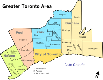 | |
| Cities | ||
| Towns | ||
| Townships and municipalities | ||