Pettus Glacier
Pettus Glacier (63°48′S 59°4′W) is a narrow deeply entrenched glacier 9 nautical miles (17 km) long, which flows north from Ebony Wall into Gavin Ice Piedmont between Poynter Hill and Tinsel Dome, Trinity Peninsula. Named by United Kingdom Antarctic Place-Names Committee (UK-APC) for Robert N. Pettus, aircraft pilot with Falkland Islands and Dependencies Aerial Survey Expedition (FIDASE), 1956–57.
| Pettus Glacier | |
|---|---|
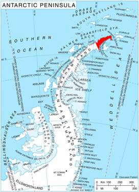 Location of Trinity Peninsula in the Antarctic Peninsula | |
 Location of Pettus in Antarctica | |
| Location | Trinity Peninsula |
| Coordinates | 63°48′S 59°04′W |
| Length | 9 nmi (17 km; 10 mi) |
| Thickness | unknown |
| Terminus | Gavin Ice Piedmont |
| Status | unknown |
Map
- Trinity Peninsula. Scale 1:250000 topographic map No. 5697. Institut für Angewandte Geodäsie and British Antarctic Survey, 1996.
References


External links
| Types |
| ||||||
|---|---|---|---|---|---|---|---|
| Anatomy |
| ||||||
| Processes | |||||||
| Measurements | |||||||
| Volcanic relations | |||||||
| Landforms |
| ||||||
| |||||||
This article is issued from Wikipedia. The text is licensed under Creative Commons - Attribution - Sharealike. Additional terms may apply for the media files.