Russell East Glacier
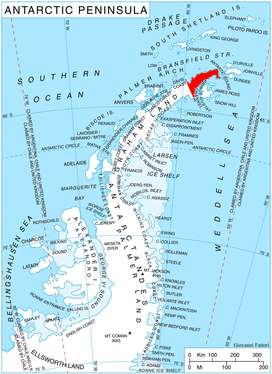
Russell East Glacier (63°44′S 58°20′W) is a glacier, 6 nautical miles (11 km) long and 3 nautical miles (6 km) wide, which lies at the north end of Detroit Plateau and flows from Mount Canicula and Verdikal Gap along the south slopes of Erul Heights eastward into Smokinya Cove in Prince Gustav Channel on the south side of Trinity Peninsula. This glacier together with Russell West Glacier, which flows westward into Bone Bay on the north side of Trinity Peninsula, form a through glacier across the north part of Antarctic Peninsula. It was first surveyed in 1946 by the Falkland Islands Dependencies Survey (FIDS). Named by the United Kingdom Antarctic Place-Names Committee (UK-APC) for V.I. Russell, surveyor and leader of the FIDS base at Hope Bay in 1946.
| Russell East Glacier | |
|---|---|
 Location of Trinity Peninsula in the Antarctic Peninsula | |
 Location of Russell East in Antarctica | |
| Location | Trinity Peninsula |
| Coordinates | 63°44′S 58°20′W |
| Length | 6 nmi (11 km; 7 mi) |
| Width | 3 nmi (6 km; 3 mi) |
| Thickness | unknown |
| Terminus | Prince Gustav Channel |
| Status | unknown |
Map
- Trinity Peninsula. Scale 1:250000 topographic map. Institut für Angewandte Geodäsie and British Antarctic Survey, 1996.
References


External links
| Types |
| ||||||
|---|---|---|---|---|---|---|---|
| Anatomy |
| ||||||
| Processes | |||||||
| Measurements | |||||||
| Volcanic relations | |||||||
| Landforms |
| ||||||
| |||||||