Hautot-l'Auvray
Hautot-l’Auvray is a commune in the Seine-Maritime department in the Normandy region in northern France.
Hautot-l’Auvray | |
|---|---|
 The church in Hautot-l'Auvray | |
.svg.png) Coat of arms | |
Location of Hautot-l’Auvray 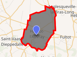
| |
 Hautot-l’Auvray  Hautot-l’Auvray | |
| Coordinates: 49°45′42″N 0°45′07″E | |
| Country | France |
| Region | Normandy |
| Department | Seine-Maritime |
| Arrondissement | Dieppe |
| Canton | Saint-Valery-en-Caux |
| Intercommunality | CC Côte d'Albâtre |
| Government | |
| • Mayor (2001–2008) | Guillaume Petit |
| Area 1 | 7.33 km2 (2.83 sq mi) |
| Population (2017-01-01)[1] | 329 |
| • Density | 45/km2 (120/sq mi) |
| Time zone | UTC+01:00 (CET) |
| • Summer (DST) | UTC+02:00 (CEST) |
| INSEE/Postal code | 76346 /76450 |
| Elevation | 77–135 m (253–443 ft) (avg. 100 m or 330 ft) |
| 1 French Land Register data, which excludes lakes, ponds, glaciers > 1 km2 (0.386 sq mi or 247 acres) and river estuaries. | |
Geography
A farming village situated in the Pays de Caux, some 31 miles (50 km) northeast of Le Havre, at the junction of the D50, D250 and D109 roads.
Population
| Year | 1962 | 1968 | 1975 | 1982 | 1990 | 1999 | 2006 |
|---|---|---|---|---|---|---|---|
| Population | 294 | 319 | 292 | 308 | 309 | 339 | 330 |
| From the year 1962 on: No double counting—residents of multiple communes (e.g. students and military personnel) are counted only once. | |||||||
Places of interest
- The church of St.Martin, dating from the thirteenth century.
- The fourteenth century chapel of Notre-Dame.
References
- "Populations légales 2017". INSEE. Retrieved 6 January 2020.
External links
| Wikimedia Commons has media related to Hautot-l'Auvray. |
- Website of Hautot l'Auvray (in French)
| Authority control |
|
|---|
This article is issued from Wikipedia. The text is licensed under Creative Commons - Attribution - Sharealike. Additional terms may apply for the media files.