Chauddagram Upazila
Chouddagram (Bengali: চৌদ্দগ্রাম) is an Upazila of Cumilla District in the Division of Chittagong, Bangladesh.[1]
Chouddagram চৌদ্দগ্রাম | |
|---|---|
Upazila | |
 Chouddagram Location in Bangladesh | |
| Coordinates: 23°13′N 91°19′E | |
| Country | |
| Division | Chittagong Division |
| District | Cumilla District |
| Area | |
| • Total | 271.73 km2 (104.92 sq mi) |
| Population (2011) | |
| • Total | 4,43,648 |
| • Density | 1,600/km2 (4,200/sq mi) |
| Time zone | UTC+6 (BST) |
| Website | http://chauddagram.comilla.gov.bd/ |
Geography
Chauddagram is located at 23.2167°N 91.3167°E . It has 57,435 households and a total area of 268.48 km².
Administration
Chauddagram has 13 Unions/Wards,1 municipality(pouroshova), 414 Mauzas/Mahallas, and 418 villages. Mayor : Rakib al hasan
The Unions are:
- Alkara
- Ujirpur
- Kankapait
- Kalikapur
- Kashinagar
- Gunabati
- Gholphasha
- Cheora
- Batisha
- Jagannath Dighi
- Munshirhat
- Shubhapur
- Sreepur[2]
Education
According to Banglapedia,Chauddagram H. J. Govt. Pilot High School (1921),Bijoykara School and College .Est- School-1970 and College- 1992 (Founder - Aga MD Aminul Islam Chowdhury),Batisa Secondary School, founded in 1926 Munsirhat High School (1954) and Payer Khola High School (1882) are notable secondary schools.[1] Other secondary schools include Gunabati M/L High School, Tarashail High School and Padua Sufia Rahman High School(1966).
See also
- Upazilas of Bangladesh
- Districts of Bangladesh
- Divisions of Bangladesh
References
- Uddin, AKM Jasim (2012). "Chauddagram Upazila". In Islam, Sirajul; Jamal, Ahmed A. (eds.). Banglapedia: National Encyclopedia of Bangladesh (Second ed.). Asiatic Society of Bangladesh.
- "Chauddagram Upazila - Banglapedia". en.banglapedia.org. Retrieved 2018-12-01.
Cumilla District | ||
|---|---|---|
| Upazila/Thana: |
| |
Capital: Chattogram | ||
| Bandarban District | 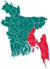 | |
| Brahmanbaria District | ||
| Chandpur District | ||
| Chattogram District | ||
| Cumilla District |
| |
| Cox's Bazar District | ||
| Feni District | ||
| Khagrachari District |
| |
| Lakshmipur District | ||
| Noakhali District | ||
| Rangamati District | ||