Vers-sur-Méouge
| Vers-sur-Méouge | |
|---|---|
| Commune | |
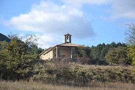 The chapel of Saint-Côme and Saint-Damien | |
 Vers-sur-Méouge Location within Auvergne-Rhône-Alpes region  Vers-sur-Méouge | |
| Coordinates: 44°13′52″N 5°34′16″E / 44.231°N 5.571°ECoordinates: 44°13′52″N 5°34′16″E / 44.231°N 5.571°E | |
| Country | France |
| Region | Auvergne-Rhône-Alpes |
| Department | Drôme |
| Arrondissement | Nyons |
| Canton | Nyons et Baronnies |
| Intercommunality | Hautes Baronnies |
| Government | |
| • Mayor (2008–2014) | Marcel Gay |
| Area1 | 13.81 km2 (5.33 sq mi) |
| Population (2008)2 | 42 |
| • Density | 3.0/km2 (7.9/sq mi) |
| Time zone | UTC+1 (CET) |
| • Summer (DST) | UTC+2 (CEST) |
| INSEE/Postal code | 26372 /26560 |
| Elevation |
749–1,395 m (2,457–4,577 ft) (avg. 810 m or 2,660 ft) |
|
1 French Land Register data, which excludes lakes, ponds, glaciers > 1 km2 (0.386 sq mi or 247 acres) and river estuaries. 2 Population without double counting: residents of multiple communes (e.g., students and military personnel) only counted once. | |
Vers-sur-Méouge is a commune in the Drôme department in southeastern France.
Population
| Historical population | ||
|---|---|---|
| Year | Pop. | ±% |
| 1911 | 166 | — |
| 1962 | 46 | −72.3% |
| 1968 | 58 | +26.1% |
| 1975 | 51 | −12.1% |
| 1982 | 28 | −45.1% |
| 1990 | 38 | +35.7% |
| 1999 | 52 | +36.8% |
| 2008 | 42 | −19.2% |
See also
References
| Wikimedia Commons has media related to Vers-sur-Méouge. |
This article is issued from
Wikipedia.
The text is licensed under Creative Commons - Attribution - Sharealike.
Additional terms may apply for the media files.