Serves-sur-Rhône
| Serves-sur-Rhône | ||
|---|---|---|
| Commune | ||
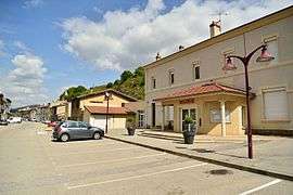 The town hall in Serves-sur-Rhône | ||
| ||
 Serves-sur-Rhône Location within Auvergne-Rhône-Alpes region  Serves-sur-Rhône | ||
| Coordinates: 45°08′22″N 4°49′06″E / 45.1394°N 4.8183°ECoordinates: 45°08′22″N 4°49′06″E / 45.1394°N 4.8183°E | ||
| Country | France | |
| Region | Auvergne-Rhône-Alpes | |
| Department | Drôme | |
| Arrondissement | Valence | |
| Canton | Tain-l'Hermitage | |
| Intercommunality | Pays de l'Hermitage | |
| Government | ||
| • Mayor (2008–2014) | Alain Lafuma | |
| Area1 | 6.49 km2 (2.51 sq mi) | |
| Population (2008)2 | 685 | |
| • Density | 110/km2 (270/sq mi) | |
| Time zone | UTC+1 (CET) | |
| • Summer (DST) | UTC+2 (CEST) | |
| INSEE/Postal code | 26341 /26600 | |
| Elevation |
117–374 m (384–1,227 ft) (avg. 123 m or 404 ft) | |
|
1 French Land Register data, which excludes lakes, ponds, glaciers > 1 km2 (0.386 sq mi or 247 acres) and river estuaries. 2 Population without double counting: residents of multiple communes (e.g., students and military personnel) only counted once. | ||
.svg.png)
Serves-sur-Rhône is a commune in the Drôme department in southeastern France.
Geography
Serves-sur-Rhône is positioned on the left bank of the River Rhône, on the Route Nationale 7, roughly 75 km (47 mi) from Lyon and 25 km (16 mi) from both Valence and Romans-sur-Isère.
Population
| Historical population | ||
|---|---|---|
| Year | Pop. | ±% |
| 1911 | 520 | — |
| 1962 | 411 | −21.0% |
| 1968 | 453 | +10.2% |
| 1975 | 369 | −18.5% |
| 1982 | 468 | +26.8% |
| 1990 | 624 | +33.3% |
| 1999 | 598 | −4.2% |
| 2008 | 685 | +14.5% |
Wine
The commune is in the AOC Côtes-du-Rhône wine producing region of Crozes-Hermitage.
See also
References
| Wikimedia Commons has media related to Serves-sur-Rhône. |
This article is issued from
Wikipedia.
The text is licensed under Creative Commons - Attribution - Sharealike.
Additional terms may apply for the media files.