Ferrassières
| Ferrassières | ||
|---|---|---|
| Commune | ||
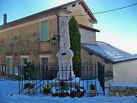 The town hall and the monument to the dead | ||
| ||
 Ferrassières Location within Auvergne-Rhône-Alpes region  Ferrassières | ||
| Coordinates: 44°08′11″N 5°28′45″E / 44.1364°N 5.4792°ECoordinates: 44°08′11″N 5°28′45″E / 44.1364°N 5.4792°E | ||
| Country | France | |
| Region | Auvergne-Rhône-Alpes | |
| Department | Drôme | |
| Arrondissement | Nyons | |
| Canton | Nyons et Baronnies | |
| Government | ||
| • Mayor (2008–2014) | Gaby Moulard | |
| Area1 | 29.27 km2 (11.30 sq mi) | |
| Population (2008)2 | 118 | |
| • Density | 4.0/km2 (10/sq mi) | |
| Time zone | UTC+1 (CET) | |
| • Summer (DST) | UTC+2 (CEST) | |
| INSEE/Postal code | 26135 /26570 | |
| Elevation | 830–1,389 m (2,723–4,557 ft) | |
|
1 French Land Register data, which excludes lakes, ponds, glaciers > 1 km2 (0.386 sq mi or 247 acres) and river estuaries. 2 Population without double counting: residents of multiple communes (e.g., students and military personnel) only counted once. | ||
.svg.png)
Ferrassières is a commune in the Drôme department in the Auvergne-Rhône-Alpes region in southeastern France.
Population
| Historical population | ||
|---|---|---|
| Year | Pop. | ±% |
| 1793 | 308 | — |
| 1800 | 317 | +2.9% |
| 1806 | 333 | +5.0% |
| 1821 | 401 | +20.4% |
| 1831 | 480 | +19.7% |
| 1836 | 441 | −8.1% |
| 1841 | 433 | −1.8% |
| 1846 | 412 | −4.8% |
| 1851 | 373 | −9.5% |
| 1856 | 411 | +10.2% |
| 1861 | 401 | −2.4% |
| 1866 | 381 | −5.0% |
| 1872 | 320 | −16.0% |
| 1876 | 351 | +9.7% |
| 1881 | 354 | +0.9% |
| 1886 | 339 | −4.2% |
| 1891 | 312 | −8.0% |
| 1896 | 309 | −1.0% |
| 1901 | 245 | −20.7% |
| 1906 | 246 | +0.4% |
| 1911 | 222 | −9.8% |
| 1921 | 182 | −18.0% |
| 1926 | 157 | −13.7% |
| 1931 | 159 | +1.3% |
| 1936 | 127 | −20.1% |
| 1946 | 139 | +9.4% |
| 1954 | 112 | −19.4% |
| 1962 | 100 | −10.7% |
| 1968 | 109 | +9.0% |
| 1975 | 118 | +8.3% |
| 1982 | 124 | +5.1% |
| 1990 | 106 | −14.5% |
| 1999 | 113 | +6.6% |
| 2008 | 118 | +4.4% |
See also
References
| Wikimedia Commons has media related to Ferrassières. |
| Authority control |
|---|
This article is issued from
Wikipedia.
The text is licensed under Creative Commons - Attribution - Sharealike.
Additional terms may apply for the media files.