Peyrus
| Peyrus | ||
|---|---|---|
| Commune | ||
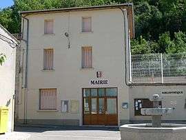 Town hall | ||
| ||
 Peyrus Location within Auvergne-Rhône-Alpes region  Peyrus | ||
| Coordinates: 44°54′49″N 5°06′32″E / 44.9136°N 5.1089°ECoordinates: 44°54′49″N 5°06′32″E / 44.9136°N 5.1089°E | ||
| Country | France | |
| Region | Auvergne-Rhône-Alpes | |
| Department | Drôme | |
| Arrondissement | Valence | |
| Canton | Crest | |
| Intercommunality | CA Valence Romans Agglo | |
| Government | ||
| • Mayor (2008–2014) | Marie-Hélène Guillon | |
| Area1 | 10.48 km2 (4.05 sq mi) | |
| Population (2008)2 | 609 | |
| • Density | 58/km2 (150/sq mi) | |
| Time zone | UTC+1 (CET) | |
| • Summer (DST) | UTC+2 (CEST) | |
| INSEE/Postal code | 26232 /26120 | |
| Elevation |
338–1,101 m (1,109–3,612 ft) (avg. 386 m or 1,266 ft) | |
|
1 French Land Register data, which excludes lakes, ponds, glaciers > 1 km2 (0.386 sq mi or 247 acres) and river estuaries. 2 Population without double counting: residents of multiple communes (e.g., students and military personnel) only counted once. | ||
.svg.png)
Peyrus is a commune in the Drôme department in southeastern France.
Population
| Historical population | ||
|---|---|---|
| Year | Pop. | ±% |
| 1911 | 503 | — |
| 1962 | 215 | −57.3% |
| 1968 | 227 | +5.6% |
| 1975 | 249 | +9.7% |
| 1982 | 296 | +18.9% |
| 1990 | 423 | +42.9% |
| 1999 | 488 | +15.4% |
| 2008 | 609 | +24.8% |
See also
References
| Wikimedia Commons has media related to Peyrus. |
| Authority control |
|---|
This article is issued from
Wikipedia.
The text is licensed under Creative Commons - Attribution - Sharealike.
Additional terms may apply for the media files.