Allex
| Allex | |
|---|---|
| Commune | |
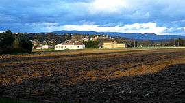 A general view of Allex | |
 Allex Location within Auvergne-Rhône-Alpes region  Allex | |
| Coordinates: 44°45′53″N 4°55′03″E / 44.7647°N 4.9175°ECoordinates: 44°45′53″N 4°55′03″E / 44.7647°N 4.9175°E | |
| Country | France |
| Region | Auvergne-Rhône-Alpes |
| Department | Drôme |
| Arrondissement | Die |
| Canton | Loriol-sur-Drôme |
| Intercommunality | Val de Drôme |
| Government | |
| • Mayor (2014-2020) | Gérard Crozier |
| Area1 | 20.17 km2 (7.79 sq mi) |
| Population (2014)2 | 2,463 |
| • Density | 120/km2 (320/sq mi) |
| Time zone | UTC+1 (CET) |
| • Summer (DST) | UTC+2 (CEST) |
| INSEE/Postal code | 26006 /26400 |
| Elevation | 124–220 m (407–722 ft) |
|
1 French Land Register data, which excludes lakes, ponds, glaciers > 1 km2 (0.386 sq mi or 247 acres) and river estuaries. 2 Population without double counting: residents of multiple communes (e.g., students and military personnel) only counted once. | |
Allex is a commune near Crest in the Drôme department in southeastern France. The Drôme River runs nearby.
Population
| Historical population | ||
|---|---|---|
| Year | Pop. | ±% |
| 1911 | 1,550 | — |
| 1962 | 1,208 | −22.1% |
| 1968 | 1,219 | +0.9% |
| 1975 | 1,179 | −3.3% |
| 1982 | 1,487 | +26.1% |
| 1990 | 1,704 | +14.6% |
| 1999 | 2,009 | +17.9% |
| 2008 | 2,472 | +23.0% |
See also
References
External links
| Wikimedia Commons has media related to Allex. |
| Wikivoyage has a travel guide for Allex. |
This article is issued from
Wikipedia.
The text is licensed under Creative Commons - Attribution - Sharealike.
Additional terms may apply for the media files.