Chanos-Curson
| Chanos-Curson | |
|---|---|
| Commune | |
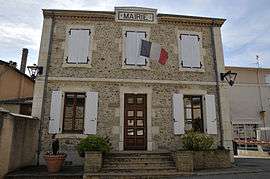 Town hall | |
 Chanos-Curson Location within Auvergne-Rhône-Alpes region  Chanos-Curson | |
| Coordinates: 45°03′46″N 4°54′51″E / 45.0628°N 4.9142°ECoordinates: 45°03′46″N 4°54′51″E / 45.0628°N 4.9142°E | |
| Country | France |
| Region | Auvergne-Rhône-Alpes |
| Department | Drôme |
| Arrondissement | Valence |
| Canton | Tain-l'Hermitage |
| Intercommunality | Pays de l'Hermitage |
| Government | |
| • Mayor (2008–2014) | Serge Blache |
| Area1 | 8.18 km2 (3.16 sq mi) |
| Population (2008)2 | 1,091 |
| • Density | 130/km2 (350/sq mi) |
| Time zone | UTC+1 (CET) |
| • Summer (DST) | UTC+2 (CEST) |
| INSEE/Postal code | 26071 /26600 |
| Elevation |
142–273 m (466–896 ft) (avg. 154 m or 505 ft) |
|
1 French Land Register data, which excludes lakes, ponds, glaciers > 1 km2 (0.386 sq mi or 247 acres) and river estuaries. 2 Population without double counting: residents of multiple communes (e.g., students and military personnel) only counted once. | |
Chanos-Curson is a commune of the Drôme department in southeastern France.
Population
| Historical population | ||
|---|---|---|
| Year | Pop. | ±% |
| 1911 | 734 | — |
| 1962 | 596 | −18.8% |
| 1968 | 624 | +4.7% |
| 1975 | 641 | +2.7% |
| 1982 | 722 | +12.6% |
| 1990 | 773 | +7.1% |
| 1999 | 944 | +22.1% |
| 2008 | 1,091 | +15.6% |
See also
References
| Wikimedia Commons has media related to Chanos-Curson. |
| Authority control |
|---|
This article is issued from
Wikipedia.
The text is licensed under Creative Commons - Attribution - Sharealike.
Additional terms may apply for the media files.