Saint-Nazaire-le-Désert
| Saint-Nazaire-le-Désert | |
|---|---|
| Commune | |
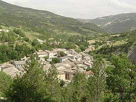 A view of Saint-Nazaire-le-Désert | |
 Saint-Nazaire-le-Désert Location within Auvergne-Rhône-Alpes region  Saint-Nazaire-le-Désert | |
| Coordinates: 44°34′15″N 5°16′36″E / 44.5708°N 5.2767°ECoordinates: 44°34′15″N 5°16′36″E / 44.5708°N 5.2767°E | |
| Country | France |
| Region | Auvergne-Rhône-Alpes |
| Department | Drôme |
| Arrondissement | Die |
| Canton | Le Diois |
| Government | |
| • Mayor (2008–2014) | Daniel Fernandez |
| Area1 | 46.62 km2 (18.00 sq mi) |
| Population (2008)2 | 138 |
| • Density | 3.0/km2 (7.7/sq mi) |
| Time zone | UTC+1 (CET) |
| • Summer (DST) | UTC+2 (CEST) |
| INSEE/Postal code | 26274 /26340 |
| Elevation |
527–1,447 m (1,729–4,747 ft) (avg. 591 m or 1,939 ft) |
|
1 French Land Register data, which excludes lakes, ponds, glaciers > 1 km2 (0.386 sq mi or 247 acres) and river estuaries. 2 Population without double counting: residents of multiple communes (e.g., students and military personnel) only counted once. | |
Saint-Nazaire-le-Désert is a commune in the Drôme department in the Auvergne-Rhône-Alpes region in southeastern France.
History
Archaeology suggests that people have settled in the area for over six thousand years. Fragments of Iron Age vases for roasting wheat have been found in the area. There is also a ruined castle, sacred architecture and a sixteenth-century church on water.
Population
| Historical population | ||
|---|---|---|
| Year | Pop. | ±% |
| 1806 | 1,169 | — |
| 1911 | 580 | −50.4% |
| 1962 | 197 | −66.0% |
| 1968 | 257 | +30.5% |
| 1975 | 205 | −20.2% |
| 1982 | 197 | −3.9% |
| 1990 | 168 | −14.7% |
| 1999 | 183 | +8.9% |
| 2008 | 138 | −24.6% |
Economy
The French goat's cheese Picodon is made in and around the area of Saint-Nazaire-le-Désert. Lavender is grown locally and products containing lavender are popular.
See also
References
| Wikimedia Commons has media related to Saint-Nazaire-le-Désert. |
This article is issued from
Wikipedia.
The text is licensed under Creative Commons - Attribution - Sharealike.
Additional terms may apply for the media files.