Omblèze
| Omblèze | |
|---|---|
| Commune | |
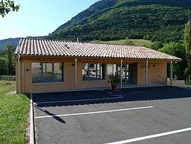 The town hall of Omblèze | |
 Omblèze Location within Auvergne-Rhône-Alpes region  Omblèze | |
| Coordinates: 44°51′52″N 5°13′12″E / 44.8644°N 5.22°ECoordinates: 44°51′52″N 5°13′12″E / 44.8644°N 5.22°E | |
| Country | France |
| Region | Auvergne-Rhône-Alpes |
| Department | Drôme |
| Arrondissement | Die |
| Canton | Crest |
| Intercommunality | Val de Drôme |
| Government | |
| • Mayor (2008–2014) | Gilbert Pourret |
| Area1 | 44.92 km2 (17.34 sq mi) |
| Population (2008)2 | 69 |
| • Density | 1.5/km2 (4.0/sq mi) |
| Time zone | UTC+1 (CET) |
| • Summer (DST) | UTC+2 (CEST) |
| INSEE/Postal code | 26221 /26400 |
| Elevation | 388–1,581 m (1,273–5,187 ft) |
|
1 French Land Register data, which excludes lakes, ponds, glaciers > 1 km2 (0.386 sq mi or 247 acres) and river estuaries. 2 Population without double counting: residents of multiple communes (e.g., students and military personnel) only counted once. | |
Omblèze is a commune in the Drôme department in southeastern France.
Population
| Historical population | ||
|---|---|---|
| Year | Pop. | ±% |
| 1911 | 269 | — |
| 1962 | 34 | −87.4% |
| 1968 | 62 | +82.4% |
| 1975 | 52 | −16.1% |
| 1982 | 54 | +3.8% |
| 1990 | 64 | +18.5% |
| 1999 | 66 | +3.1% |
| 2008 | 69 | +4.5% |
See also
References
| Wikimedia Commons has media related to Omblèze. |
This article is issued from
Wikipedia.
The text is licensed under Creative Commons - Attribution - Sharealike.
Additional terms may apply for the media files.