Margès
| Margès | |
|---|---|
| Commune | |
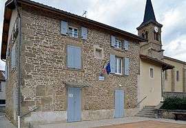 Town hall | |
 Margès Location within Auvergne-Rhône-Alpes region  Margès | |
| Coordinates: 45°08′52″N 5°02′11″E / 45.1478°N 5.0364°ECoordinates: 45°08′52″N 5°02′11″E / 45.1478°N 5.0364°E | |
| Country | France |
| Region | Auvergne-Rhône-Alpes |
| Department | Drôme |
| Arrondissement | Valence |
| Canton | Drôme des collines |
| Intercommunality | Pays de l'Herbasse |
| Government | |
| • Mayor (2008–2014) | Daniel Dumoulin |
| Area1 | 9.79 km2 (3.78 sq mi) |
| Population (2008)2 | 877 |
| • Density | 90/km2 (230/sq mi) |
| Time zone | UTC+1 (CET) |
| • Summer (DST) | UTC+2 (CEST) |
| INSEE/Postal code | 26174 /26260 |
| Elevation |
216–344 m (709–1,129 ft) (avg. 245 m or 804 ft) |
|
1 French Land Register data, which excludes lakes, ponds, glaciers > 1 km2 (0.386 sq mi or 247 acres) and river estuaries. 2 Population without double counting: residents of multiple communes (e.g., students and military personnel) only counted once. | |
Margès is a commune in the Drôme department in southeastern France.
Population
| Historical population | ||
|---|---|---|
| Year | Pop. | ±% |
| 1911 | 556 | — |
| 1962 | 319 | −42.6% |
| 1968 | 370 | +16.0% |
| 1975 | 373 | +0.8% |
| 1982 | 444 | +19.0% |
| 1990 | 532 | +19.8% |
| 1999 | 723 | +35.9% |
| 2008 | 877 | +21.3% |
See also
References
| Wikimedia Commons has media related to Margès. |
This article is issued from
Wikipedia.
The text is licensed under Creative Commons - Attribution - Sharealike.
Additional terms may apply for the media files.