Saint-Christophe-et-le-Laris
| Saint-Christophe-et-le-Laris | |
|---|---|
| Commune | |
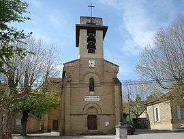 The church of Saint-Christophe-et-le-Laris | |
 Saint-Christophe-et-le-Laris Location within Auvergne-Rhône-Alpes region  Saint-Christophe-et-le-Laris | |
| Coordinates: 45°12′39″N 5°04′20″E / 45.2108°N 5.0722°ECoordinates: 45°12′39″N 5°04′20″E / 45.2108°N 5.0722°E | |
| Country | France |
| Region | Auvergne-Rhône-Alpes |
| Department | Drôme |
| Arrondissement | Valence |
| Canton | Drôme des collines |
| Intercommunality | CA Valence Romans Agglo |
| Government | |
| • Mayor (2008–2014) | Francis Barry |
| Area1 | 11.35 km2 (4.38 sq mi) |
| Population (2008)2 | 393 |
| • Density | 35/km2 (90/sq mi) |
| Time zone | UTC+1 (CET) |
| • Summer (DST) | UTC+2 (CEST) |
| INSEE/Postal code | 26298 /26350 |
| Elevation |
320–502 m (1,050–1,647 ft) (avg. 350 m or 1,150 ft) |
|
1 French Land Register data, which excludes lakes, ponds, glaciers > 1 km2 (0.386 sq mi or 247 acres) and river estuaries. 2 Population without double counting: residents of multiple communes (e.g., students and military personnel) only counted once. | |
Saint-Christophe-et-le-Laris is a commune in the Drôme department in southeastern France.
Population
| Historical population | ||
|---|---|---|
| Year | Pop. | ±% |
| 1911 | 591 | — |
| 1962 | 319 | −46.0% |
| 1968 | 377 | +18.2% |
| 1975 | 323 | −14.3% |
| 1982 | 297 | −8.0% |
| 1990 | 318 | +7.1% |
| 1999 | 289 | −9.1% |
| 2008 | 393 | +36.0% |
See also
References
| Wikimedia Commons has media related to Saint-Christophe-et-le-Laris. |
This article is issued from
Wikipedia.
The text is licensed under Creative Commons - Attribution - Sharealike.
Additional terms may apply for the media files.