Springfield metropolitan area, Missouri
| Springfield, Missouri | |
|---|---|
| Springfield–Nixa–Branson Missouri Combined Metropolitan Area | |
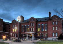
 Downtown Springfield viewed from Jordan Valley Park | |
| Country | United States |
| State(s) | Missouri |
| Largest city | Springfield |
| Other cities |
- Battlefield - Nixa - Ozark - Republic - Branson - Marshfield - Buffalo - Willard - |
| Area | |
| • Total | 3,021 sq mi (7,820 km2) |
| Population (2016 estimates) | |
| • Total | 544,712 |
| • Rank | 83rd in the U.S. |
| Historical population | |||
|---|---|---|---|
| Census | Pop. | %± | |
| 1960 | 126,274 | — | |
| 1970 | 152,929 | 21.1% | |
| 1980 | 207,704 | 35.8% | |
| 1990 | 240,593 | 15.8% | |
| 2000 | 368,374 | 53.1% | |
| 2010 | 520,589 | 41.3% | |
| Est. 2017 | 549,423 | 5.5% | |
| U.S. Decennial Census | |||
The Springfield–Branson, Missouri Combined Metropolitan Area, as defined by the United States Census Bureau, is an area consisting of seven counties in southwestern Missouri, anchored by the city of Springfield, the state's third largest city. Other primary population centers in the metro area include Branson, Nixa, Ozark, Republic, Marshfield, Bolivar, and Willard. Currently, the city limits of Springfield reach the Ozark City limits at the Christian County line on US 65, the city limits of Republic at James River Freeway on the southwest side of the city, and the Strafford city limits on Route 744 on the northeast side of the city. As of the 2010 census, the MSA had a population of 520,589, though the 2015 Estimates place the population at 541,991.
Counties
| County | 2016 Estimate | 2010 Census | Change |
|---|---|---|---|
| Greene County | 289,805 | 275,174 | +5.32% |
| Christian County | 85,432 | 77,422 | +10.35% |
| Taney County | 55,355 | 51,675 | +7.12% |
| Webster County | 38,665 | 36,202 | +6.80% |
| Polk County | 31,794 | 31,137 | +2.11% |
| Stone County | 31,699 | 32,202 | −1.56% |
| Dallas County | 16,673 | 16,777 | −0.62% |
| Total | 549,423 | 520,585 | +5.54% |
Communities
Anchor cities
- Springfield (Principal city) Pop: 166,810
Places with 5,000 to 20,000 inhabitants
- Nixa Pop: 20,984
- Ozark Pop: 19,120
- Republic Pop: 16,005
- Branson Pop: 11,431
- Bolivar Pop: 10,714
- Marshfield Pop: 7,138
- Battlefield Pop: 6,001
- Willard Pop: 5,454
Places with 1,000 to 5,000 inhabitants
|
Places with 500 to 1,000 inhabitants
- Highlandville Pop: 915
- Reeds Spring Pop: 886
- Rockaway Beach Pop: 857
- Fremont Hills Pop: 847
- Fordland Pop: 801
- Walnut Grove Pop: 723
- Pleasant Hope Pop: 614
- Bull Creek Pop: 590
- Indian Point Pop: 520
Places with less than 500 inhabitants
|
Unincorporated places

School systems
- Billings R-IV School District
- Bolivar R-1 School District
- Chadwick School District
- Clever R-V School District
- Dallas Co. R-1 School District
- Fair Grove R-10 School District
- Greenwood Laboratory School
- Logan-Rogersville R-VIII School District
- Marian C Early R-V (Morrisville) School District
- Nixa R-II School District
- Ozark R-VI School District
- Pleasant Hope R-VI School District
- Republic R-III School District
- Spokane R-VII School District
- Springfield Catholic Schools
- Springfield R-12 School District
- Strafford R-VI School District
- Walnut Grove R-V School District
- Willard R-2 School District
Education
Secondary
Springfield Public Schools is the largest fully accredited school district in the State of Missouri with nearly 25,000 students and a graduation rate of roughly 88%.[1] Nixa Public Schools, located just south of Springfield, is a growing district of 6,000 students that frequently ranks above the national average in ACT scores and has for the last ten years earned the highest state recognition for academic achievement given in Missouri.[2] Other growing districts in the area are located in the cities of Ozark, Republic, Strafford, Branson and Marshfield. Private schools in the area include the Greenwood Laboratory School in Springfield, located on the Missouri State campus, and the Summit Preparatory School, located near James River Freeway in Chesterfield Village.

There are also several private religious schools in the area, including Springfield Catholic and Springfield Lutheran.[3]
Colleges and universities
Missouri State University in Springfield is the second largest university in the state with roughly 26,000 attending students representing all 50 states 83 countries. Other universities in Springfield include Drury University, a private liberal arts college with more than 5,000 students frequently ranked among the best private liberal arts colleges in the Midwest, and OTC with approximately 15,000 students, where students can earn a one-year certificate or a two-year associate degree.
Outside of the Springfield area, Bolivar holds Southwest Baptist University, a Division II school well known for its nursing program. College of the Ozarks, located near Branson, is a liberal arts college which is tuition free thanks to its student work program and school donations.
Transportation
Principal Highways


Air
.jpg)
The area is served by Springfield-Branson National Airport which has direct flights on Delta, United, American and Allegiant to thirteen cities across the United States, including hubs such as Chicago, Dallas, Atlanta, Charlotte and Houston, among others. With roughly one million passengers per year, it is one of the fastest growing airports of its size in the country. [4] A new terminal was opened at the airport in 2007 with 10 gates, expandable to 60, and runways can accommodate the Boeing 747 and large military aircraft.
Branson Airport is the only privately built airport in the country, and also has flights to select cities in the United States, although no major airlines serve the airport and service is minor and sporadic, meaning that Springfield-Branson National Airport is the principal airport for those living in the region.[5]
Public transportation
Public transportation in the metropolitan area is focused primarily in Springfield. City Utilities operates many buses on several different routes throughout the city, and bus service is available 365 days per year with less frequent weekend, holiday and evening routes.
Greenways
The area has a growing number of Greenway trails, 70 miles (112 km) run through parks and green areas, while 81 miles (130 km) are located on city streets. Such routes include The Link, which runs on local roads through the city of Springfield, and the Trail of Tears Link, while the Frisco Link connects Springfield with Bolivar to the north.
References
- ↑ http://www.springfieldpublicschoolsmo.org/pages/SPSMO/DistrictInfo/Quality_Improvement___Accounta/QIA_Links/Demographic_Data
- ↑ "Nixa Area Chamber". www.nixachamber.com. Retrieved 8 April 2018.
- ↑ Departika, Creativore,. "Live in Springfield Missouri - Private K-12". www.liveinspringfieldmo.com. Retrieved 8 April 2018.
- ↑ News, reporter Emily Wood and videographer Tim Leimkuhler, KY3. "Springfield - Branson National Airport likely will reach 1 million passengers in 2017". ky3.com. Retrieved 8 April 2018.
- ↑ "Missouri's new Branson Airport struggling to keep fliers". USA TODAY. Retrieved 2017-12-01.
