Billings, Missouri
| Billings, Missouri | |
|---|---|
| City | |
| Nickname(s): Billin's | |
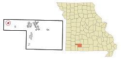 Location of Billings, Missouri | |
| Coordinates: 37°3′50″N 93°33′14″W / 37.06389°N 93.55389°WCoordinates: 37°3′50″N 93°33′14″W / 37.06389°N 93.55389°W | |
| Country | United States |
| State | Missouri |
| County | Christian |
| Area[1] | |
| • Total | 0.89 sq mi (2.31 km2) |
| • Land | 0.89 sq mi (2.31 km2) |
| • Water | 0 sq mi (0 km2) |
| Elevation | 1,368 ft (417 m) |
| Population (2010)[2] | |
| • Total | 1,035 |
| • Estimate (2016)[3] | 1,092 |
| • Density | 1,200/sq mi (450/km2) |
| Time zone | UTC−06:00 (Central (CST)) |
| • Summer (DST) | UTC−05:00 (CDT) |
| ZIP code | 65610 |
| Area code(s) | 417 |
| FIPS code | 29-05626[4] |
| GNIS feature ID | 0714237[5] |
| Website | billingsmo.com |
Billings is a city in Christian County, Missouri, United States. The population was 1,035 at the 2010 census. It is part of the Springfield, Missouri metropolitan area.
History
Billings was platted in 1872.[6] The community was named after railroad baron Frederick H. Billings, who helped build the town a church in exchange for the naming rights.[7] A post office has been in operation at Billings since 1871.[8]
Geography
Billings is located at 37°3′50″N 93°33′14″W / 37.06389°N 93.55389°W (37.064001, -93.553819).[9]
According to the United States Census Bureau, the city has a total area of 0.89 square miles (2.31 km2), all of it land.[1]
Demographics
| Historical population | |||
|---|---|---|---|
| Census | Pop. | %± | |
| 1880 | 129 | — | |
| 1890 | 464 | 259.7% | |
| 1900 | 702 | 51.3% | |
| 1910 | 760 | 8.3% | |
| 1920 | 614 | −19.2% | |
| 1930 | 472 | −23.1% | |
| 1940 | 452 | −4.2% | |
| 1950 | 597 | 32.1% | |
| 1960 | 602 | 0.8% | |
| 1970 | 760 | 26.2% | |
| 1980 | 911 | 19.9% | |
| 1990 | 989 | 8.6% | |
| 2000 | 1,091 | 10.3% | |
| 2010 | 1,035 | −5.1% | |
| Est. 2016 | 1,092 | [3] | 5.5% |
| U.S. Decennial Census | |||
2010 census
As of the census[2] of 2010, there were 1,035 people, 437 households, and 281 families residing in the city. The population density was 1,162.9 inhabitants per square mile (449.0/km2). There were 504 housing units at an average density of 566.3 per square mile (218.6/km2). The racial makeup of the city was 96.8% White, 0.3% African American, 1.0% Native American, 0.2% Asian, 0.6% from other races, and 1.2% from two or more races. Hispanic or Latino of any race were 1.0% of the population.
There were 437 households of which 33.0% had children under the age of 18 living with them, 43.9% were married couples living together, 13.0% had a female householder with no husband present, 7.3% had a male householder with no wife present, and 35.7% were non-families. 31.6% of all households were made up of individuals and 15.6% had someone living alone who was 65 years of age or older. The average household size was 2.37 and the average family size was 2.90.
The median age in the city was 37.5 years. 26.5% of residents were under the age of 18; 8.6% were between the ages of 18 and 24; 24.5% were from 25 to 44; 23.4% were from 45 to 64; and 16.9% were 65 years of age or older. The gender makeup of the city was 45.1% male and 54.9% female.
2000 census
As of the census[4] of 2000, there were 1,091 people, 454 households, and 306 families residing in the city. The population density was 1,400.0 people per square mile (540.0/km²). There were 492 housing units at an average density of 631.4 per square mile (243.5/km²). The racial makeup of the city was 98.26% White, 0.37% African American, 0.55% Native American, and 0.82% from two or more races. Hispanic or Latino of any race were 0.09% of the population.
There were 454 households out of which 33.7% had children under the age of 18 living with them, 50.9% were married couples living together, 12.1% had a female householder with no husband present, and 32.4% were non-families. 28.9% of all households were made up of individuals and 15.0% had someone living alone who was 65 years of age or older. The average household size was 2.40 and the average family size was 2.95.
In the city the population was spread out with 26.9% under the age of 18, 8.7% from 18 to 24, 27.8% from 25 to 44, 22.3% from 45 to 64, and 14.4% who were 65 years of age or older. The median age was 34 years. For every 100 females, there were 83.7 males. For every 100 females age 18 and over, there were 81.4 males.
The median income for a household in the city was $28,207, and the median income for a family was $34,861. Males had a median income of $24,615 versus $19,881 for females. The per capita income for the city was $16,503. About 14.1% of families and 15.1% of the population were below the poverty line, including 19.3% of those under age 18 and 24.4% of those age 65 or over.
Notable people
- Holless Wilbur Allen, inventor of the compound bow[10]
- Leon Rausch, vocalist with Bob Wills & The Texas Playboys[11]
- William P. Sullivan, politician[12]
- Susan Sommer-Luarca, world renowned artist[13]
Notable events
- In 2012 Billings High School won the Missouri Class 2A boys basketball state championship.[14]
References
- 1 2 "US Gazetteer files 2010". United States Census Bureau. Archived from the original on 2012-01-24. Retrieved 2012-07-08.
- 1 2 "American FactFinder". United States Census Bureau. Retrieved 2012-07-08.
- 1 2 "Population and Housing Unit Estimates". Retrieved June 9, 2017.
- 1 2 "American FactFinder". United States Census Bureau. Archived from the original on 2013-09-11. Retrieved 2008-01-31.
- ↑ "US Board on Geographic Names". United States Geological Survey. 2007-10-25. Retrieved 2008-01-31.
- ↑ "Christian County Place Names, 1928–1945 (archived)". The State Historical Society of Missouri. Archived from the original on 24 June 2016. Retrieved 18 September 2016.
- ↑ Eaton, David Wolfe (1916). How Missouri Counties, Towns and Streams Were Named. The State Historical Society of Missouri. p. 275.
- ↑ "Post Offices". Jim Forte Postal History. Archived from the original on 6 March 2016. Retrieved 18 September 2016.
- ↑ "US Gazetteer files: 2010, 2000, and 1990". United States Census Bureau. 2011-02-12. Retrieved 2011-04-23.
- ↑ "Archery Hall of Fame".
- ↑ "Leon Rausch biography".
- ↑ William P. Sullivan
- ↑
- ↑ "Show Me Showdown results". Missouri State High School Activities Association website. 2012-03-17. Retrieved 2012-03-18.
External links
- Historic maps of Billings in the Sanborn Maps of Missouri Collection at the University of Missouri
Municipalities and communities of Christian County, Missouri, United States | ||
|---|---|---|
| Cities |  | |
| Village | ||
| Townships |
| |
| CDP | ||
| Unincorporated communities | ||
| Ghost towns | ||
| Footnotes | ‡This populated place also has portions in an adjacent county or counties | |
