Rogersville, Missouri
| Rogersville, Missouri | |
|---|---|
| City | |
 Location of Rogersville, Missouri | |
| Coordinates: 37°7′3″N 93°3′29″W / 37.11750°N 93.05806°WCoordinates: 37°7′3″N 93°3′29″W / 37.11750°N 93.05806°W | |
| Country | United States |
| State | Missouri |
| Counties | Webster, Greene |
| Area[1] | |
| • Total | 3.43 sq mi (8.91 km2) |
| • Land | 3.43 sq mi (8.91 km2) |
| • Water | 0 sq mi (0 km2) |
| Elevation | 1,460 ft (445 m) |
| Population (2010)[2] | |
| • Total | 3,073 |
| • Estimate (2016)[3] | 3,519 |
| • Density | 900/sq mi (340/km2) |
| Time zone | UTC-6 (Central (CST)) |
| • Summer (DST) | UTC-5 (CDT) |
| ZIP code | 65742 |
| Area code(s) | 417 |
| FIPS code | 29-62894[4] |
| GNIS feature ID | 0725537[5] |
Rogersville is a city in Greene and Webster Counties in the U.S. state of Missouri. The population was 3,073 at the 2010 census. It is part of the Springfield, Missouri Metropolitan Statistical Area. Rogersville was formally known as the "Raccoon Capital of the World".[6][7] In 2006, 417 Magazine ranked Rogersville as the 8th best place to live in Southwest Missouri.[8]
History
Rogersville was named after Doctor Rogers, a pioneer settler.[9] A post office called Rogersville has been in operation since 1882.[10] The Citizen's Bank of Rogersville was formed as a corporation on December 15, 1908, with $10,000 in capital stock.[11]
The history of Rogersville has been documented by the Citizen's Bank of Rogersville and is shown below.
The largest settlement in this area in the mid 1800's was Henderson, with a population of about 300. Henderson was located 16 miles east of Springfield in a valley, by a stream and on the mail highway. It was a perfect place for a town.
In 1882, the Kansas City and Memphis Railroad came through two miles to the south of Henderson. When it became known that a depot was to be erected, a young physician, Dr. Isaac Rogers agreed to donate $50 to defray the expense of surveying and laying out lots and streets if they would use his name for the settlement. The original survey was done by J.J. Watts.
The first postmaster was appointed in September 1882. Five rural carriers began in 1904 using horse and buggy. The population of Rogersville had grown to 450. School was held in the blacksmith shop in 1884. A community church, which housed a lodge hall on the second story, was built in 1885. A newspaper, The Rogersville Record, obtained a "second class matter permit" at the post office in October 1915. The first bank opened in 1890 but failed during the Depression. The Citizens Bank of Rogersville was chartered in 1908. Rogersville was incorporated as a village in 1916. Some street lights were operating as early as 1927. In 1932, US Highway 60 was paved through town.
There is no city, village or hamlet named "Logan." The Logan family donated the land on Farm Road 164, for the Logan Elementary School, built in 1955. In 1965, the K-8 Logan School District in southeast Greene County consolidated with the Rogersville School District in Webster County, and the combined entity became known as the Logan-Rogersville School District.[12]
There is, however, the Logan Cemetery about a half mile west of the Logan Elementary School on farm road 219 and also the old Crossroad Store at the intersection of farm road 164 and 219. This area is generally known as Logan.
Around late 1929 or early 1930, the Bank of Rogersville was robbed by two men who stole $981. About a dozen men rode out to chase the robbers, one of which was shot and the other was captured. The trial was held in the Rogersville High School gym for the captured robber, and he was sentenced to jail.[13]
In 1957, a fire was discovered in a vacant building in Rogersville on a Saturday night around 10:30 p.m., which burned out of control due to Rogersville having no fire-fighting equipment or a city water supply. Calls for aid were sent out to surrounding communities including the Fordland Air Force Station, the Seymour Volunteer Fire Department, the Ozark Rural Fire Department, and the Marshfield Department. Four businesses were destroyed, including a market and a new theater, with damages estimated at $75,000.[14]
In 1992, the Webster County Council on Aging formed a "Senior Services Committee" to address the needs of its senior citizens. In 1993, the committee decided to ask for a 5-cent tax increase to extend services on the August ballot, but the issue failed. In 1994, a forum was held with the assistance of the Southwest Missouri Office on Aging (SMOA) to discuss the possibility of a Rogersville Senior Center. A temporary center was formed in May 1994, and after fundraising events and community donations, the Rogersville Senior Center opened on January 17, 1995.[15]
Geography
According to the United States Census Bureau, the city has a total area of 3.44 square miles (8.91 km2), all of it land.[1]
Demographics
| Historical population | |||
|---|---|---|---|
| Census | Pop. | %± | |
| 1920 | 408 | — | |
| 1930 | 461 | 13.0% | |
| 1940 | 430 | −6.7% | |
| 1950 | 321 | −25.3% | |
| 1960 | 447 | 39.3% | |
| 1970 | 595 | 33.1% | |
| 1980 | 741 | 24.5% | |
| 1990 | 995 | 34.3% | |
| 2000 | 1,508 | 51.6% | |
| 2010 | 3,073 | 103.8% | |
| Est. 2016 | 3,519 | [3] | 14.5% |
| U.S. Decennial Census[16] | |||
2010 census
As of the census[2] of 2010, there were 3,073 people, 1,138 households, and 833 families residing in the city. The population density was 893.3 inhabitants per square mile (344.9/km2). There were 1,240 housing units at an average density of 360.5 per square mile (139.2/km2). The racial makeup of the city was 95.0% White, 0.4% African American, 0.7% Native American, 0.4% Asian, 0.1% Pacific Islander, 0.7% from other races, and 2.7% from two or more races. Hispanic or Latino of any race were 3.5% of the population.
There were 1,138 households of which 46.5% had children under the age of 18 living with them, 53.0% were married couples living together, 15.1% had a female householder with no husband present, 5.1% had a male householder with no wife present, and 26.8% were non-families. 21.8% of all households were made up of individuals and 8.2% had someone living alone who was 65 years of age or older. The average household size was 2.70 and the average family size was 3.16.
The median age in the city was 29.8 years. 33.2% of residents were under the age of 18; 8.3% were between the ages of 18 and 24; 31.9% were from 25 to 44; 17.6% were from 45 to 64; and 8.9% were 65 years of age or older. The gender makeup of the city was 48.6% male and 51.4% female.
2000 census
As of the census[4] of 2000, there were 1,508 people, 583 households, and 409 families residing in the city. The population density was 1,318.4 inhabitants per square mile (510.7/km²). There were 640 housing units at an average density of 559.5 per square mile (216.8/km²). The racial makeup of the city was 95.69% White, 0.40% African American, 0.73% Native American, 0.40% Asian, and 2.79% from two or more races. Hispanic or Latino of any race were 1.19% of the population.
There were 583 households out of which 43.2% had children under the age of 18 living with them, 52.8% were married couples living together, 12.0% had a female householder with no husband present, and 29.7% were non-families. 26.6% of all households were made up of individuals and 10.8% had someone living alone who was 65 years of age or older. The average household size was 2.58 and the average family size was 3.13.
In the city, the population was spread out with 31.8% under the age of 18, 8.7% from 18 to 24, 33.1% from 25 to 44, 17.2% from 45 to 64, and 9.2% who were 65 years of age or older. The median age was 30 years. For every 100 females, there were 90.6 males. For every 100 females age 18 and over, there were 86.8 males.
The median income for a household in the city was $30,417, and the median income for a family was $39,432. Males had a median income of $26,650 versus $20,395 for females. The per capita income for the city was $16,173. About 9.3% of families and 11.5% of the population were below the poverty line, including 14.1% of those under age 18 and 9.7% of those age 65 or over.
Economy
In August 2017, a ribbon cutting was held for the opening of a Sonic Drive-In location in Rogersville.[17]
Every year, the Rogersville Area Chamber of Commerce presents a Business of the Year Award to a local business for their service to the community. Recent recipients of the award are listed below:
Arts and culture
In the city of Rogersville alongside Highway B and the passing train tracks, there is a revitalized Frisco caboose that represents the Rogersville Caboose Veterans Memorial. The memorial was donated by the American Legion Goad-Ballinger Post 69 on July 1, 1995, and contains a plaque that reads as follows:
Dedicated to all American Veterans of War who through their patriotism and valor helped to preserve the freedom of the United States of America for all its people. One nation, under God, indivisible, with liberty & justice for all.[25]
Government
According to the city of Rogersville audit report for the year ending June 30, 2016, tax revenues totaled $1,034,124 representing 83% of the funding for governmental activities. The remaining $217,976 representing 17% of the funding for governmental activities was raised from program revenues. According to the audit report, "the combined fund balances of the City’s governmental funds as of June 30, 2016, were $1,331,449. The General Fund decreased by $1,058,067 primarily due to the MoDOT project."[26] The costs of the governmental activities for the year ending June 30, 2016, is shown below.
| Service | Cost |
|---|---|
| Administration | $308,351 |
| Police and Court | $501,520 |
| Street | $187,065 |
| Park | $64,985 |
| Economic Development | $1,141,181 |
| Debt Service | $64,102 |
| Total Cost | $2,267,204 |
Education
Rogersville is served by the Logan-Rogersville R-VIII School District, which contains 3 elementary and 2 secondary schools. The public schools are listed below.[27]
Elementary schools
- Logan-Rogersville Primary School (Pre-K – 1st)
- Logan-Rogersville Elementary School (2nd – 3rd)
- Logan-Rogersville Upper Elementary School (4th – 6th)
Secondary schools
- Logan-Rogersville Middle School (7th – 8th)
- Logan-Rogersville High School (9th – 12th)
Infrastructure
The Missouri Department of Transportation oversaw the construction of Project Freeway: U.S. 60 Rogersville, which was completed in early November 2016. The project included three new interchanges built along Highway 60 and a series of outer roads and backage roads.[28] The project was designed and built by Ozark Regional Road Constructors (ORRC) and was estimated at a cost of $27 million.[29] The project was recognized by the Design-Build Institute of America (DBIA) with the 2017 National Award of Excellence and the Chairman's Award for Community Impact and Social Responsibility for including community components such as the project’s "Young Women in Engineering Program, a partnership with the Logan-Rogersville School District, and the Minority Outreach Program at Missouri State University. The outreach programs used the highway project as a laboratory to expose female high school students to the engineering field and exposed minority students at the university to the highway design and construction industries."[30][31]
In December 2016, improved railroad crossings were completed in Rogersville along Route B. The project was a partnership between the City of Rogersville, BNSF Railway, and the Missouri Department of Transportation and was estimated at a cost of $6.7 million.[32]
References
- 1 2 "US Gazetteer files 2010". United States Census Bureau. Archived from the original on 2012-07-14. Retrieved 2012-07-08.
- 1 2 "American FactFinder". United States Census Bureau. Retrieved 2012-07-08.
- 1 2 "Population and Housing Unit Estimates". Retrieved June 9, 2017.
- 1 2 "American FactFinder". United States Census Bureau. Retrieved 2008-01-31.
- ↑ "US Board on Geographic Names". United States Geological Survey. 2007-10-25. Retrieved 2008-01-31.
- ↑ Berneking, Ettie (February 2014). "Rogersville Missouri". 417 Magazine. Retrieved December 24, 2017.
- ↑ James, Stuart (February 1963). "Coon Fever.. Our Favorite Epidemic". Popular Mechanics. Vol. 119 no. 2. Hearst Magazines. p. 236. ISSN 0032-4558. Retrieved December 24, 2017.
- ↑ Fisk, Evan (August 2006). "Best Places to Live 2006". 417 Magazine. Retrieved January 4, 2018.
- ↑ Eaton, David Wolfe (1918). How Missouri Counties, Towns and Streams Were Named. The State Historical Society of Missouri. p. 371.
- ↑ "Post Offices". Jim Forte Postal History. Retrieved 1 January 2017.
- ↑ "About Us". Citizen's Bank of Rogersville. Retrieved December 21, 2017.
- ↑ "History of Rogersville". Citizen's Bank of Rogersville. Retrieved December 21, 2017.
- ↑ Dale 2012, p. 8.
- ↑ Dale 2012, p. 5.
- ↑ Dale 2012, p. 28–30.
- ↑ "Census of Population and Housing". Census.gov. Retrieved June 4, 2015.
- ↑ Staff Writer (August 28, 2017). "Sonic's Rogersville Location Open for Business". The Marshfield Mail. Retrieved January 5, 2018.
- ↑ Bliss, Karen (December 21, 2012). "Wildcat Tool Rental Receives Business of the Year Award". The Marshfield Mail. Retrieved December 24, 2017.
- ↑ Staff Writer (December 21, 2017). "Wildcat Tool Rental Named Rogersville, MO., Business of the Year". Rental Equipment Register. Retrieved December 24, 2017.
- ↑ Bliss, Karen (January 6, 2014). "Red Rock Coffee Company Named Rogersville Business of the Year". The Marshfield Mail. Retrieved December 24, 2017.
- ↑ Rogersville Area Chamber of Commerce (December 10, 2014). "Facebook Post". Retrieved December 24, 2017.
- ↑ Cullinan, Mike (January 1, 2016). "Business of the Year Award Comes Into Focus". The Marshfield Mail. Retrieved December 24, 2017.
- ↑ Cullinan, Mike (December 30, 2016). "Designs on Quality, Customer Satisfaction Lead to Award". The Marshfield Mail. Retrieved December 24, 2017.
- ↑ Staff Writer (December 8, 2017). "Fordland Clinic Named 2017 Business of the Year". Fordland Clinic. Retrieved December 24, 2017.
- ↑ "Rogersville Caboose Veterans Memorial – Rogersville, Mo". Waymarking. Retrieved December 24, 2017.
- ↑ Staff Accountant(s) (November 22, 2016). "City of Rogersville Basic Financial Statements, Year Ending June 30, 2016". KPM CPAs & Advisors. p. 12. Retrieved November 20, 2017.
- ↑ "Logan-Rogersville R-VIII Schools". Logan-Rogersville School District. Retrieved November 19, 2017.
- ↑ "Project Freeway: U.S. 60 Rogersville". Missouri Department of Transportation. Retrieved November 20, 2017.
- ↑ Southwest District Office (June 11, 2014). "Design/Build Team Selected For Major Route 60 Improvements in Rogersville". Missouri Department of Transportation. Retrieved November 21, 2017.
- ↑ Southwest District Office (November 17, 2017). "Project Freeway: U.S. 60 Rogersville Wins National Award of Excellence". Missouri Department of Transportation. Retrieved November 21, 2017.
- ↑ "2017 Design-Build Project/Team Awards". Design-Build Institute of America (DBIA). Retrieved November 21, 2017.
- ↑ "Webster County Route B Relocation/Railroad Crossing Improvements Rogersville". Missouri Department of Transportation. Retrieved November 21, 2017.
Bibliography
- Dale, Randy (2012). Written at Webster County Library–Rogersville. The History of Rogersville and the Surrounding Area. 1. Missouri: Briggs Printing.
External links
Municipalities and communities of Greene County, Missouri, United States | ||
|---|---|---|
| Cities | 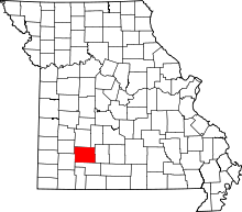 | |
| Townships |
| |
| Unincorporated communities | ||
| Former settlement | ||
| Footnotes | ‡This populated place also has portions in an adjacent county or counties | |
Municipalities and communities of Webster County, Missouri, United States | ||
|---|---|---|
| Cities |  | |
| Village | ||
| Townships |
| |
| Unincorporated communities | ||
| Ghost towns | ||
| Footnotes | ‡This populated place also has portions in an adjacent county or counties | |
