Niangua, Missouri
| Niangua, Missouri | |
|---|---|
| City | |
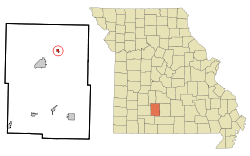 Location of Niangua, Missouri | |
| Coordinates: 37°23′20″N 92°49′52″W / 37.38889°N 92.83111°WCoordinates: 37°23′20″N 92°49′52″W / 37.38889°N 92.83111°W | |
| Country | United States |
| State | Missouri |
| County | Webster |
| Area[1] | |
| • Total | 0.41 sq mi (1.06 km2) |
| • Land | 0.41 sq mi (1.06 km2) |
| • Water | 0 sq mi (0 km2) |
| Elevation | 1,440 ft (439 m) |
| Population (2010)[2] | |
| • Total | 405 |
| • Estimate (2016)[3] | 418 |
| • Density | 990/sq mi (380/km2) |
| Time zone | UTC-6 (Central (CST)) |
| • Summer (DST) | UTC-5 (CDT) |
| ZIP code | 65713 |
| Area code(s) | 417 |
| FIPS code | 29-52418[4] |
| GNIS feature ID | 0723350[5] |
Niangua is a city in Webster County, Missouri, United States. The population was 405 at the 2010 census. Niangua is part of the Springfield, Missouri Metropolitan Statistical Area.
History
The first settlement was made at Niangua prior to the American Civil War.[6] A post office called Niangua has been in operation since 1870.[7] The community takes its name from the nearby Niangua River.[8]
Geography
Niangua is located at 37°23′20″N 92°49′52″W / 37.38889°N 92.83111°W (37.388793, -92.831077).[9] According to the United States Census Bureau, the city has a total area of 0.41 square miles (1.06 km2), all of it land.[1]
It lies three miles from Interstate 44 and five miles north of Marshfield.
Demographics
| Historical population | |||
|---|---|---|---|
| Census | Pop. | %± | |
| 1920 | 283 | — | |
| 1930 | 253 | −10.6% | |
| 1940 | 293 | 15.8% | |
| 1950 | 344 | 17.4% | |
| 1960 | 287 | −16.6% | |
| 1970 | 309 | 7.7% | |
| 1980 | 376 | 21.7% | |
| 1990 | 459 | 22.1% | |
| 2000 | 445 | −3.1% | |
| 2010 | 405 | −9.0% | |
| Est. 2016 | 418 | [3] | 3.2% |
| U.S. Decennial Census[10] | |||
2010 census
As of the census[2] of 2010, there were 405 people, 174 households, and 113 families residing in the city. The population density was 987.8 inhabitants per square mile (381.4/km2). There were 200 housing units at an average density of 487.8 per square mile (188.3/km2). The racial makeup of the city was 97.3% White, 0.5% African American, 1.5% Native American, 0.2% Asian, 0.2% from other races, and 0.2% from two or more races. Hispanic or Latino of any race were 1.7% of the population.
There were 174 households of which 27.6% had children under the age of 18 living with them, 43.1% were married couples living together, 13.2% had a female householder with no husband present, 8.6% had a male householder with no wife present, and 35.1% were non-families. 29.9% of all households were made up of individuals and 15.5% had someone living alone who was 65 years of age or older. The average household size was 2.33 and the average family size was 2.77.
The median age in the city was 41.4 years. 23.2% of residents were under the age of 18; 8.6% were between the ages of 18 and 24; 22% were from 25 to 44; 28.6% were from 45 to 64; and 17.5% were 65 years of age or older. The gender makeup of the city was 47.9% male and 52.1% female.
2000 census
As of the census[4] of 2000, there were 445 people, 179 households, and 124 families residing in the city. The population density was 1,088.6 people per square mile (419.1/km²). There were 202 housing units at an average density of 494.1 per square mile (190.2/km²). The racial makeup of the city was 96.18% White, 0.45% African American, 2.02% Native American, 0.67% from other races, and 0.67% from two or more races. Hispanic or Latino of any race were 1.35% of the population.
There were 179 households out of which 31.3% had children under the age of 18 living with them, 55.9% were married couples living together, 11.2% had a female householder with no husband present, and 30.2% were non-families. 27.9% of all households were made up of individuals and 11.7% had someone living alone who was 65 years of age or older. The average household size was 2.49 and the average family size was 3.04.
In the city the population was spread out with 26.1% under the age of 18, 8.1% from 18 to 24, 27.0% from 25 to 44, 23.6% from 45 to 64, and 15.3% who were 65 years of age or older. The median age was 38 years. For every 100 females, there were 99.6 males. For every 100 females age 18 and over, there were 103.1 males.
The median income for a household in the city was $26,000, and the median income for a family was $27,500. Males had a median income of $26,000 versus $19,792 for females. The per capita income for the city was $12,509. About 12.5% of families and 16.9% of the population were below the poverty line, including 24.3% of those under age 18 and 17.3% of those age 65 or over.
Notable people
United States Senator Roy Blunt was born in Niangua.
References
- 1 2 "US Gazetteer files 2010". United States Census Bureau. Archived from the original on 2012-01-24. Retrieved 2012-07-08.
- 1 2 "American FactFinder". United States Census Bureau. Retrieved 2012-07-08.
- 1 2 "Population and Housing Unit Estimates". Retrieved June 9, 2017.
- 1 2 "American FactFinder". United States Census Bureau. Retrieved 2008-01-31.
- ↑ "US Board on Geographic Names". United States Geological Survey. 2007-10-25. Retrieved 2008-01-31.
- ↑ "Webster County Place Names, 1928–1945". The State Historical Society of Missouri. Archived from the original on June 24, 2016. Retrieved January 2, 2017.
- ↑ "Post Offices". Jim Forte Postal History. Retrieved 1 January 2017.
- ↑ Eaton, David Wolfe (1918). How Missouri Counties, Towns and Streams Were Named. The State Historical Society of Missouri. p. 371.
- ↑ "US Gazetteer files: 2010, 2000, and 1990". United States Census Bureau. 2011-02-12. Retrieved 2011-04-23.
- ↑ "Census of Population and Housing". Census.gov. Retrieved June 4, 2015.
Municipalities and communities of Webster County, Missouri, United States | ||
|---|---|---|
| Cities | 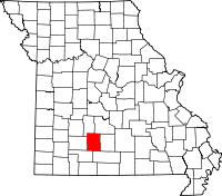 | |
| Village | ||
| Townships |
| |
| Unincorporated communities | ||
| Ghost towns | ||
| Footnotes | ‡This populated place also has portions in an adjacent county or counties | |
