Hollister, Missouri
| Hollister, Missouri | |
|---|---|
| Village | |
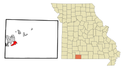 Location within Taney County and Missouri | |
| Coordinates: 36°37′25″N 93°12′58″W / 36.62361°N 93.21611°WCoordinates: 36°37′25″N 93°12′58″W / 36.62361°N 93.21611°W | |
| Country | United States |
| State | Missouri |
| County | Taney |
| Area[1] | |
| • Total | 6.84 sq mi (17.72 km2) |
| • Land | 6.68 sq mi (17.30 km2) |
| • Water | 0.16 sq mi (0.41 km2) |
| Elevation | 722 ft (220 m) |
| Population (2010)[2] | |
| • Total | 4,426 |
| • Estimate (2016)[3] | 4,486 |
| • Density | 650/sq mi (250/km2) |
| Time zone | UTC-6 (Central (CST)) |
| • Summer (DST) | UTC-5 (CDT) |
| ZIP codes | 65672-65673 |
| Area code | 417 |
| FIPS code | 29-32662[4] |
| GNIS ID | 0719716[5] |
Hollister is a city in Taney County, Missouri, United States. The population was 4,426 at the 2010 census.
History
Melinda Fortner settled in Hollister in the early 1880s, after establishing a claim on a 120-acre tract of land in 1867. Reuben Kirkham opened a general store and applied for a post office, suggesting the name Hollister after his daughter, born in Hollister, California.[6][7] A post office called Hollister has been in operation since 1904.[8]
The Downing Street Historic District was listed on the National Register of Historic Places in 1978.
Geography
Hollister is located at 36°37′25″N 93°12′58″W / 36.623678°N 93.216158°W (36.623678, -93.216158).[9]
According to the United States Census Bureau, the city has a total area of 6.84 square miles (17.72 km2), of which, 6.68 square miles (17.30 km2) is land and 0.16 square miles (0.41 km2) is water.[1]
Branson Airport is the nearest airport to Hollister.
Demographics
| Historical population | |||
|---|---|---|---|
| Census | Pop. | %± | |
| 1910 | 111 | — | |
| 1920 | 309 | 178.4% | |
| 1930 | 419 | 35.6% | |
| 1940 | 370 | −11.7% | |
| 1950 | 542 | 46.5% | |
| 1960 | 600 | 10.7% | |
| 1970 | 906 | 51.0% | |
| 1980 | 1,439 | 58.8% | |
| 1990 | 2,628 | 82.6% | |
| 2000 | 3,867 | 47.1% | |
| 2010 | 4,426 | 14.5% | |
| Est. 2016 | 4,486 | [3] | 1.4% |
| U.S. Decennial Census | |||
Hollister is part of the Branson, Missouri Micropolitan Statistical Area.
2010 census
As of the census[2] of 2010, there were 4,426 people, 1,847 households, and 1,129 families residing in the city. The population density was 662.6 inhabitants per square mile (255.8/km2). There were 2,199 housing units at an average density of 329.2 per square mile (127.1/km2). The racial makeup of the city was 92.5% White, 0.9% African American, 1.2% Native American, 0.5% Asian, 0.2% Pacific Islander, 2.8% from other races, and 1.9% from two or more races. Hispanic or Latino of any race were 6.4% of the population.
There were 1,847 households of which 30.6% had children under the age of 18 living with them, 41.3% were married couples living together, 14.4% had a female householder with no husband present, 5.5% had a male householder with no wife present, and 38.9% were non-families. 30.2% of all households were made up of individuals and 10.2% had someone living alone who was 65 years of age or older. The average household size was 2.34 and the average family size was 2.90.
The median age in the city was 36.6 years. 23.2% of residents were under the age of 18; 10.1% were between the ages of 18 and 24; 26.6% were from 25 to 44; 23.7% were from 45 to 64; and 16.3% were 65 years of age or older. The gender makeup of the city was 48.2% male and 51.8% female.
2000 census
As of the census[4] of 2000, there were 3,867 people, 1,682 households, and 1,005 families residing in the city. The population density was 1,039.0 people per square mile (401.4/km2). There were 1,931 housing units at an average density of 518.8 per square mile (200.4/km2). The racial makeup of the city was 96.53% White, 0.21% African American, 1.14% Native American, 0.16% Asian, 0.16% Pacific Islander, 0.78% from other races, and 1.03% from two or more races. Hispanic or Latino of any race were 3.08% of the population.
There were 1,682 households out of which 27.1% had children under the age of 18 living with them, 42.5% were married couples living together, 13.2% had a female householder with no husband present, and 40.2% were non-families. 31.8% of all households were made up of individuals and 9.5% had someone living alone who was 65 years of age or older. The average household size was 2.23 and the average family size was 2.79.
In the city the population was spread out with 22.6% under the age of 18, 12.5% from 18 to 24, 29.1% from 25 to 44, 19.4% from 45 to 64, and 16.3% who were 65 years of age or older. The median age was 35 years. For every 100 females, there were 88.3 males. For every 100 females age 18 and over, there were 82.4 males.
The median income for a household in the city was $24,535, and the median income for a family was $30,433. Males had a median income of $20,748 versus $18,274 for females. The per capita income for the city was $12,716. About 10.6% of families and 13.2% of the population were below the poverty line, including 17.6% of those under age 18 and 7.8% of those age 65 or over.
Notable people
- Phil Gagliano (1941-2016), professional baseball player.
- Gale Wade, professional baseball player.
References
- 1 2 "US Gazetteer files 2010". United States Census Bureau. Archived from the original on 2012-01-24. Retrieved 2012-07-08.
- 1 2 "American FactFinder". United States Census Bureau. Retrieved 2012-07-08.
- 1 2 "Population and Housing Unit Estimates". Retrieved June 9, 2017.
- 1 2 "American FactFinder". United States Census Bureau. Retrieved 2008-01-31.
- ↑ "US Board on Geographic Names". United States Geological Survey. 2007-10-25. Retrieved 2008-01-31.
- ↑ "History of Hollister". Retrieved March 17, 2017.
- ↑ "Taney County Place Names, 1928–1945". The State Historical Society of Missouri. Archived from the original on June 24, 2016. Retrieved March 17, 2017.
- ↑ "Post Offices". Jim Forte Postal History. Retrieved 27 December 2016.
- ↑ "US Gazetteer files: 2010, 2000, and 1990". United States Census Bureau. 2011-02-12. Retrieved 2011-04-23.
External links
Municipalities and communities of Taney County, Missouri, United States | ||
|---|---|---|
| Cities | 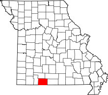 | |
| Villages | ||
| Townships | ||
| CDP | ||
| Other unincorporated communities | ||
| Ghost towns | ||
| Footnotes | ‡This populated place also has portions in an adjacent county or counties | |