Chestnutridge, Missouri
Chestnutridge is an unincorporated community in southwestern Christian County, Missouri (USA)[1] and is located about fourteen miles south of Ozark and about 3.5 miles southeast of Spokane. The community is located on Chestnut Ridge at an elevation of 1325 feet.[1] It is on Missouri Route BB just east of Missouri Route 176 and about two miles west of U.S. Route 65.[2]
Chesnutridge is part of the Springfield, Missouri Metropolitan Statistical Area.
A post office called Chestnutridge has been in operation since 1902.[3] The community takes its name from a nearby ridge of the same name where chestnut trees were abundant.[4]
References
- 1 2 GNIS
- ↑ Missouri Atlas & Gazetteer, DeLorme, 1998, First edition, p. 62, ISBN 0-89933-224-2
- ↑ "Post Offices". Jim Forte Postal History. Archived from the original on 6 March 2016. Retrieved 18 September 2016.
- ↑ "Christian County Place Names, 1928–1945 (archived)". The State Historical Society of Missouri. Archived from the original on 24 June 2016. Retrieved 19 September 2016.
Coordinates: 36°50′12″N 93°15′07″W / 36.83667°N 93.25194°W
Municipalities and communities of Christian County, Missouri, United States | ||
|---|---|---|
| Cities | 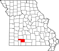 | |
| Village | ||
| Townships |
| |
| CDP | ||
| Unincorporated communities | ||
| Ghost towns | ||
| Footnotes | ‡This populated place also has portions in an adjacent county or counties | |

This article is issued from
Wikipedia.
The text is licensed under Creative Commons - Attribution - Sharealike.
Additional terms may apply for the media files.