Seymour, Missouri
| Seymour, Missouri | |
|---|---|
| City | |
 Seymour Square, looking South, 2006 | |
 Location of Seymour in Webster County and Missouri | |
| Coordinates: 37°08′47″N 92°46′08″W / 37.14639°N 92.76889°WCoordinates: 37°08′47″N 92°46′08″W / 37.14639°N 92.76889°W[1] | |
| Country | United States |
| State | Missouri |
| County | Webster |
| Area[2] | |
| • Total | 2.76 sq mi (7.15 km2) |
| • Land | 2.76 sq mi (7.15 km2) |
| • Water | 0 sq mi (0 km2) |
| Elevation[1] | 1,644 ft (501 m) |
| Population (2010)[3] | |
| • Total | 1,921 |
| • Estimate (2016)[4] | 1,987 |
| • Density | 700/sq mi (270/km2) |
| Time zone | UTC-6 (Central (CST)) |
| • Summer (DST) | UTC-5 (CST) |
| Website | Official website |
Seymour is a city in southeastern Webster County, Missouri, United States. The population was 1,921 at the 2010 census. It is part of the Springfield, Missouri Metropolitan Statistical Area.
History
.jpg)
Seymour was laid out in 1882.[5] The community's name is a transfer from Seymour, Indiana.[6] A post office called Seymour has been in operation since 1881.[7]
The Col. Thomas C. Love House was listed on the National Register of Historic Places in 1985.[8]
Geography
Seymour is located on the southeastern edge of the Springfield Plateau in the Ozark Mountains. Streams to the east flow into the Gasconade River, the headwaters of the James River lie to the north and Finley Creek drains the south side of the town. U.S. Route 60 passes the north side of the town and Missouri routes K, C and BB serve the town. The community of Diggins is 4.5 miles to the west and Mansfield is ten miles to the east along route 60. The Burlington Northern Santa Fe railroad's single-tracked Springfield-Memphis line runs through the town just north of the town square. [9]
According to the United States Census Bureau, the city has a total area of 2.76 square miles (7.15 km2), all of it land.[2]
Demographics
| Historical population | |||
|---|---|---|---|
| Census | Pop. | %± | |
| 1890 | 388 | — | |
| 1900 | 527 | 35.8% | |
| 1910 | 590 | 12.0% | |
| 1920 | 751 | 27.3% | |
| 1930 | 681 | −9.3% | |
| 1940 | 751 | 10.3% | |
| 1950 | 1,015 | 35.2% | |
| 1960 | 1,046 | 3.1% | |
| 1970 | 1,208 | 15.5% | |
| 1980 | 1,535 | 27.1% | |
| 1990 | 1,636 | 6.6% | |
| 2000 | 1,834 | 12.1% | |
| 2010 | 1,921 | 4.7% | |
| Est. 2016 | 1,987 | [4] | 3.4% |
| U.S. Decennial Census[10] | |||
2010 census
As of the census[3] of 2010, there were 1,921 people, 746 households, and 510 families residing in the city. The population density was 696.0 inhabitants per square mile (268.7/km2). There were 846 housing units at an average density of 306.5 per square mile (118.3/km2). The racial makeup of the city was 95.5% White, 0.3% African American, 1.0% Native American, 0.3% Asian, 0.1% Pacific Islander, 0.7% from other races, and 2.1% from two or more races. Hispanic or Latino of any race were 2.8% of the population.
There were 746 households of which 36.5% had children under the age of 18 living with them, 46.9% were married couples living together, 15.1% had a female householder with no husband present, 6.3% had a male householder with no wife present, and 31.6% were non-families. 28.2% of all households were made up of individuals and 15.2% had someone living alone who was 65 years of age or older. The average household size was 2.52 and the average family size was 3.05.
The median age in the city was 39.2 years. 26.7% of residents were under the age of 18; 8.8% were between the ages of 18 and 24; 20.9% were from 25 to 44; 25.4% were from 45 to 64; and 18.1% were 65 years of age or older. The gender makeup of the city was 48.0% male and 52.0% female.
2000 census
As of the census[11] of 2000, there were 1,834 people, 711 households, and 479 families residing in the city. The population density was 699.3 people per square mile (270.3/km²). There were 792 housing units at an average density of 302.0 per square mile (116.7/km²). The racial makeup of the city was 96.29% White, 0.05% African American, 0.55% Native American, 0.38% Asian, 0.71% from other races, and 2.02% from two or more races. Hispanic or Latino of any race were 1.80% of the population.
There were 711 households out of which 35.2% had children under the age of 18 living with them, 50.4% were married couples living together, 13.1% had a female householder with no husband present, and 32.5% were non-families. 29.4% of all households were made up of individuals and 18.6% had someone living alone who was 65 years of age or older. The average household size was 2.50 and the average family size was 3.08.
In the city the population was spread out with 28.5% under the age of 18, 8.1% from 18 to 24, 26.6% from 25 to 44, 19.2% from 45 to 64, and 17.7% who were 65 years of age or older. The median age was 36 years. For every 100 females, there were 89.5 males. For every 100 females age 18 and over, there were 83.5 males.
The median income for a household in the city was $25,093, and the median income for a family was $30,048. Males had a median income of $23,938 versus $18,481 for females. The per capita income for the city was $12,486. About 13.7% of families and 18.1% of the population were below the poverty line, including 20.3% of those under age 18 and 32.1% of those age 65 or over.
Amish community
Outside of Seymour is a large Old Order Amish Community. This community of Swiss Amish was founded in 1968 and consists of 13 church districts in 2014 and a total Amish population of about 2,250 people.[12][13]
Economy
Seymour has two grocery stores, three gas stations, two banks, a YMCA, one high school, one elementary school and one middle school and a modern public library. Seymour has an active Lions Club, an Arts Council and a Masonic Lodge. Seymour has a weekly newspaper whose office is located on the west side of the town square.
The Seymour Merchants Association holds an annual Apple Festival the second weekend of every September.
Government
The City of Seymour has an alderman/administrator government structure. The current mayor of Seymour is Richard Vinson. The current City Administrator is Sam Burt. The chief of Police position is currently open.[14]
References
- 1 2 U.S. Geological Survey Geographic Names Information System: Seymour, Missouri
- 1 2 "US Gazetteer files 2010". United States Census Bureau. Archived from the original on 2012-01-24. Retrieved 2012-07-08.
- 1 2 "American FactFinder". United States Census Bureau. Retrieved 2012-07-08.
- 1 2 "Population and Housing Unit Estimates". Retrieved June 9, 2017.
- ↑ Eaton, David Wolfe (1918). How Missouri Counties, Towns and Streams Were Named. The State Historical Society of Missouri. p. 371.
- ↑ "Webster County Place Names, 1928–1945". The State Historical Society of Missouri. Archived from the original on June 24, 2016. Retrieved January 2, 2017.
- ↑ "Post Offices". Jim Forte Postal History. Retrieved 1 January 2017.
- ↑ "MISSOURI - Webster County". nationalregisterofhistoricplaces.com. Retrieved 3 January 2017.
- ↑ Missouri Atlas & Gazetteer, DeLorme, 1998, First edition, p. 53, ISBN 0-89933-224-2
- ↑ "Census of Population and Housing". Census.gov. Retrieved June 4, 2015.
- ↑ "American FactFinder". United States Census Bureau. Retrieved 2008-01-31.
- ↑ "Archived copy" (PDF). Archived from the original (PDF) on 2016-04-20. Retrieved 2016-04-07. Joseph F. Donnermeyer and Corey Anderon: The Amish Population: County Estimates and Settlement Patterns, page 95.
- ↑ Joseph F. Donnermeyer and Davis Luthy: Amish Settlements across America: 2013, page 116.
- ↑ "City Government." Seymour, Missouri. Seymour, Missouri, n.d. Web. 2 July 2017. <http://www.seymourmissouri.org/web/government.htm>.
External links
- City of Seymour
- Webster County Citizen
- Historic maps of Seymour in the Sanborn Maps of Missouri Collection at the University of Missouri
Municipalities and communities of Webster County, Missouri, United States | ||
|---|---|---|
| Cities | 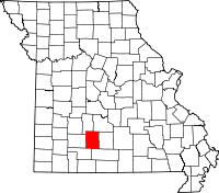 | |
| Village | ||
| Townships |
| |
| Unincorporated communities | ||
| Ghost towns | ||
| Footnotes | ‡This populated place also has portions in an adjacent county or counties | |
