Blue Eye, Missouri
| Blue Eye, Missouri | |
|---|---|
| Village | |
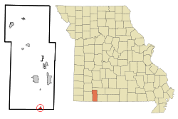 Location of Blue Eye, Missouri | |
| Coordinates: 36°30′03″N 93°23′46″W / 36.50083°N 93.39611°WCoordinates: 36°30′03″N 93°23′46″W / 36.50083°N 93.39611°W | |
| Country | United States |
| State | Missouri |
| County | Stone |
| Area[1] | |
| • Total | 1.17 sq mi (3.03 km2) |
| • Land | 1.17 sq mi (3.03 km2) |
| • Water | 0 sq mi (0 km2) |
| Elevation[2] | 1,286 ft (392 m) |
| Population (2010)[3] | |
| • Total | 167 |
| • Estimate (2016)[4] | 160 |
| • Density | 140/sq mi (55/km2) |
| Time zone | UTC-6 (Central (CST)) |
| • Summer (DST) | UTC-5 (CDT) |
| ZIP code | 65611 |
| Area code(s) | 417 |
| FIPS code | 29-06526[5] |
| GNIS feature ID | 0714403[2] |
Blue Eye is a village in Stone County, Missouri, United States. The population was 167 at the 2010 census. It is part of the Branson, Missouri Micropolitan Statistical Area. Blue Eye, Missouri is adjacent to Blue Eye, Arkansas.
History
The first permanent settlement at Blue Eye was made in the 1860s.[6] According to tradition, Blue Eye was so named from the noted blue eye color of an early postmaster.[7]
Geography
Blue Eye is located south of Table Rock Lake and just north of the Missouri-Arkansas border. Blue Eye is at the end of Missouri Route 13 as the road continues into Arkansas as Arkansas Route 21.[8]
According to the United States Census Bureau, the village has a total area of 1.17 square miles (3.03 km2), all of it land.[1]
Demographics
| Historical population | |||
|---|---|---|---|
| Census | Pop. | %± | |
| 1960 | 74 | — | |
| 1970 | 91 | 23.0% | |
| 1980 | 94 | 3.3% | |
| 1990 | 112 | 19.1% | |
| 2000 | 129 | 15.2% | |
| 2010 | 167 | 29.5% | |
| Est. 2016 | 160 | [4] | −4.2% |
| U.S. Decennial Census[9] | |||
2010 census
As of the census[3] of 2010, there were 167 people, 75 households, and 48 families residing in the village. The population density was 142.7 inhabitants per square mile (55.1/km2). There were 205 housing units at an average density of 175.2 per square mile (67.6/km2). The racial makeup of the village was 97.0% White, 0.6% Native American, and 2.4% from two or more races. Hispanic or Latino of any race were 1.8% of the population.
There were 75 households of which 20.0% had children under the age of 18 living with them, 50.7% were married couples living together, 10.7% had a female householder with no husband present, 2.7% had a male householder with no wife present, and 36.0% were non-families. 32.0% of all households were made up of individuals and 12% had someone living alone who was 65 years of age or older. The average household size was 2.23 and the average family size was 2.77.
The median age in the village was 44.3 years. 19.8% of residents were under the age of 18; 9% were between the ages of 18 and 24; 22.2% were from 25 to 44; 27.6% were from 45 to 64; and 21.6% were 65 years of age or older. The gender makeup of the village was 46.7% male and 53.3% female.
2000 census
As of the census[5] of 2000, there were 129 people, 49 households, and 38 families residing in the town. The population density was 240.5 people per square mile (92.2/km²). There were 57 housing units at an average density of 106.3 per square mile (40.8/km²). The racial makeup of the town was 99.22% White, and 0.78% Native American.
There were 49 households out of which 36.7% had children under the age of 18 living with them, 63.3% were married couples living together, 12.2% had a female householder with no husband present, and 22.4% were non-families. 18.4% of all households were made up of individuals and 10.2% had someone living alone who was 65 years of age or older. The average household size was 2.63 and the average family size was 3.03.
In the town the population was spread out with 27.1% under the age of 18, 5.4% from 18 to 24, 31.0% from 25 to 44, 24.8% from 45 to 64, and 11.6% who were 65 years of age or older. The median age was 37 years. For every 100 females there were 67.5 males. For every 100 females age 18 and over, there were 91.8 males.
The median income for a household in the town was $35,313, and the median income for a family was $36,875. Males had a median income of $23,438 versus $16,250 for females. The per capita income for the town was $14,183. There were 15.6% of families and 23.9% of the population living below the poverty line, including 50.0% of under 18 and none of those over 64.
Education
Blue Eye R-V School District operates one elementary school, one middle school and Blue Eye High School.[10]
Blue Eye has a public library, a branch of the Stone County Library.[11]
References
- 1 2 "US Gazetteer files 2010". United States Census Bureau. Archived from the original on 2012-01-24. Retrieved 2012-07-08.
- 1 2 U.S. Geological Survey Geographic Names Information System: Blue Eye, Missouri
- 1 2 "American FactFinder". United States Census Bureau. Retrieved 2012-07-08.
- 1 2 "Population and Housing Unit Estimates". Retrieved June 9, 2017.
- 1 2 "American FactFinder". United States Census Bureau. Archived from the original on 2013-09-11. Retrieved 2008-01-31.
- ↑ Quimby, Myron J. (1969). Scratch Ankle, U.S.A.: American place names and their derivation. A. S. Barnes. p. 54.
Settled in the 1860's...
- ↑ Moyer, Armond; Moyer, Winifred (1958). The origins of unusual place-names. Keystone Pub. Associates. p. 15.
- ↑ Missouri Atlas & Gazetteer, DeLorme, 1998, First edition, p. 61, ISBN 0-89933-224-2
- ↑ "Census of Population and Housing". Census.gov. Archived from the original on May 12, 2015. Retrieved June 4, 2015.
- ↑ "Blue Eye R-V". www.blueeye.k12.mo.us. Retrieved 2018-08-11.
- ↑ "Locations". Stone County Library. Retrieved 25 March 2018.
External links
Municipalities and communities of Stone County, Missouri, United States | ||
|---|---|---|
| Cities | 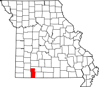 | |
| Villages | ||
| CDP | ||
| Unincorporated communities | ||
| Ghost town | ||
| Footnotes | ‡This populated place also has portions in an adjacent county or counties | |