Foyil, Oklahoma
| Foyil, Oklahoma | |
|---|---|
| Town | |
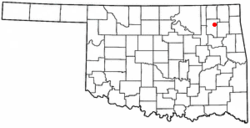 Location of Foyil, Oklahoma | |
| Coordinates: 36°26′2″N 95°31′15″W / 36.43389°N 95.52083°WCoordinates: 36°26′2″N 95°31′15″W / 36.43389°N 95.52083°W | |
| Country | United States |
| State | Oklahoma |
| County | Rogers |
| Government | |
| • Type | Town |
| Area | |
| • Total | 0.4 sq mi (0.9 km2) |
| • Land | 0.4 sq mi (0.9 km2) |
| • Water | 0.0 sq mi (0.0 km2) |
| Elevation | 761 ft (232 m) |
| Population (2000) | |
| • Total | 234 |
| • Density | 657.2/sq mi (253.7/km2) |
| Time zone | UTC-6 (Central (CST)) |
| • Summer (DST) | UTC-5 (CDT) |
| ZIP code | 74031 |
| Area code(s) | 539/918 |
| FIPS code | 40-27600[1] |
| GNIS feature ID | 1100428[2] |
Foyil is a town in Rogers County, Oklahoma, United States. It was named for Alfred Foyil, a local landowner and the first postmaster of the town.[3] The population was 344 at the 2010 census, a 47.0 percent increase from 234 at the 2000 census.[4]
Geography
Foyil is located at 36°26′2″N 95°31′15″W / 36.43389°N 95.52083°W (36.433792, -95.520707).[5] The town is 10 miles (16 km) northeast of Claremore and 9 miles (14 km) southwest of Chelsea. According to the United States Census Bureau, the town has a total area of 0.4 square miles (1.0 km2), all of it land.
Demographics
| Historical population | |||
|---|---|---|---|
| Census | Pop. | %± | |
| 1920 | 109 | — | |
| 1930 | 184 | 68.8% | |
| 1940 | 170 | −7.6% | |
| 1950 | 146 | −14.1% | |
| 1960 | 127 | −13.0% | |
| 1970 | 164 | 29.1% | |
| 1980 | 191 | 16.5% | |
| 1990 | 86 | −55.0% | |
| 2000 | 234 | 172.1% | |
| 2010 | 344 | 47.0% | |
| Est. 2015 | 343 | [6] | −0.3% |
| U.S. Decennial Census[7] | |||
As of the census[1] of 2000, there were 234 people, 97 households, and 68 families residing in the town. The population density was 657.2 people per square mile (251.0/km²). There were 112 housing units at an average density of 314.6 per square mile (120.1/km²). The racial makeup of the town was 79.06% White, 9.40% Native American, 1.71% from other races, and 9.83% from two or more races. Hispanic or Latino of any race were 2.56% of the population.
There were 97 households out of which 23.7% had children under the age of 18 living with them, 57.7% were married couples living together, 11.3% had a female householder with no husband present, and 28.9% were non-families. 23.7% of all households were made up of individuals and 12.4% had someone living alone who was 65 years of age or older. The average household size was 2.41 and the average family size was 2.83.
In the town, the population was spread out with 21.8% under the age of 18, 6.8% from 18 to 24, 22.6% from 25 to 44, 33.3% from 45 to 64, and 15.4% who were 65 years of age or older. The median age was 44 years. For every 100 females, there were 95.0 males. For every 100 females age 18 and over, there were 88.7 males.
The median income for a household in the town was $23,125, and the median income for a family was $28,500. Males had a median income of $27,083 versus $24,107 for females. The per capita income for the town was $11,260. About 31.9% of families and 33.7% of the population were below the poverty line, including 37.7% of those under the age of eighteen and 15.6% of those sixty five or over.
References
- 1 2 "American FactFinder". United States Census Bureau. Archived from the original on 2013-09-11. Retrieved 2008-01-31.
- ↑ "US Board on Geographic Names". United States Geological Survey. 2007-10-25. Retrieved 2008-01-31.
- ↑ Larry O'Dell, "Foyil," Encyclopedia of Oklahoma History and Culture. Accessed April 26, 2015.
- ↑ MuniNetGuide:Foyil, Oklahoma Archived 2012-10-07 at the Wayback Machine.
- ↑ "US Gazetteer files: 2010, 2000, and 1990". United States Census Bureau. 2011-02-12. Retrieved 2011-04-23.
- ↑ "Annual Estimates of the Resident Population for Incorporated Places: April 1, 2010 to July 1, 2015". Archived from the original on July 14, 2016. Retrieved July 2, 2016.
- ↑ "Census of Population and Housing". Census.gov. Archived from the original on May 12, 2015. Retrieved June 4, 2015.
External links
Municipalities and communities of Rogers County, Oklahoma, United States | ||
|---|---|---|
| Cities | 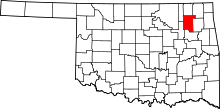 | |
| Towns | ||
| CDPs | ||
| Other unincorporated communities |
| |
| Footnotes | ‡This populated place also has portions in an adjacent county or counties | |