Paget Glacier
| Paget Glacier | |
|---|---|
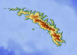 Location of Paget Glacier in South Georgia | |
| Location | South Georgia |
| Coordinates | 54°24′S 36°28′W / 54.400°S 36.467°W / -54.400; -36.467 |
| Length | 4 nmi (7 km; 5 mi) |
| Width | 1 nmi (2 km; 1 mi) |
| Thickness | unknown |
| Terminus | Nordenskjöld Glacier |
| Status | unknown |
Paget Glacier (54°24′S 36°28′W / 54.400°S 36.467°W / -54.400; -36.467Coordinates: 54°24′S 36°28′W / 54.400°S 36.467°W / -54.400; -36.467) is a glacier in South Georgia, 4 miles (6 km) long and 1 mile (1.6 km) wide, which flows northeast from the north slopes of Mount Paget into the west side of Nordenskjold Glacier. The glacier was roughly surveyed in 1928–29 by a German expedition under Kohl-Larsen, and resurveyed in 1951–52 by the SGS. The name, which is derived from nearby Mount Paget, was given by the SGS in 1951–52.[1]
See also
References
- ↑ "Paget Glacier, Antarctica". Geographical Names. Retrieved 23 January 2018.
![]()
This article is issued from
Wikipedia.
The text is licensed under Creative Commons - Attribution - Sharealike.
Additional terms may apply for the media files.