Keilhau Glacier
| Keilhau Glacier | |
|---|---|
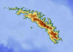 Location of Keilhau Glacier in South Georgia | |
| Location | South Georgia |
| Coordinates | 54°16′S 37°4′W / 54.267°S 37.067°W / -54.267; -37.067 |
| Length | 5 nmi (9 km; 6 mi) |
| Thickness | unknown |
| Terminus | Jossac Bight |
| Status | unknown |
Keilhau Glacier (54°16′S 37°4′W / 54.267°S 37.067°W / -54.267; -37.067Coordinates: 54°16′S 37°4′W / 54.267°S 37.067°W / -54.267; -37.067) is a glacier 5 nautical miles (9 km) long flowing west from Kohl Plateau and then southwest to Jossac Bight, on the south coast of South Georgia. It was mapped by Olaf Holtedahl during his visit to South Georgia in 1927–28, and named by him for Baltazar M. Keilhau, a Norwegian geologist and professor of mineralogy at the University of Christiania.[1][2]
See also
References
- ↑ "Keilhau Glacier". Geographic Names Information System. United States Geological Survey. Retrieved 2013-04-16.
- ↑ "Keilhau Glacier, Antarctica". Geographical Names. Retrieved 22 January 2018.
![]()
This article is issued from
Wikipedia.
The text is licensed under Creative Commons - Attribution - Sharealike.
Additional terms may apply for the media files.