Ross Glacier
Not to be confused with Ross Ice Shelf in Antarctica
| Ross Glacier | |
|---|---|
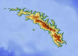 Location of Ross Glacier in South Georgia | |
| Location | South Georgia |
| Coordinates | 54°33′S 36°6′W / 54.550°S 36.100°W / -54.550; -36.100 |
| Length | 6 nmi (11 km; 7 mi) |
| Thickness | unknown |
| Terminus | Royal Bay |
| Status | unknown |
Ross Glacier (54°33′S 36°6′W / 54.550°S 36.100°W / -54.550; -36.100Coordinates: 54°33′S 36°6′W / 54.550°S 36.100°W / -54.550; -36.100) is a glacier 6 miles (10 km) long, flowing east from the juncture of Allardyce and Salvesen Ranges to Little Moltke Harbour, Royal Bay, on the north coast of South Georgia.[1] First mapped by the German group of the International Polar Year Investigations, 1882–83, and named for Sir James Clark Ross.[2]
See also
References
- ↑ Bicheno, Hugh (2006) Razor's Edge: The Unofficial History of the Falklands War. London. Weidenfeld & Nicolson. ISBN 978-0-7538-2186-2
- ↑ "Ross Glacier, Antarctica". Geographical Names. Retrieved 23 January 2018.
![]()
This article is issued from
Wikipedia.
The text is licensed under Creative Commons - Attribution - Sharealike.
Additional terms may apply for the media files.