Crean Glacier
| Crean Glacier | |
|---|---|
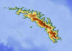 Location of Crean Glacier in South Georgia | |
| Location | South Georgia |
| Coordinates | 54°8′S 37°1′W / 54.133°S 37.017°W / -54.133; -37.017 |
| Length | 4 nmi (7 km; 5 mi) |
| Thickness | unknown |
| Terminus | Antarctic Bay |
| Status | unknown |
Crean Glacier (54°8′S 37°1′W / 54.133°S 37.017°W / -54.133; -37.017Coordinates: 54°8′S 37°1′W / 54.133°S 37.017°W / -54.133; -37.017) is a glacier 4 miles (6.4 km) long, flowing northwest from Wilckens Peaks to the head of Antarctic Bay on the north coast of South Georgia. It was surveyed by the South Georgia Survey in the period 1951–57 and named by the UK Antarctic Place-Names Committee for Irishman Tom Crean, Second Officer of the Endurance during the British expedition under Ernest Shackleton, 1914–16. Crean accompanied Shackleton and Frank Worsley in the James Caird from Elephant Island to King Haakon Bay, South Georgia, and made the overland crossing with them to Stromness; this glacier lies on the route.[1]
See also
References
- ↑ "Crean Glacier, Antarctica". Geographical Names. Retrieved 21 January 2018.

This article is issued from
Wikipedia.
The text is licensed under Creative Commons - Attribution - Sharealike.
Additional terms may apply for the media files.