Novosilski Glacier
| Novosilski Glacier | |
|---|---|
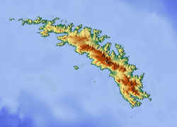 Location of Novosilski Glacier in South Georgia | |
| Location | South Georgia |
| Coordinates | 54°40′S 36°18′W / 54.667°S 36.300°W / -54.667; -36.300 |
| Length | 8 nmi (15 km; 9 mi) |
| Width | 2 nmi (4 km; 2 mi) |
| Thickness | unknown |
| Terminus | Novosilski Bay |
| Status | unknown |
Novosilski Glacier (54°40′S 36°18′W / 54.667°S 36.300°W / -54.667; -36.300Coordinates: 54°40′S 36°18′W / 54.667°S 36.300°W / -54.667; -36.300) is a glacier, 8 miles (13 km) long and 2 miles (3.2 km) wide, flowing in a westerly direction from the southwest slopes of the Salvesen Range to Novosilski Bay on the south coast of South Georgia. First surveyed and named by a German expedition 1928-29, under Kohl-Larsen. The name derives from nearby Novosilski Bay.[1]
See also
References
- ↑ "Novosilski Glacier, Antarctica". Geographical Names. Retrieved 22 January 2018.
![]()
This article is issued from
Wikipedia.
The text is licensed under Creative Commons - Attribution - Sharealike.
Additional terms may apply for the media files.