Montfaucon, Gard
| Montfaucon | ||
|---|---|---|
| Commune | ||
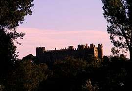 The Chateau of Montfaucon | ||
| ||
 Montfaucon Location within Occitanie region  Montfaucon | ||
| Coordinates: 44°04′31″N 4°45′19″E / 44.0753°N 4.7553°ECoordinates: 44°04′31″N 4°45′19″E / 44.0753°N 4.7553°E | ||
| Country | France | |
| Region | Occitanie | |
| Department | Gard | |
| Arrondissement | Nîmes | |
| Canton | Roquemaure | |
| Intercommunality | CA Gard Rhodanien | |
| Government | ||
| • Mayor (2008–2014) | Joël Manzanère | |
| Area1 | 4.24 km2 (1.64 sq mi) | |
| Population (2008)2 | 1,364 | |
| • Density | 320/km2 (830/sq mi) | |
| Time zone | UTC+1 (CET) | |
| • Summer (DST) | UTC+2 (CEST) | |
| INSEE/Postal code | 30178 /30150 | |
| Elevation | 23–68 m (75–223 ft) | |
|
1 French Land Register data, which excludes lakes, ponds, glaciers > 1 km2 (0.386 sq mi or 247 acres) and river estuaries. 2 Population without double counting: residents of multiple communes (e.g., students and military personnel) only counted once. | ||
.svg.png)
Montfaucon is a commune in the Gard department in southern France. The town lies on the right bank of the Rhône.
Population
| Historical population | ||
|---|---|---|
| Year | Pop. | ±% |
| 1962 | 590 | — |
| 1968 | 658 | +11.5% |
| 1975 | 1,058 | +60.8% |
| 1982 | 1,153 | +9.0% |
| 1990 | 1,266 | +9.8% |
| 1999 | 1,329 | +5.0% |
| 2008 | 1,364 | +2.6% |
See also
References
| Wikimedia Commons has media related to Montfaucon (Gard). |
This article is issued from
Wikipedia.
The text is licensed under Creative Commons - Attribution - Sharealike.
Additional terms may apply for the media files.