Lirac
| Lirac | ||
|---|---|---|
| Commune | ||
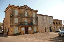 Town hall | ||
| ||
 Lirac Location within Occitanie region  Lirac | ||
| Coordinates: 44°02′12″N 4°41′27″E / 44.0367°N 4.6908°ECoordinates: 44°02′12″N 4°41′27″E / 44.0367°N 4.6908°E | ||
| Country | France | |
| Region | Occitanie | |
| Department | Gard | |
| Arrondissement | Nîmes | |
| Canton | Roquemaure | |
| Government | ||
| • Mayor (2008–2014) | Jean-Louis Potherat | |
| Area1 | 9.76 km2 (3.77 sq mi) | |
| Population (2008)2 | 838 | |
| • Density | 86/km2 (220/sq mi) | |
| Time zone | UTC+1 (CET) | |
| • Summer (DST) | UTC+2 (CEST) | |
| INSEE/Postal code | 30149 /30126 | |
| Elevation |
88–266 m (289–873 ft) (avg. 83 m or 272 ft) | |
|
1 French Land Register data, which excludes lakes, ponds, glaciers > 1 km2 (0.386 sq mi or 247 acres) and river estuaries. 2 Population without double counting: residents of multiple communes (e.g., students and military personnel) only counted once. | ||
.svg.png)
Lirac is a commune in the Gard department in southern France.
Population
| Year | 1962 | 1968 | 1975 | 1982 | 1990 | 1999 | 2008 |
|---|---|---|---|---|---|---|---|
| Population | 272 | 317 | 329 | 442 | 631 | 737 | 838 |
See also
References
External links
| Wikimedia Commons has media related to Lirac. |
- Commune website (in French)
This article is issued from
Wikipedia.
The text is licensed under Creative Commons - Attribution - Sharealike.
Additional terms may apply for the media files.