Manduel
| Manduel | ||
|---|---|---|
| Commune | ||
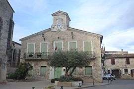 The town hall in Manduel | ||
| ||
 Manduel Location within Occitanie region  Manduel | ||
| Coordinates: 43°49′10″N 4°28′27″E / 43.8194°N 4.4742°ECoordinates: 43°49′10″N 4°28′27″E / 43.8194°N 4.4742°E | ||
| Country | France | |
| Region | Occitanie | |
| Department | Gard | |
| Arrondissement | Nîmes | |
| Canton | Marguerittes | |
| Intercommunality | CA Nîmes Métropole | |
| Government | ||
| • Mayor (2008–2014) | Marie-Louise Sabatier | |
| Area1 | 26.46 km2 (10.22 sq mi) | |
| Population (2008)2 | 5,721 | |
| • Density | 220/km2 (560/sq mi) | |
| Time zone | UTC+1 (CET) | |
| • Summer (DST) | UTC+2 (CEST) | |
| INSEE/Postal code | 30155 /30129 | |
| Elevation |
50–77 m (164–253 ft) (avg. 62 m or 203 ft) | |
| Website | www.manduel.fr | |
|
1 French Land Register data, which excludes lakes, ponds, glaciers > 1 km2 (0.386 sq mi or 247 acres) and river estuaries. 2 Population without double counting: residents of multiple communes (e.g., students and military personnel) only counted once. | ||

Manduel (Occitan: Manduelh) is a commune in the Gard department in southern France.
Population
| Historical population | ||
|---|---|---|
| Year | Pop. | ±% |
| 1938 | 1,953 | — |
| 1942 | 986 | −49.5% |
| 1946 | 1,328 | +34.7% |
| 1956 | 1,453 | +9.4% |
| 1968 | 1,649 | +13.5% |
| 1975 | 2,389 | +44.9% |
| 1982 | 3,554 | +48.8% |
| 1990 | 5,579 | +57.0% |
| 1999 | 5,748 | +3.0% |
| 2008 | 5,721 | −0.5% |
| 2012 | 5,773 | +0.9% |
See also
References
External links
| Wikimedia Commons has media related to Manduel. |
| Authority control |
|---|
This article is issued from
Wikipedia.
The text is licensed under Creative Commons - Attribution - Sharealike.
Additional terms may apply for the media files.