Saint-Victor-de-Malcap
| Saint-Victor-de-Malcap | ||
|---|---|---|
| Commune | ||
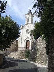 The church in Saint-Victor-de-Malcap | ||
| ||
 Saint-Victor-de-Malcap Location within Occitanie region  Saint-Victor-de-Malcap | ||
| Coordinates: 44°14′53″N 4°13′19″E / 44.2481°N 4.2219°ECoordinates: 44°14′53″N 4°13′19″E / 44.2481°N 4.2219°E | ||
| Country | France | |
| Region | Occitanie | |
| Department | Gard | |
| Arrondissement | Alès | |
| Canton | Rousson | |
| Intercommunality | Pays de Cèze | |
| Government | ||
| • Mayor (2008–2014) | Serge Dondini | |
| Area1 | 10.87 km2 (4.20 sq mi) | |
| Population (2008)2 | 659 | |
| • Density | 61/km2 (160/sq mi) | |
| Time zone | UTC+1 (CET) | |
| • Summer (DST) | UTC+2 (CEST) | |
| INSEE/Postal code | 30303 /30500 | |
| Elevation | 117–231 m (384–758 ft) | |
|
1 French Land Register data, which excludes lakes, ponds, glaciers > 1 km2 (0.386 sq mi or 247 acres) and river estuaries. 2 Population without double counting: residents of multiple communes (e.g., students and military personnel) only counted once. | ||
.svg.png)
Saint-Victor-de-Malcap is a commune in the Gard department in southern France.
Population
| Historical population | ||
|---|---|---|
| Year | Pop. | ±% |
| 1793 | 440 | — |
| 1821 | 456 | +3.6% |
| 1846 | 823 | +80.5% |
| 1872 | 805 | −2.2% |
| 1901 | 626 | −22.2% |
| 1926 | 536 | −14.4% |
| 1946 | 457 | −14.7% |
| 1962 | 485 | +6.1% |
| 1968 | 412 | −15.1% |
| 1975 | 412 | +0.0% |
| 1982 | 505 | +22.6% |
| 1990 | 506 | +0.2% |
| 1999 | 538 | +6.3% |
| 2008 | 659 | +22.5% |
See also
References
| Wikimedia Commons has media related to Saint-Victor-de-Malcap. |
This article is issued from
Wikipedia.
The text is licensed under Creative Commons - Attribution - Sharealike.
Additional terms may apply for the media files.