Saint-Laurent-le-Minier
| Saint-Laurent-le-Minier | ||
|---|---|---|
| Commune | ||
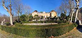 Chateau | ||
| ||
 Saint-Laurent-le-Minier Location within Occitanie region  Saint-Laurent-le-Minier | ||
| Coordinates: 43°55′59″N 3°39′18″E / 43.9331°N 3.655°ECoordinates: 43°55′59″N 3°39′18″E / 43.9331°N 3.655°E | ||
| Country | France | |
| Region | Occitanie | |
| Department | Gard | |
| Arrondissement | Le Vigan | |
| Canton | Le Vigan | |
| Intercommunality | Pays Viganais | |
| Government | ||
| • Mayor (2008–2014) | André Rouanet | |
| Area1 | 13.26 km2 (5.12 sq mi) | |
| Population (2008)2 | 364 | |
| • Density | 27/km2 (71/sq mi) | |
| Time zone | UTC+1 (CET) | |
| • Summer (DST) | UTC+2 (CEST) | |
| INSEE/Postal code | 30280 /30440 | |
| Elevation |
154–849 m (505–2,785 ft) (avg. 170 m or 560 ft) | |
|
1 French Land Register data, which excludes lakes, ponds, glaciers > 1 km2 (0.386 sq mi or 247 acres) and river estuaries. 2 Population without double counting: residents of multiple communes (e.g., students and military personnel) only counted once. | ||
.svg.png)
Saint-Laurent-le-Minier is a commune in the Gard department in southern France.
Population
| Historical population | ||
|---|---|---|
| Year | Pop. | ±% |
| 1962 | 603 | — |
| 1968 | 610 | +1.2% |
| 1975 | 448 | −26.6% |
| 1982 | 384 | −14.3% |
| 1990 | 340 | −11.5% |
| 1999 | 362 | +6.5% |
| 2008 | 364 | +0.6% |
See also
References
| Wikimedia Commons has media related to Saint-Laurent-le-Minier. |
This article is issued from
Wikipedia.
The text is licensed under Creative Commons - Attribution - Sharealike.
Additional terms may apply for the media files.